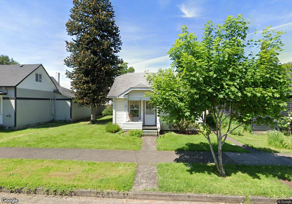
735 Laurel St Junction City, OR 97448
Estimated Value: $297,608 - $325,000
3
Beds
1
Bath
964
Sq Ft
$324/Sq Ft
Est. Value
About This Home
This home is located at 735 Laurel St, Junction City, OR 97448 and is currently estimated at $312,652, approximately $324 per square foot. 735 Laurel St is a home located in Lane County with nearby schools including Junction City High School.
Ownership History
Date
Name
Owned For
Owner Type
Purchase Details
Closed on
Jan 30, 2007
Sold by
Akins David L and Akins Patricia A
Bought by
Brooks Kay
Current Estimated Value
Home Financials for this Owner
Home Financials are based on the most recent Mortgage that was taken out on this home.
Original Mortgage
$124,000
Outstanding Balance
$74,064
Interest Rate
6.11%
Mortgage Type
Purchase Money Mortgage
Estimated Equity
$238,588
Purchase Details
Closed on
Jan 20, 2006
Sold by
Chapman Ray L and Smith Donna M
Bought by
Akins David L and Akins Patricia A
Home Financials for this Owner
Home Financials are based on the most recent Mortgage that was taken out on this home.
Original Mortgage
$102,000
Interest Rate
6.32%
Mortgage Type
Fannie Mae Freddie Mac
Purchase Details
Closed on
Nov 17, 1997
Sold by
Tyler Earld V and Tyler Frances N
Bought by
Chapman Ray L and Smith Donna M
Create a Home Valuation Report for This Property
The Home Valuation Report is an in-depth analysis detailing your home's value as well as a comparison with similar homes in the area
Home Values in the Area
Average Home Value in this Area
Purchase History
| Date | Buyer | Sale Price | Title Company |
|---|---|---|---|
| Brooks Kay | $155,000 | Western Title & Escrow Compa | |
| Akins David L | $136,000 | Western Title & Escrow Compa | |
| Chapman Ray L | -- | -- |
Source: Public Records
Mortgage History
| Date | Status | Borrower | Loan Amount |
|---|---|---|---|
| Open | Brooks Kay | $124,000 | |
| Previous Owner | Akins David L | $102,000 |
Source: Public Records
Tax History Compared to Growth
Tax History
| Year | Tax Paid | Tax Assessment Tax Assessment Total Assessment is a certain percentage of the fair market value that is determined by local assessors to be the total taxable value of land and additions on the property. | Land | Improvement |
|---|---|---|---|---|
| 2024 | $1,781 | $106,075 | -- | -- |
| 2023 | $1,781 | $102,986 | $0 | $0 |
| 2022 | $1,661 | $99,987 | $0 | $0 |
| 2021 | $1,628 | $97,075 | $0 | $0 |
| 2020 | $1,576 | $94,248 | $0 | $0 |
| 2019 | $1,521 | $91,503 | $0 | $0 |
| 2018 | $1,477 | $86,250 | $0 | $0 |
| 2017 | $1,425 | $86,250 | $0 | $0 |
| 2016 | $1,385 | $83,738 | $0 | $0 |
| 2015 | $1,224 | $81,299 | $0 | $0 |
| 2014 | $1,230 | $78,931 | $0 | $0 |
Source: Public Records
Map
Nearby Homes
- 617 Juniper St
- 1090 Nyssa St
- 351 Juniper St
- 0 Holly St
- 930 Holly St
- 1225 W 10th Ave Unit 26
- 1225 W 10th Ave Unit 28
- 1225 W 10th Ave Unit 50
- 1225 W 10th Ave Unit 53
- 1262 Kalmia St
- 850 Spruce St
- 1011 Rose St
- 1085 W 1st Ave Unit 8
- 1377 Juniper St
- 954 Elm St
- 805 Deal St
- 93982 Prairie (Off Street) Rd
- 188 Sumac Ct
- 1021 Deal St
- 1480 Ivy St