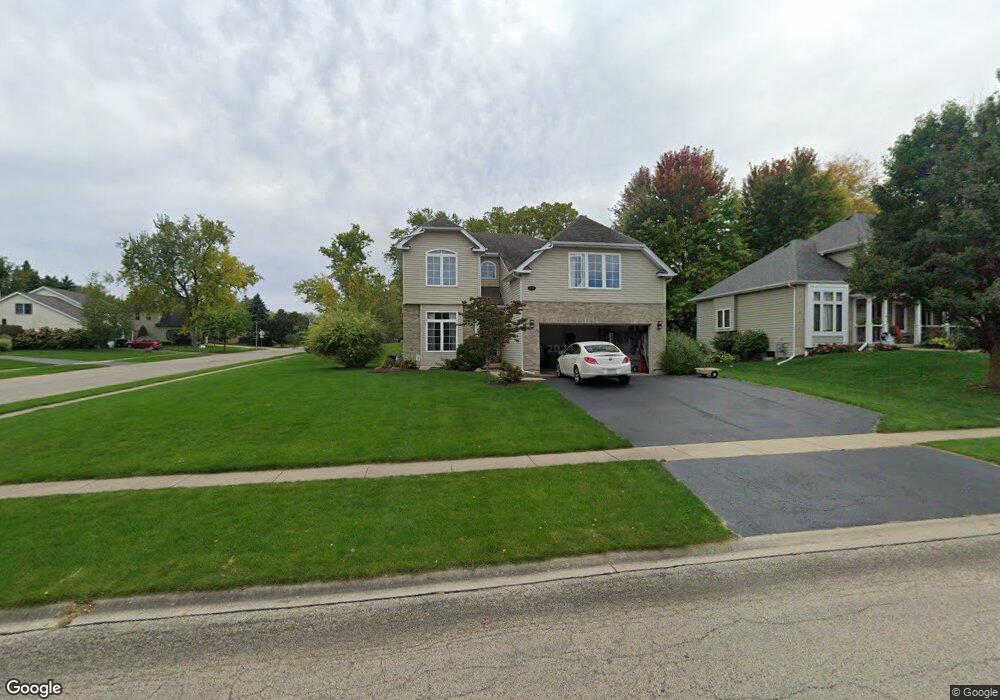
735 Lisa St Woodstock, IL 60098
Estimated Value: $361,000 - $418,000
4
Beds
3
Baths
2,041
Sq Ft
$188/Sq Ft
Est. Value
About This Home
This home is located at 735 Lisa St, Woodstock, IL 60098 and is currently estimated at $383,707, approximately $187 per square foot. 735 Lisa St is a home located in McHenry County with nearby schools including Olson Elementary School, Creekside Middle School, and Woodstock High School.
Ownership History
Date
Name
Owned For
Owner Type
Purchase Details
Closed on
Jul 21, 2003
Sold by
Koester George
Bought by
Lough Larry S and Lough Jane A
Current Estimated Value
Home Financials for this Owner
Home Financials are based on the most recent Mortgage that was taken out on this home.
Original Mortgage
$197,600
Interest Rate
5.3%
Mortgage Type
Unknown
Purchase Details
Closed on
Jul 11, 2002
Sold by
Hay Thomas and Hay Richard
Bought by
Koester George
Create a Home Valuation Report for This Property
The Home Valuation Report is an in-depth analysis detailing your home's value as well as a comparison with similar homes in the area
Home Values in the Area
Average Home Value in this Area
Purchase History
| Date | Buyer | Sale Price | Title Company |
|---|---|---|---|
| Lough Larry S | $247,000 | Nlt Title Llc | |
| Koester George | $25,500 | -- |
Source: Public Records
Mortgage History
| Date | Status | Borrower | Loan Amount |
|---|---|---|---|
| Closed | Lough Larry S | $197,600 | |
| Closed | Lough Larry S | $24,700 |
Source: Public Records
Tax History Compared to Growth
Tax History
| Year | Tax Paid | Tax Assessment Tax Assessment Total Assessment is a certain percentage of the fair market value that is determined by local assessors to be the total taxable value of land and additions on the property. | Land | Improvement |
|---|---|---|---|---|
| 2024 | $8,266 | $105,716 | $12,536 | $93,180 |
| 2023 | $7,787 | $95,602 | $11,337 | $84,265 |
| 2022 | $7,874 | $87,372 | $10,061 | $77,311 |
| 2021 | $7,454 | $81,633 | $9,400 | $72,233 |
| 2020 | $7,152 | $77,568 | $8,932 | $68,636 |
| 2019 | $6,916 | $74,043 | $8,526 | $65,517 |
| 2018 | $6,566 | $69,907 | $9,725 | $60,182 |
| 2017 | $6,409 | $65,795 | $9,153 | $56,642 |
| 2016 | $6,300 | $60,921 | $8,475 | $52,446 |
| 2013 | -- | $59,148 | $8,416 | $50,732 |
Source: Public Records
Map
Nearby Homes
- 233 Arthur Dr
- 4220 Meadowridge Rd
- 3851 Riverwoods Dr
- 4224 Meadowridge Rd
- 4240 Meadowridge Rd
- 3836 Riverwoods Dr
- 3830 Riverwoods Dr
- 4265 Meadowridge Rd
- 1301 Longwood Dr E
- 0 Rt 47 & Hercules Rd Hwy Unit MRD12103853
- 914 Pleasant St
- 824 Washington St
- 431 Washington St
- 13808 Washington St
- 0 Rt 47 & Lucas Rd Unit MRD12293021
- 740 Victoria Dr
- 327 Lincoln Ave
- 814 Robert Dr
- 320 W Donovan Ave
- 150 1st St