Estimated Value: $267,000 - $320,000
3
Beds
2
Baths
2,712
Sq Ft
$111/Sq Ft
Est. Value
About This Home
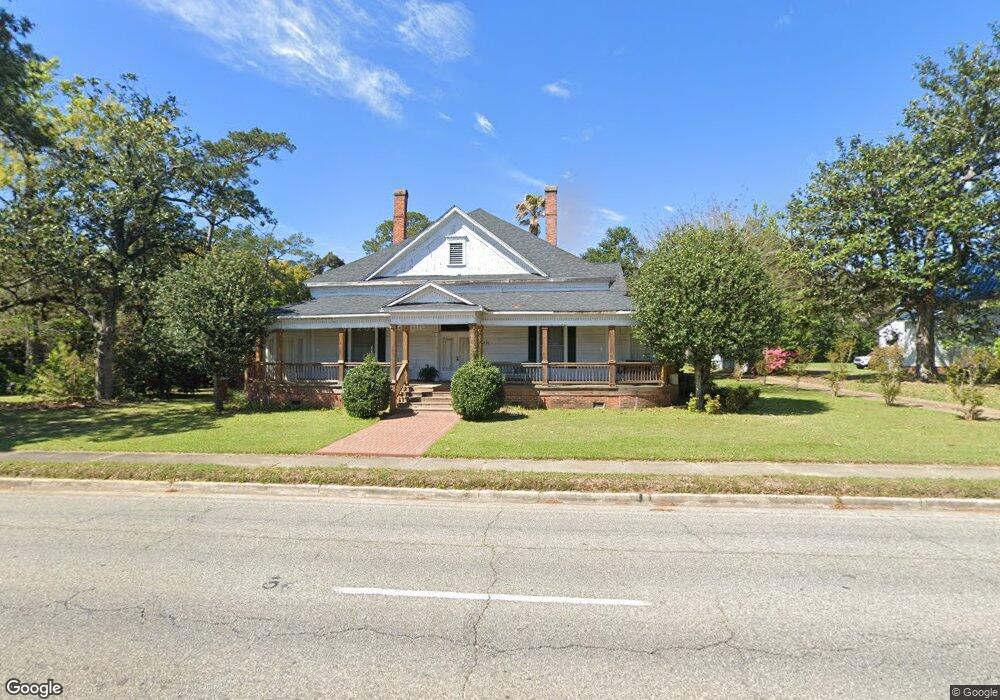
This home is located at 735 N Broad St, Cairo, GA 39828 and is currently estimated at $300,427, approximately $110 per square foot. 735 N Broad St is a home located in Grady County with nearby schools including Cairo High School.
Ownership History
Date
Name
Owned For
Owner Type
Purchase Details
Closed on
Aug 6, 2010
Sold by
Federal Home Loan Mortgage Corporation
Bought by
Ciaccio Kristal G
Current Estimated Value
Home Financials for this Owner
Home Financials are based on the most recent Mortgage that was taken out on this home.
Original Mortgage
$151,953
Outstanding Balance
$100,760
Interest Rate
4.6%
Mortgage Type
FHA
Estimated Equity
$199,667
Purchase Details
Closed on
Oct 6, 2009
Sold by
Citimortgage Inc
Bought by
Federal Home Loan Mortgage Corp
Purchase Details
Closed on
Jun 22, 2006
Sold by
Hadden Curtis Wayne
Bought by
Rocuant Albert and Rocuant Debra D
Purchase Details
Closed on
Jun 5, 1981
Bought by
Hadden Curtis Wayne
Create a Home Valuation Report for This Property
The Home Valuation Report is an in-depth analysis detailing your home's value as well as a comparison with similar homes in the area
Purchase History
| Date | Buyer | Sale Price | Title Company |
|---|---|---|---|
| Ciaccio Kristal G | $154,000 | -- | |
| Federal Home Loan Mortgage Corp | -- | -- | |
| Citimortgage Inc | $225,000 | -- | |
| Rocuant Albert | $315,000 | -- | |
| Hadden Curtis Wayne | $20,600 | -- |
Source: Public Records
Mortgage History
| Date | Status | Borrower | Loan Amount |
|---|---|---|---|
| Open | Ciaccio Kristal G | $151,953 |
Source: Public Records
Tax History
| Year | Tax Paid | Tax Assessment Tax Assessment Total Assessment is a certain percentage of the fair market value that is determined by local assessors to be the total taxable value of land and additions on the property. | Land | Improvement |
|---|---|---|---|---|
| 2024 | $3,143 | $101,386 | $7,656 | $93,730 |
| 2023 | $4,333 | $118,721 | $11,334 | $107,387 |
| 2022 | $4,510 | $118,721 | $11,334 | $107,387 |
| 2021 | $4,498 | $118,116 | $11,334 | $106,782 |
| 2020 | $4,510 | $118,116 | $11,334 | $106,782 |
| 2019 | $4,509 | $118,116 | $11,334 | $106,782 |
| 2018 | $4,345 | $118,116 | $11,334 | $106,782 |
| 2017 | $4,179 | $118,116 | $11,334 | $106,782 |
| 2016 | $3,644 | $100,735 | $11,334 | $89,401 |
| 2015 | $3,608 | $100,735 | $11,334 | $89,401 |
| 2014 | $3,609 | $100,735 | $11,334 | $89,401 |
| 2013 | -- | $96,615 | $11,334 | $85,281 |
Source: Public Records
Map
Nearby Homes
- 00 00 Hwy 111 South Tract 2
- 220 8th Ave NW
- 2975 U S 84
- 125 6th Ave NW
- 909 4th St NW
- 4761 Hadley Ferry Rd
- 00 6th St NW
- 698 12th Ave NW
- 00 Hwy 111 South Tract 1
- X 1st St
- 0 1st St
- 1420 Parallel Dr NW
- 00 Blackberry Ln
- 00 Meridian Rd
- Lot #15, 3 64 Acres Oakbend Cir
- 1016 Syrup Mill Creek Ln
- 1497 U S 84
- 711 2nd Ave NE
- 000 15th Ave Nw -- Tract 2
- 000 15th Ave Nw -- Tract 1
Your Personal Tour Guide
Ask me questions while you tour the home.