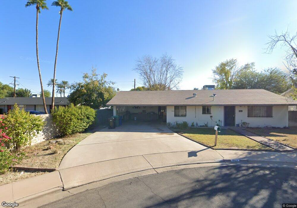
735 N Date Mesa, AZ 85201
Riverview NeighborhoodEstimated Value: $308,777 - $373,000
Studio
1
Bath
1,360
Sq Ft
$260/Sq Ft
Est. Value
About This Home
This home is located at 735 N Date, Mesa, AZ 85201 and is currently estimated at $353,944, approximately $260 per square foot. 735 N Date is a home located in Maricopa County with nearby schools including Franklin at Brimhall Elementary School, Emerson Elementary School, and Franklin West Elementary School.
Ownership History
Date
Name
Owned For
Owner Type
Purchase Details
Closed on
Aug 29, 2005
Sold by
Coombs Janet S
Bought by
Whipple Milton Dale
Current Estimated Value
Home Financials for this Owner
Home Financials are based on the most recent Mortgage that was taken out on this home.
Original Mortgage
$105,000
Outstanding Balance
$38,551
Interest Rate
1%
Mortgage Type
Negative Amortization
Estimated Equity
$315,393
Purchase Details
Closed on
Apr 21, 1997
Sold by
Reidhead Larry Boyd
Bought by
Whipple Milton Dale and Whipple Janet
Create a Home Valuation Report for This Property
The Home Valuation Report is an in-depth analysis detailing your home's value as well as a comparison with similar homes in the area
Home Values in the Area
Average Home Value in this Area
Purchase History
| Date | Buyer | Sale Price | Title Company |
|---|---|---|---|
| Whipple Milton Dale | $200,000 | -- | |
| Whipple Milton Dale | $66,000 | -- | |
| Whipple Milton Dale | $66,000 | -- | |
| Whipple Milton Dale | $66,000 | -- | |
| Whipple Milton Dale | $66,000 | -- | |
| Whipple Milton Dale | $66,000 | -- | |
| Whipple Milton Dale | -- | -- | |
| Whipple Milton Dale | -- | -- | |
| Reidhead Darryl Oscar | -- | -- | |
| Reidhead Joseph West | -- | -- | |
| Whipple Val Willard | -- | -- |
Source: Public Records
Mortgage History
| Date | Status | Borrower | Loan Amount |
|---|---|---|---|
| Open | Whipple Milton Dale | $105,000 |
Source: Public Records
Tax History
| Year | Tax Paid | Tax Assessment Tax Assessment Total Assessment is a certain percentage of the fair market value that is determined by local assessors to be the total taxable value of land and additions on the property. | Land | Improvement |
|---|---|---|---|---|
| 2025 | $889 | $10,707 | -- | -- |
| 2024 | $899 | $10,197 | -- | -- |
| 2023 | $899 | $25,610 | $5,120 | $20,490 |
| 2022 | $879 | $19,710 | $3,940 | $15,770 |
| 2021 | $903 | $17,680 | $3,530 | $14,150 |
| 2020 | $891 | $16,810 | $3,360 | $13,450 |
| 2019 | $826 | $14,160 | $2,830 | $11,330 |
| 2018 | $788 | $12,280 | $2,450 | $9,830 |
| 2017 | $763 | $11,520 | $2,300 | $9,220 |
| 2016 | $750 | $10,460 | $2,090 | $8,370 |
| 2015 | $708 | $8,660 | $1,730 | $6,930 |
Source: Public Records
Map
Nearby Homes
- 837 N Revere Unit E
- 861 N Revere Unit E
- 606 N Country Club Dr
- 923 N Country Club Dr
- 455 W 5th Place
- 1027 N Revere
- 805 N Westwood
- 555 W University Dr
- 453 W University Dr
- 532 N Grand
- 453 W 3rd Place
- 1051 W Dixon St
- 222 W Brown Rd Unit 66
- 222 W Brown Rd Unit 57
- 222 W Brown Rd Unit 26
- 222 W Brown Rd Unit 36
- 222 W Brown Rd Unit 107
- 1042 W 9th Place
- 1051 N Grand
- 1105 W 6th Place
- 729 N Date
- 736 N Orange Cir
- 730 N Orange Cir
- 730 N Orange Cir
- 721 N Date
- 740 N Date
- 740 N Orange Cir
- 722 N Orange Cir
- 738 N Date
- 730 N Date
- 553 W Rio Salado Pkwy Unit 202
- 555 W Rio Salado Pkwy Unit 202
- 555 W Rio Salado Pkwy Unit C
- 713 N Date
- 545 W 8th St
- 720 N Date
- 714 N Orange Cir
- 712 N Date
- 705 N Date
- 731 N Orange Cir
Your Personal Tour Guide
Ask me questions while you tour the home.