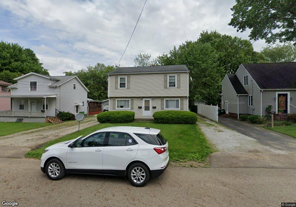
735 N Way St Unit 737 Barberton, OH 44203
North Barberton NeighborhoodEstimated Value: $130,000 - $186,696
4
Beds
2
Baths
1,792
Sq Ft
$84/Sq Ft
Est. Value
About This Home
This home is located at 735 N Way St Unit 737, Barberton, OH 44203 and is currently estimated at $149,924, approximately $83 per square foot. 735 N Way St Unit 737 is a home located in Summit County with nearby schools including Barberton Middle School, Barberton Intermediate School 3-5, and Barberton High School.
Ownership History
Date
Name
Owned For
Owner Type
Purchase Details
Closed on
Jun 1, 2007
Sold by
Cacioppo Sherrie L
Bought by
Mingle Charles R
Current Estimated Value
Home Financials for this Owner
Home Financials are based on the most recent Mortgage that was taken out on this home.
Original Mortgage
$71,100
Outstanding Balance
$10,291
Interest Rate
6.22%
Mortgage Type
Purchase Money Mortgage
Estimated Equity
$139,633
Purchase Details
Closed on
Jun 9, 1995
Sold by
Kash Kim
Bought by
Cacioppo Sherrie L
Create a Home Valuation Report for This Property
The Home Valuation Report is an in-depth analysis detailing your home's value as well as a comparison with similar homes in the area
Home Values in the Area
Average Home Value in this Area
Purchase History
| Date | Buyer | Sale Price | Title Company |
|---|---|---|---|
| Mingle Charles R | $79,000 | Ohio Title | |
| Cacioppo Sherrie L | $70,000 | -- |
Source: Public Records
Mortgage History
| Date | Status | Borrower | Loan Amount |
|---|---|---|---|
| Open | Mingle Charles R | $71,100 |
Source: Public Records
Tax History Compared to Growth
Tax History
| Year | Tax Paid | Tax Assessment Tax Assessment Total Assessment is a certain percentage of the fair market value that is determined by local assessors to be the total taxable value of land and additions on the property. | Land | Improvement |
|---|---|---|---|---|
| 2025 | $2,143 | $42,442 | $9,839 | $32,603 |
| 2024 | $2,143 | $42,442 | $9,839 | $32,603 |
| 2023 | $2,143 | $42,442 | $9,839 | $32,603 |
| 2022 | $1,626 | $27,927 | $6,433 | $21,494 |
| 2021 | $1,624 | $27,927 | $6,433 | $21,494 |
| 2020 | $1,590 | $27,920 | $6,430 | $21,490 |
| 2019 | $1,613 | $23,010 | $5,660 | $17,350 |
| 2018 | $1,425 | $23,010 | $5,660 | $17,350 |
| 2017 | $1,443 | $23,010 | $5,660 | $17,350 |
| 2016 | $1,446 | $23,010 | $5,660 | $17,350 |
| 2015 | $1,443 | $23,010 | $5,660 | $17,350 |
| 2014 | $1,436 | $23,010 | $5,660 | $17,350 |
| 2013 | $1,469 | $24,410 | $5,660 | $18,750 |
Source: Public Records
Map
Nearby Homes
- 103 Mitchell St
- 690 Saint Clair Ave
- 30 W Hiram St
- 44 W Summit St
- 818 N Summit St
- 277 Glenn St
- 146 Hermann St
- 0 Wooster Rd N
- 143 Glenn St
- 137 Hermann St
- 645 Madison Ave
- 0 Romig Ave
- 213 Hermann St
- 613 Wooster Rd N
- 1924 Caroline Ave
- 76 Hazelwood Ave
- 250 Evergreen St
- 117 Fernwood Ave
- 103 & 103 1/2 Fernwood Ave
- 412 Grandview Ave