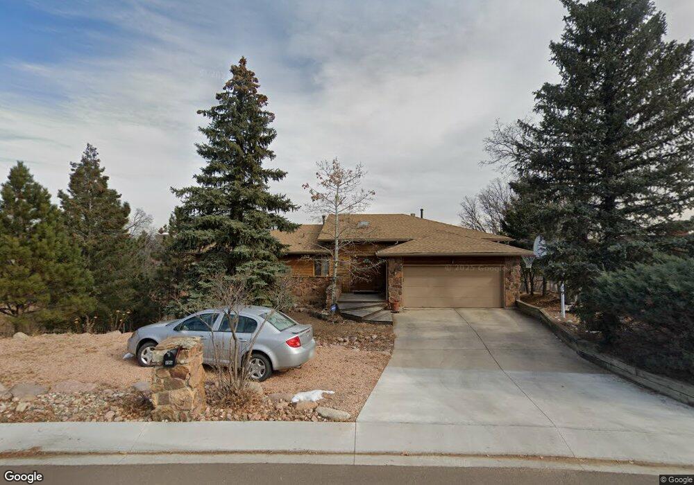
735 Polaris Dr Colorado Springs, CO 80906
Skyway NeighborhoodEstimated Value: $647,000 - $758,000
3
Beds
2
Baths
1,830
Sq Ft
$377/Sq Ft
Est. Value
About This Home
This home is located at 735 Polaris Dr, Colorado Springs, CO 80906 and is currently estimated at $689,214, approximately $376 per square foot. 735 Polaris Dr is a home located in El Paso County with nearby schools including Gold Camp Elementary School, Cheyenne Mountain Junior High School, and Cheyenne Mountain High School.
Ownership History
Date
Name
Owned For
Owner Type
Purchase Details
Closed on
Dec 1, 1987
Bought by
Wheelan Ute M
Current Estimated Value
Purchase Details
Closed on
May 14, 1987
Bought by
Wheelan Ute M
Purchase Details
Closed on
Jan 7, 1987
Bought by
Wheelan Ute M
Purchase Details
Closed on
Aug 7, 1981
Bought by
Wheelan Ute M
Purchase Details
Closed on
Jul 22, 1971
Bought by
Wheelan Ute M
Purchase Details
Closed on
Dec 11, 1964
Bought by
Wheelan Ute M
Create a Home Valuation Report for This Property
The Home Valuation Report is an in-depth analysis detailing your home's value as well as a comparison with similar homes in the area
Home Values in the Area
Average Home Value in this Area
Purchase History
| Date | Buyer | Sale Price | Title Company |
|---|---|---|---|
| Wheelan Ute M | -- | -- | |
| Wheelan Ute M | -- | -- | |
| Wheelan Ute M | -- | -- | |
| Wheelan Ute M | -- | -- | |
| Wheelan Ute M | -- | -- | |
| Wheelan Ute M | -- | -- |
Source: Public Records
Tax History Compared to Growth
Tax History
| Year | Tax Paid | Tax Assessment Tax Assessment Total Assessment is a certain percentage of the fair market value that is determined by local assessors to be the total taxable value of land and additions on the property. | Land | Improvement |
|---|---|---|---|---|
| 2025 | $2,631 | $45,180 | -- | -- |
| 2024 | $2,531 | $41,910 | $10,050 | $31,860 |
| 2023 | $2,531 | $41,910 | $10,050 | $31,860 |
| 2022 | $2,205 | $32,360 | $8,410 | $23,950 |
| 2021 | $2,329 | $33,290 | $8,650 | $24,640 |
| 2020 | $1,607 | $29,540 | $7,720 | $21,820 |
| 2019 | $1,589 | $29,540 | $7,720 | $21,820 |
| 2018 | $1,296 | $25,130 | $6,830 | $18,300 |
| 2017 | $1,291 | $25,130 | $6,830 | $18,300 |
| 2016 | $1,227 | $25,470 | $7,160 | $18,310 |
| 2015 | $1,225 | $25,470 | $7,160 | $18,310 |
| 2014 | $1,125 | $24,030 | $7,160 | $16,870 |
Source: Public Records
Map
Nearby Homes
- 707 Orion Dr
- 705 Orion Dr
- 2302 Hercules Dr
- 2915 Pegasus Dr
- 2419 Astron Dr
- 625 Vista Grande Dr
- 2771 Rigel Dr
- 506 Orion Place
- 2845 Halleys Ct
- 2455 Stratton Forest Heights
- 1915 Cantwell Grove
- 1975 Fox Mountain Point
- 3012 Electra Dr S
- 2054 Stratton Forest Heights
- 1404 Gold Camp Rd
- 1407 Sunrise Ln
- 1306 Lime Rock Ln
- 351 Bergamo Way
- 2854 Stratton Forest Heights
- 1675 Little Bear Creek Point Unit 4
- 737 Polaris Dr
- 723 Polaris Dr
- 729 Polaris Dr
- 728 Scorpio Cir
- 719 Polaris Dr
- 736 Scorpio Cir
- 2630 Scorpio Dr
- 738 Polaris Dr
- 726 Scorpio Cir
- 2604 Scorpio Dr
- 729 Scorpio Cir
- 740 Scorpio Cir
- 730 Polaris Dr
- 722 Scorpio Cir
- 717 Polaris Dr
- 728 Polaris Dr
- 737 Scorpio Cir
- 2709 Andromeda Dr
- 2717 Andromeda Dr
- 719 Scorpio Cir