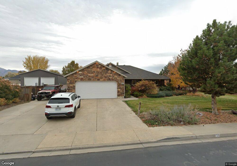
735 W 10 N Lindon, UT 84042
Estimated Value: $746,000 - $1,066,000
3
Beds
4
Baths
2,662
Sq Ft
$331/Sq Ft
Est. Value
About This Home
This home is located at 735 W 10 N, Lindon, UT 84042 and is currently estimated at $880,775, approximately $330 per square foot. 735 W 10 N is a home located in Utah County with nearby schools including Aspen Elementary School, Oak Canyon Junior High School, and Pleasant Grove High School.
Ownership History
Date
Name
Owned For
Owner Type
Purchase Details
Closed on
Aug 19, 1998
Sold by
Higgs Donald E and Higgs Orelene L
Bought by
Mann Thomas S and Mann Norma J
Current Estimated Value
Create a Home Valuation Report for This Property
The Home Valuation Report is an in-depth analysis detailing your home's value as well as a comparison with similar homes in the area
Home Values in the Area
Average Home Value in this Area
Purchase History
| Date | Buyer | Sale Price | Title Company |
|---|---|---|---|
| Mann Thomas S | -- | -- |
Source: Public Records
Tax History Compared to Growth
Tax History
| Year | Tax Paid | Tax Assessment Tax Assessment Total Assessment is a certain percentage of the fair market value that is determined by local assessors to be the total taxable value of land and additions on the property. | Land | Improvement |
|---|---|---|---|---|
| 2025 | $3,379 | $782,400 | $233,000 | $549,400 |
| 2024 | $3,379 | $416,515 | $0 | $0 |
| 2023 | $3,204 | $424,215 | $0 | $0 |
| 2022 | $3,104 | $397,045 | $0 | $0 |
| 2021 | $2,883 | $556,100 | $151,500 | $404,600 |
| 2020 | $2,676 | $508,100 | $140,300 | $367,800 |
| 2019 | $2,436 | $482,500 | $131,800 | $350,700 |
| 2018 | $2,538 | $474,000 | $123,300 | $350,700 |
| 2017 | $2,557 | $256,025 | $0 | $0 |
| 2016 | $2,548 | $236,005 | $0 | $0 |
| 2015 | $2,424 | $212,245 | $0 | $0 |
| 2014 | $2,312 | $200,530 | $0 | $0 |
Source: Public Records
Map
Nearby Homes
- 578 W 150 S
- 523 W 100 S
- 499 N 420 W Unit 138
- 511 N 475 W
- 472 W 520 N
- 464 W 520 N
- 1991 N 920 W
- 367 W Songbird Ln
- 264 N Old Farm Ln
- 560 N Buffalo Grass Ln
- 558 N Buffalo Grass Ln
- 556 N Buffalo Grass Ln
- 554 N Buffalo Grass Ln
- 564 N Buffalo Grass Ln Unit 1250
- 1277 W Sweet Corn Ln
- 425 N Locust Ave
- 557 N Buffalo Grass Ln
- 1430 W Kelsey Way
- 575 N Buffalo Grass Ln
- 556 N Cornstalk Ln