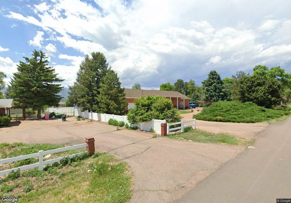
7350 Ross Dr Colorado Springs, CO 80920
Falcon Estates NeighborhoodEstimated Value: $611,326 - $695,000
4
Beds
2
Baths
2,180
Sq Ft
$295/Sq Ft
Est. Value
About This Home
This home is located at 7350 Ross Dr, Colorado Springs, CO 80920 and is currently estimated at $643,582, approximately $295 per square foot. 7350 Ross Dr is a home located in El Paso County with nearby schools including Pioneer Elementary School, Mountain Ridge Middle School, and Rampart High School.
Ownership History
Date
Name
Owned For
Owner Type
Purchase Details
Closed on
Jun 1, 2010
Sold by
Wheeler Kari Dee
Bought by
Davis Gregory A
Current Estimated Value
Home Financials for this Owner
Home Financials are based on the most recent Mortgage that was taken out on this home.
Original Mortgage
$188,800
Outstanding Balance
$126,235
Interest Rate
5%
Mortgage Type
New Conventional
Estimated Equity
$517,347
Purchase Details
Closed on
Oct 2, 2000
Sold by
Skaggs William G and Skaggs Brenda M
Bought by
Wheeler Kari Dee
Home Financials for this Owner
Home Financials are based on the most recent Mortgage that was taken out on this home.
Original Mortgage
$168,750
Interest Rate
7.99%
Purchase Details
Closed on
Mar 1, 1981
Bought by
Davis Kari Dee
Create a Home Valuation Report for This Property
The Home Valuation Report is an in-depth analysis detailing your home's value as well as a comparison with similar homes in the area
Home Values in the Area
Average Home Value in this Area
Purchase History
| Date | Buyer | Sale Price | Title Company |
|---|---|---|---|
| Davis Gregory A | -- | None Available | |
| Wheeler Kari Dee | $225,000 | Land Title | |
| Davis Kari Dee | -- | -- |
Source: Public Records
Mortgage History
| Date | Status | Borrower | Loan Amount |
|---|---|---|---|
| Open | Davis Gregory A | $188,800 | |
| Previous Owner | Wheeler Kari Dee | $168,750 |
Source: Public Records
Tax History Compared to Growth
Tax History
| Year | Tax Paid | Tax Assessment Tax Assessment Total Assessment is a certain percentage of the fair market value that is determined by local assessors to be the total taxable value of land and additions on the property. | Land | Improvement |
|---|---|---|---|---|
| 2025 | $2,831 | $45,260 | -- | -- |
| 2024 | $2,401 | $50,890 | $13,300 | $37,590 |
| 2023 | $2,401 | $50,890 | $13,300 | $37,590 |
| 2022 | $2,114 | $31,950 | $7,350 | $24,600 |
| 2021 | $2,349 | $32,870 | $7,560 | $25,310 |
| 2020 | $1,920 | $24,940 | $6,580 | $18,360 |
| 2019 | $1,900 | $24,940 | $6,580 | $18,360 |
| 2018 | $1,629 | $21,020 | $5,760 | $15,260 |
| 2017 | $1,623 | $21,020 | $5,760 | $15,260 |
| 2016 | $1,671 | $21,620 | $6,370 | $15,250 |
| 2015 | $1,668 | $21,620 | $6,370 | $15,250 |
| 2014 | $1,504 | $19,470 | $5,970 | $13,500 |
Source: Public Records
Map
Nearby Homes
- 1884 Fuller Rd
- 7191 Ross Dr
- 7424 Bell Dr
- 1907 Independence Dr
- 1880 Independence Dr
- 2110 Whitehorn Dr N
- 1871 Brookwood Dr
- 1275 Berglind Rd
- 7137 Murdoch Dr
- 1510 York Rd Unit 101
- 1932 Silkwood Dr
- 1160 Berglind Rd
- 6633 Dublin Loop W Unit 4
- 6632 Dublin Loop W
- 6699 Bethesda Point Unit B
- 6598 Bethesda Point Unit B
- 6881 Los Reyes Cir
- 6872 Los Reyes Cir
- 2650 Bannister Ct
- 2068 Silkwood Dr