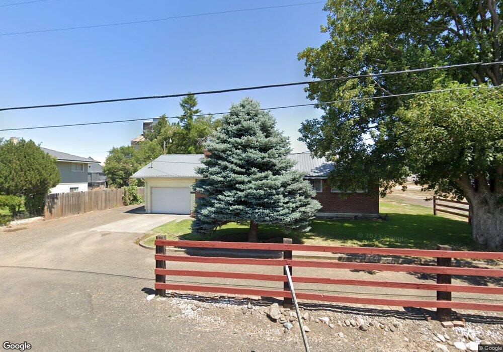
73527 Highway 331 Pendleton, OR 97801
Estimated Value: $378,151 - $404,000
3
Beds
2
Baths
1,384
Sq Ft
$282/Sq Ft
Est. Value
About This Home
This home is located at 73527 Highway 331, Pendleton, OR 97801 and is currently estimated at $389,717, approximately $281 per square foot. 73527 Highway 331 is a home located in Umatilla County with nearby schools including McKay Creek Elementary School, Sunridge Middle School, and Pendleton High School.
Ownership History
Date
Name
Owned For
Owner Type
Purchase Details
Closed on
Apr 10, 2014
Sold by
Fairbank Matthew C and Fairbank Ashelee R
Bought by
Gordon Martina Lou and Sloan Jared C
Current Estimated Value
Home Financials for this Owner
Home Financials are based on the most recent Mortgage that was taken out on this home.
Original Mortgage
$170,943
Outstanding Balance
$127,547
Interest Rate
4.32%
Mortgage Type
New Conventional
Estimated Equity
$262,170
Purchase Details
Closed on
Nov 21, 2008
Sold by
Thompson Richard
Bought by
Fairbank Matthew C and Fairbank Ashelee R
Home Financials for this Owner
Home Financials are based on the most recent Mortgage that was taken out on this home.
Original Mortgage
$164,461
Interest Rate
5.9%
Mortgage Type
VA
Create a Home Valuation Report for This Property
The Home Valuation Report is an in-depth analysis detailing your home's value as well as a comparison with similar homes in the area
Purchase History
| Date | Buyer | Sale Price | Title Company |
|---|---|---|---|
| Gordon Martina Lou | $175,500 | Pioneer Title Co | |
| Fairbank Matthew C | $161,000 | Pioneer Title Co |
Source: Public Records
Mortgage History
| Date | Status | Borrower | Loan Amount |
|---|---|---|---|
| Open | Gordon Martina Lou | $170,943 | |
| Previous Owner | Fairbank Matthew C | $164,461 |
Source: Public Records
Tax History
| Year | Tax Paid | Tax Assessment Tax Assessment Total Assessment is a certain percentage of the fair market value that is determined by local assessors to be the total taxable value of land and additions on the property. | Land | Improvement |
|---|---|---|---|---|
| 2025 | -- | -- | -- | -- |
| 2023 | $0 | $0 | $0 | $0 |
| 2022 | $0 | $0 | $0 | $0 |
| 2021 | $0 | $0 | $0 | $0 |
| 2020 | $0 | $156,590 | $49,190 | $107,400 |
| 2018 | $0 | $147,610 | $46,360 | $101,250 |
| 2017 | $0 | $143,320 | $45,010 | $98,310 |
| 2016 | $0 | $139,150 | $43,700 | $95,450 |
| 2015 | -- | $127,350 | $39,990 | $87,360 |
| 2014 | $1,464 | $127,350 | $39,990 | $87,360 |
Source: Public Records
Map
Nearby Homes
- 45315 Trail Dr
- 73426 Memory Ln
- 0 NE School Dr Unit 1-5 23352584
- 3510 NE King Place
- 40 NE Mount Hebron Dr
- 11 NE Nelson Dr
- 1914 SE Court Ave
- 941 SE 9th St
- 1213 SW 17th Place
- 703 SE Isaac Ave
- 805 SE 6th St
- 0 Oregon 11
- 120 SE 7th St
- 701 SE Court Ave
- 612 SE Dorion Ave
- 515 SE 4th St
- 27 SE Kirk Place
- 922 S Main St
- 606 SW 2nd St
- 606 SW 3rd St
- 73493 Highway 331
- 73533 Highway 331
- 73493 Highway 331
- 73481 Highway 331
- 73473 Oregon 331
- 73473 Highway 331
- 46511 Horseshoe Ln
- 73455 Highway 331
- 73563 Highway 331
- 73563 Highway 331
- 46529 Horseshoe Ln
- 73541 Oregon 331
- 46535 Horseshoe Ln
- 0 Horseshoe Ln
- 73589 Highway 331
- 46543 Horseshoe Ln
- 73601 Highway 331
- 46540 Horseshoe Ln
- 46559 Horseshoe Ln
- 46552 Horseshoe Ln
Your Personal Tour Guide
Ask me questions while you tour the home.