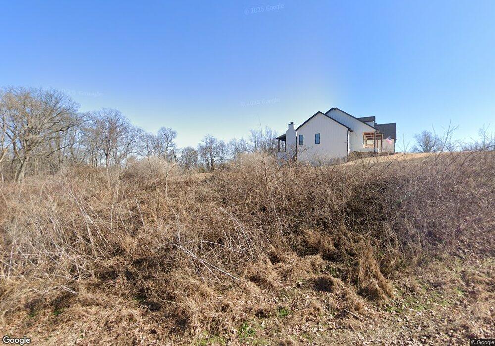
7355 SW Lee Harris Rd Bentonville, AR 72713
Estimated Value: $169,000 - $352,000
--
Bed
1
Bath
3,790
Sq Ft
$73/Sq Ft
Est. Value
About This Home
This home is located at 7355 SW Lee Harris Rd, Bentonville, AR 72713 and is currently estimated at $276,710, approximately $73 per square foot. 7355 SW Lee Harris Rd is a home with nearby schools including Vaughn Elementary, Grimsley Junior High School, and Creekside Middle School.
Ownership History
Date
Name
Owned For
Owner Type
Purchase Details
Closed on
May 2, 2022
Sold by
Calcon Inc
Bought by
Eric And Tammy Flohr Revocable Trust and Flohr
Current Estimated Value
Purchase Details
Closed on
Nov 5, 2021
Sold by
Hubbard Brandon and Hubbard Michelle
Bought by
Frischknecht Seth D and Frischknecht Amelia
Purchase Details
Closed on
Apr 23, 2021
Sold by
Highland Llc
Bought by
Hubbard Brandon and Hubbard Michelle
Home Financials for this Owner
Home Financials are based on the most recent Mortgage that was taken out on this home.
Original Mortgage
$243,750
Interest Rate
2.4%
Mortgage Type
Commercial
Create a Home Valuation Report for This Property
The Home Valuation Report is an in-depth analysis detailing your home's value as well as a comparison with similar homes in the area
Home Values in the Area
Average Home Value in this Area
Purchase History
| Date | Buyer | Sale Price | Title Company |
|---|---|---|---|
| Eric And Tammy Flohr Revocable Trust | $201,250 | First National Title | |
| Frischknecht Seth D | $162,500 | Advantage Title & Escrow | |
| Hubbard Brandon | $325,000 | City Title & Closing |
Source: Public Records
Mortgage History
| Date | Status | Borrower | Loan Amount |
|---|---|---|---|
| Previous Owner | Hubbard Brandon | $243,750 |
Source: Public Records
Tax History Compared to Growth
Tax History
| Year | Tax Paid | Tax Assessment Tax Assessment Total Assessment is a certain percentage of the fair market value that is determined by local assessors to be the total taxable value of land and additions on the property. | Land | Improvement |
|---|---|---|---|---|
| 2025 | $11,761 | $191,181 | $39,468 | $151,713 |
| 2024 | $1,754 | $39,468 | $39,468 | $0 |
| 2023 | $1,595 | $25,806 | $25,806 | $0 |
| 2022 | $7 | $110 | $110 | $0 |
| 2021 | $7 | $470 | $470 | $0 |
| 2020 | $0 | $0 | $0 | $0 |
Source: Public Records
Map
Nearby Homes
- 6404 SW High Meadow Blvd
- 6300 SW Bear Rd
- 7101 SW Basswood Ave
- 6908 SW Basswood Ave
- 7001 SW Basswood Ave
- 7004 SW Basswood Ave
- 6907 SW Basswood Ave
- 6910 SW Basswood Ave
- 6702 SW Acacia St
- 6905 SW Basswood Ave
- 7008 SW Basswood Ave
- 7002 SW Basswood Ave
- 6900 SW Basswood Ave
- 6901 SW Basswood Ave
- 6902 SW Basswood Ave
- 6909 SW Basswood Ave
- 7005 SW Basswood Ave
- 6110 Osage St
- 7009 SW High Meadow Blvd
- 7003 SW High Meadow Blvd
- 2807 SW Hampshire Ave
- 1330 Marjorie St
- 750 Harbison St
- 1310 Marjorie St
- 721 Harbison St
- 6001 NW Grant St
- 6006 NW Grant St
- 6003 NW Grant St
- 6004 NW Grant St
- 6002 NW Grant St
- 6000 NW Grant St
- 6012 NW Grant St
- 6102 NW Grant St
- 6011 NW Grant St
- 6105 NW Grant St
- 2907 SW Hampshire Ave
- 2811 SW Hampshire Ave
- 730 Harbison St
- 631 Harbison St
- 710 Harbison St