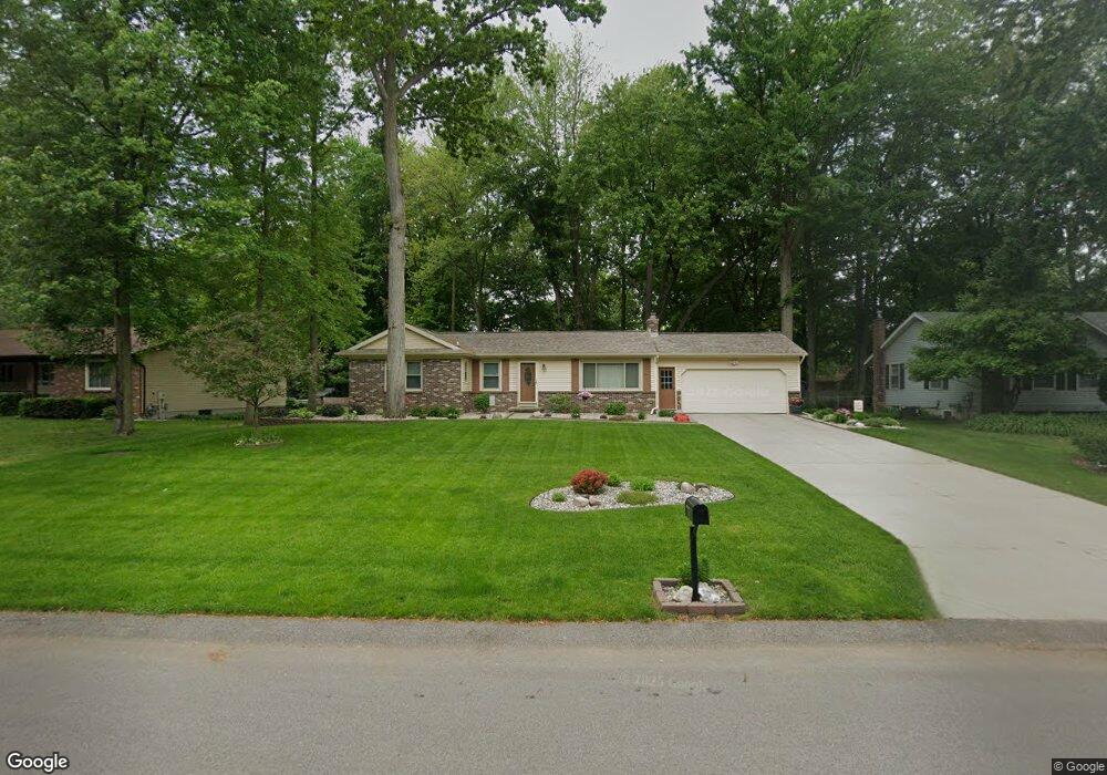
7355 Yorkshire Dr Hudsonville, MI 49426
Estimated Value: $375,621 - $412,000
3
Beds
2
Baths
1,800
Sq Ft
$216/Sq Ft
Est. Value
About This Home
This home is located at 7355 Yorkshire Dr, Hudsonville, MI 49426 and is currently estimated at $389,655, approximately $216 per square foot. 7355 Yorkshire Dr is a home located in Ottawa County with nearby schools including Bauer Elementary School, Baldwin Street Middle School, and Hudsonville Freshman Campus.
Ownership History
Date
Name
Owned For
Owner Type
Purchase Details
Closed on
Sep 10, 2013
Sold by
Sweet Paul R and Sweet Kathryn L
Bought by
Sweet Paul R and Sweet Kathryn L
Current Estimated Value
Purchase Details
Closed on
Jul 25, 2003
Sold by
Brandt James L and Brandt Janice L
Bought by
Sweet Paul R and Sweet Kathryn L
Home Financials for this Owner
Home Financials are based on the most recent Mortgage that was taken out on this home.
Original Mortgage
$139,900
Interest Rate
6.44%
Mortgage Type
Purchase Money Mortgage
Create a Home Valuation Report for This Property
The Home Valuation Report is an in-depth analysis detailing your home's value as well as a comparison with similar homes in the area
Home Values in the Area
Average Home Value in this Area
Purchase History
| Date | Buyer | Sale Price | Title Company |
|---|---|---|---|
| Sweet Paul R | -- | None Available | |
| Sweet Paul R | $144,900 | Metropolitan Title Company |
Source: Public Records
Mortgage History
| Date | Status | Borrower | Loan Amount |
|---|---|---|---|
| Previous Owner | Sweet Paul R | $139,900 |
Source: Public Records
Tax History Compared to Growth
Tax History
| Year | Tax Paid | Tax Assessment Tax Assessment Total Assessment is a certain percentage of the fair market value that is determined by local assessors to be the total taxable value of land and additions on the property. | Land | Improvement |
|---|---|---|---|---|
| 2025 | $2,433 | $159,900 | $0 | $0 |
| 2024 | $2,106 | $156,700 | $0 | $0 |
| 2023 | $2,011 | $133,100 | $0 | $0 |
| 2022 | $2,051 | $123,900 | $0 | $0 |
| 2021 | $1,993 | $112,600 | $0 | $0 |
| 2020 | $1,972 | $103,700 | $0 | $0 |
| 2019 | $1,975 | $99,000 | $0 | $0 |
| 2018 | $1,841 | $88,900 | $0 | $0 |
| 2017 | $1,808 | $85,800 | $0 | $0 |
| 2016 | $1,797 | $77,500 | $0 | $0 |
| 2015 | $1,715 | $76,300 | $0 | $0 |
| 2014 | $1,715 | $68,900 | $0 | $0 |
Source: Public Records
Map
Nearby Homes
- 7114 Tory Dr
- 4087 Baldwin St
- 7399 Hidden Forest Ct
- 0 Baldwin St
- 6950 Meadowcreek Dr
- 7068 Jasper Dr
- 6863 Bridgeport Dr
- 3646 Lenters Dr
- 7918 Westside Dr
- 4372 Shady Oak Ct
- 4663 Hidden Ridge Dr Unit lot 38
- 3528 Tearose Dr
- 8075 42nd Ave
- 4672 Lexem Dr
- 4717 Lexem Dr Unit Lot 41
- 4699 Lexem Dr
- 7318 Alycia Dr
- 3546 Eagles Roost Trail Unit 3
- 3808 Port Sheldon St
- 6561 Van Dam Ave
- 7337 Yorkshire Dr
- 7369 Yorkshire Dr
- 4278 Heritage Dr
- 7317 Yorkshire Dr
- 7387 Yorkshire Dr
- 4256 Pheasant Run Dr
- 4282 Heritage Dr
- 7301 Yorkshire Dr
- 7358 Yorkshire Dr
- 4270 Heritage Dr
- 7372 Yorkshire Dr
- 7344 Yorkshire Dr
- 4288 Heritage Dr
- 7316 Yorkshire Dr
- 7388 Yorkshire Dr
- 7330 Yorkshire Dr
- 7289 Yorkshire Dr
- 7302 Yorkshire Dr
- 4296 Heritage Dr
- 7415 Yorkshire Dr