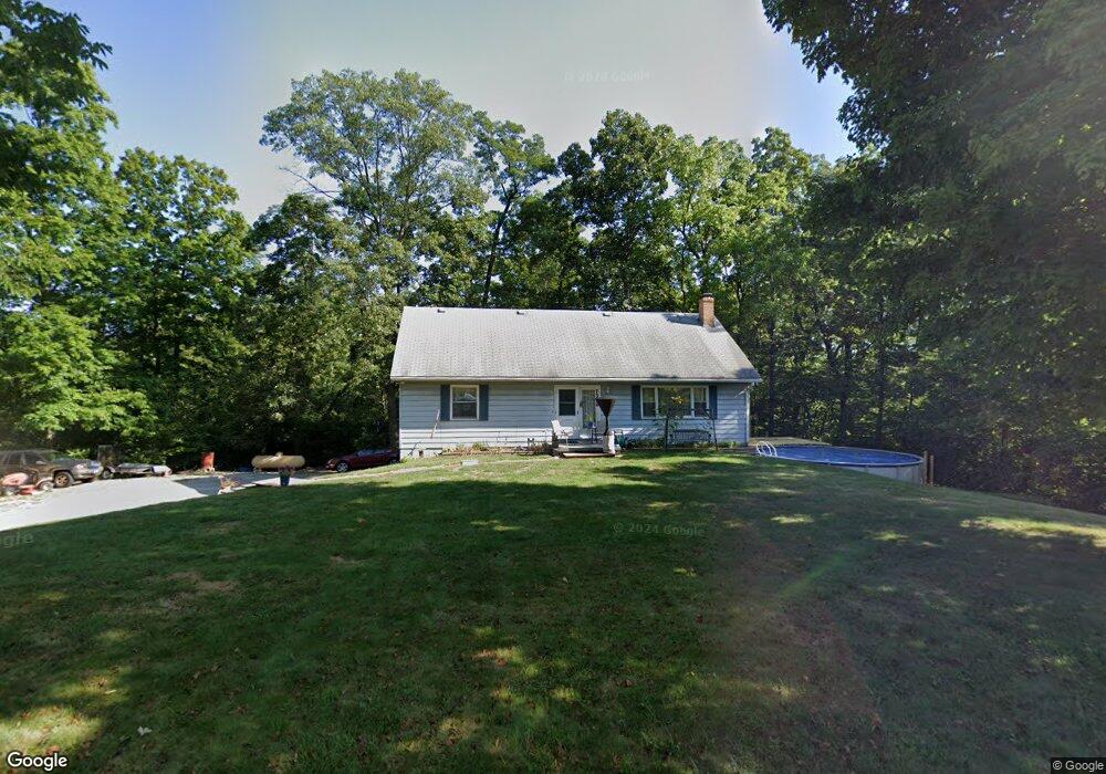
7356 Coonpath Rd Carroll, OH 43112
Bloom NeighborhoodEstimated Value: $383,404 - $450,000
4
Beds
2
Baths
1,904
Sq Ft
$220/Sq Ft
Est. Value
About This Home
This home is located at 7356 Coonpath Rd, Carroll, OH 43112 and is currently estimated at $418,351, approximately $219 per square foot. 7356 Coonpath Rd is a home located in Fairfield County with nearby schools including Bloom Carroll Primary School, Bloom Carroll Intermediate School, and Bloom-Carroll Middle School.
Ownership History
Date
Name
Owned For
Owner Type
Purchase Details
Closed on
Jul 8, 2022
Sold by
Mace David and Dickerson Ronda
Bought by
Mace David and Mace Nancy
Current Estimated Value
Home Financials for this Owner
Home Financials are based on the most recent Mortgage that was taken out on this home.
Original Mortgage
$255,000
Outstanding Balance
$243,127
Interest Rate
6.13%
Mortgage Type
New Conventional
Estimated Equity
$175,224
Purchase Details
Closed on
Jan 19, 2022
Sold by
Mallory Mark D
Bought by
Mace David
Purchase Details
Closed on
Oct 15, 2021
Sold by
David Mace
Bought by
Dickerson Ronda and Crago Debra
Purchase Details
Closed on
Feb 23, 2021
Sold by
Mallory Mark D
Bought by
Mace David
Purchase Details
Closed on
Mar 23, 2016
Sold by
Mace Alberta F
Bought by
David Mace
Create a Home Valuation Report for This Property
The Home Valuation Report is an in-depth analysis detailing your home's value as well as a comparison with similar homes in the area
Home Values in the Area
Average Home Value in this Area
Purchase History
| Date | Buyer | Sale Price | Title Company |
|---|---|---|---|
| Mace David | -- | None Listed On Document | |
| Mace David | -- | Hall Andrew C | |
| Dickerson Ronda | -- | None Listed On Document | |
| Mace David | -- | Hall Andrew C | |
| David Mace | -- | -- |
Source: Public Records
Mortgage History
| Date | Status | Borrower | Loan Amount |
|---|---|---|---|
| Open | Mace David | $255,000 |
Source: Public Records
Tax History
| Year | Tax Paid | Tax Assessment Tax Assessment Total Assessment is a certain percentage of the fair market value that is determined by local assessors to be the total taxable value of land and additions on the property. | Land | Improvement |
|---|---|---|---|---|
| 2025 | $8,426 | $119,590 | $50,710 | $68,880 |
| 2024 | $8,426 | $102,260 | $29,530 | $72,730 |
| 2023 | $4,336 | $102,260 | $29,530 | $72,730 |
| 2022 | $4,370 | $102,260 | $29,530 | $72,730 |
| 2021 | $3,494 | $73,900 | $23,630 | $50,270 |
| 2020 | $3,532 | $73,900 | $23,630 | $50,270 |
| 2019 | $3,543 | $73,900 | $23,630 | $50,270 |
| 2018 | $2,725 | $58,440 | $19,850 | $38,590 |
| 2017 | $2,568 | $57,490 | $18,900 | $38,590 |
| 2016 | $2,145 | $57,490 | $18,900 | $38,590 |
| 2015 | $2,049 | $54,010 | $18,900 | $35,110 |
| 2014 | $1,966 | $54,010 | $18,900 | $35,110 |
| 2013 | $1,966 | $54,010 | $18,900 | $35,110 |
Source: Public Records
Map
Nearby Homes
- 3510 Kauffman Rd NW
- 7195 Alspach Rd NW
- 8322 Benson Rd
- 2115 Lamb Rd NW
- 3540 Carroll-Southern Rd NW
- 2155 Carroll-Southern Rd NW
- 50 Market St
- 52 W Canal St
- 2291 Carroll-Southern Rd NW
- 0 Sitterley Rd NW Unit 226004980
- 8158 Brittany Dr NW
- 5840 High St NW
- 5341 Carnes Rd NW
- 5560 Amanda Northern Rd NW
- 5699 Feldon Ct NW
- 7835 E Ohio State Ln NW
- 6103 Pickerington Rd
- 5840 Amanda Northern Rd NW
- 55 Betz Rd SW
- 6985 Royalton Rd SW
- 7285 Coonpath Rd
- 7255 Coonpath Rd
- 7353 Coonpath Rd
- 7353 Coonpath Rd NW
- 7205 Coonpath Rd
- 3160 Pickerington Rd
- 2900 Pickerington Rd
- 7204 Coonpath Rd
- 7207 Coonpath Rd
- 7207 Coonpath Rd
- 2856 Pickerington Rd
- 2971 Pickerington Rd
- 2800 Pickerington Rd
- 7153 Coonpath Rd
- 2780 Pickerington Rd
- 7105 Coonpath Rd
- 7110 Coonpath Rd
- 7340 Woodale Dr
- 7420 Woodale Dr
- 7131 Coonpath Rd
Your Personal Tour Guide
Ask me questions while you tour the home.