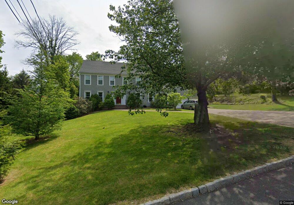
736 Davis Rd Gillette, NJ 07933
Estimated Value: $1,055,000 - $1,164,000
Studio
--
Bath
3,172
Sq Ft
$350/Sq Ft
Est. Value
About This Home
This home is located at 736 Davis Rd, Gillette, NJ 07933 and is currently estimated at $1,110,685, approximately $350 per square foot. 736 Davis Rd is a home located in Morris County with nearby schools including Gillette Elementary School, Millington Elementary School, and Central Middle School.
Ownership History
Date
Name
Owned For
Owner Type
Purchase Details
Closed on
Oct 18, 2011
Sold by
Magee Margaret and Magee Drew J
Bought by
Williams Mark A and Williams Paula A
Current Estimated Value
Home Financials for this Owner
Home Financials are based on the most recent Mortgage that was taken out on this home.
Original Mortgage
$360,000
Outstanding Balance
$246,125
Interest Rate
4.15%
Mortgage Type
Stand Alone First
Estimated Equity
$864,560
Purchase Details
Closed on
Nov 17, 1997
Sold by
Magee Drew and Magee Margaret
Bought by
Magee Margaret
Purchase Details
Closed on
Dec 4, 1996
Sold by
Basile Nicholas and Basile Rachel P
Bought by
Magee Drew J and Magee Margaret G
Home Financials for this Owner
Home Financials are based on the most recent Mortgage that was taken out on this home.
Original Mortgage
$230,000
Interest Rate
7.12%
Create a Home Valuation Report for This Property
The Home Valuation Report is an in-depth analysis detailing your home's value as well as a comparison with similar homes in the area
Home Values in the Area
Average Home Value in this Area
Purchase History
We collect this data history from publicly available records. To have your information removed, we recommend requesting removal directly through your county’s website.
| Date | Buyer | Sale Price | Title Company |
|---|---|---|---|
| Williams Mark A | $611,730 | Chicago Title Insurance Co | |
| Magee Margaret | -- | -- | |
| Magee Drew J | $383,500 | Chicago Title Insurance Co |
Source: Public Records
Mortgage History
We collect this data history from publicly available records. To have your information removed, we recommend requesting removal directly through your county’s website.
| Date | Status | Borrower | Loan Amount |
|---|---|---|---|
| Open | Williams Mark A | $360,000 | |
| Previous Owner | Magee Drew J | $230,000 |
Source: Public Records
Tax History
| Year | Tax Paid | Tax Assessment Tax Assessment Total Assessment is a certain percentage of the fair market value that is determined by local assessors to be the total taxable value of land and additions on the property. | Land | Improvement |
|---|---|---|---|---|
| 2025 | $17,328 | $799,000 | $250,500 | $548,500 |
| 2024 | $16,943 | $772,900 | $246,000 | $526,900 |
| 2023 | $16,943 | $754,700 | $241,500 | $513,200 |
| 2022 | $16,208 | $720,100 | $223,500 | $496,600 |
| 2021 | $16,208 | $657,800 | $218,100 | $439,700 |
| 2020 | $15,938 | $657,800 | $218,100 | $439,700 |
| 2019 | $15,727 | $657,500 | $216,700 | $440,800 |
| 2018 | $15,508 | $652,700 | $213,100 | $439,600 |
| 2017 | $15,253 | $647,400 | $210,000 | $437,400 |
| 2016 | $14,980 | $638,000 | $205,500 | $432,500 |
| 2015 | $15,135 | $516,200 | $220,500 | $295,700 |
| 2014 | $14,805 | $516,200 | $220,500 | $295,700 |
Source: Public Records
Map
Nearby Homes
- 686 Meyersville Rd
- 837 Meyersville Rd
- 783 Long Hill Rd
- 184 Hickory Tavern Rd
- 224 Gates Ave
- 0 Homestead Rd
- 124 Gates Ave
- 101 Gates Ave
- 200 Pleasant Plains Rd
- 630 Valley Rd
- 26 Sunrise Dr
- 49 Preston Dr
- 08-09 Castle Place
- 315 Morristown Rd
- 223 Chaucer Dr
- 133 Central Ave
- 48 Central Ave
- 231 Main Ave
- 39 Surrey Ln
- 62 Forest Ave
- 181 E Springbrook Dr
- 743 Davis Rd
- 705 Meyersville Rd
- 182 E Springbrook Dr
- 730 Meyersville Rd
- 748 Meyersville Rd
- 184 E Springbrook Dr
- 720 Meyersville Rd
- 755 Davis Rd
- 175 E Springbrook Dr
- 762 Meyersville Rd
- 697 Meyersville Rd
- 6 Blue Star Dr
- 772 Meyersville Rd
- 148 E Springbrook Dr
- 176 E Springbrook Dr
- 710 Meyersville Rd
- 144 E Springbrook Dr
- 691 Meyersville Rd
- 18 Blue Star Dr
Your Personal Tour Guide
Ask me questions while you tour the home.