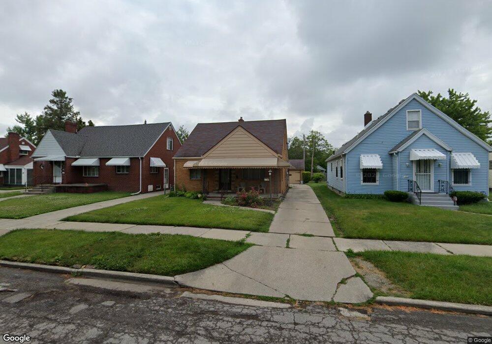
736 Evesham Ave Toledo, OH 43607
Scott Park NeighborhoodEstimated Value: $75,905 - $95,000
3
Beds
1
Bath
1,256
Sq Ft
$67/Sq Ft
Est. Value
About This Home
This home is located at 736 Evesham Ave, Toledo, OH 43607 and is currently estimated at $84,726, approximately $67 per square foot. 736 Evesham Ave is a home located in Lucas County with nearby schools including Jesup W. Scott High School, Explorers Academy, and Explorers Academy of Science and Technology.
Ownership History
Date
Name
Owned For
Owner Type
Purchase Details
Closed on
Mar 10, 2025
Sold by
Thomas Tracy and Calhoun Orrin
Bought by
Thomas Tracy S
Current Estimated Value
Purchase Details
Closed on
Aug 26, 2008
Sold by
Holewinski Mary Ann and Holewinski Lawrence D
Bought by
Michael Dan and Michael Arstella C
Home Financials for this Owner
Home Financials are based on the most recent Mortgage that was taken out on this home.
Original Mortgage
$41,993
Interest Rate
6.31%
Mortgage Type
FHA
Purchase Details
Closed on
Mar 5, 1999
Sold by
Urzykowski Casper F
Bought by
Holewinski Mary Ann
Create a Home Valuation Report for This Property
The Home Valuation Report is an in-depth analysis detailing your home's value as well as a comparison with similar homes in the area
Home Values in the Area
Average Home Value in this Area
Purchase History
| Date | Buyer | Sale Price | Title Company |
|---|---|---|---|
| Thomas Tracy S | -- | None Listed On Document | |
| Michael Dan | $42,000 | None Available | |
| Holewinski Mary Ann | $48,000 | -- |
Source: Public Records
Mortgage History
| Date | Status | Borrower | Loan Amount |
|---|---|---|---|
| Previous Owner | Michael Dan | $41,993 |
Source: Public Records
Tax History
| Year | Tax Paid | Tax Assessment Tax Assessment Total Assessment is a certain percentage of the fair market value that is determined by local assessors to be the total taxable value of land and additions on the property. | Land | Improvement |
|---|---|---|---|---|
| 2025 | -- | $15,260 | $3,290 | $11,970 |
| 2024 | $548 | $15,260 | $3,290 | $11,970 |
| 2023 | $1,180 | $16,170 | $2,030 | $14,140 |
| 2022 | $1,170 | $16,170 | $2,030 | $14,140 |
| 2021 | $1,159 | $16,170 | $2,030 | $14,140 |
| 2020 | $1,119 | $13,335 | $1,645 | $11,690 |
| 2019 | $1,085 | $13,335 | $1,645 | $11,690 |
| 2018 | $1,064 | $13,335 | $1,645 | $11,690 |
| 2017 | $1,129 | $13,020 | $1,610 | $11,410 |
| 2016 | $1,097 | $37,200 | $4,600 | $32,600 |
| 2015 | $1,051 | $37,200 | $4,600 | $32,600 |
| 2014 | $819 | $13,020 | $1,610 | $11,410 |
| 2013 | $819 | $13,020 | $1,610 | $11,410 |
Source: Public Records
Map
Nearby Homes
- 824 N University Ave
- 1019 Woodstock Ave
- 811 N University Ave
- 933 Waverly Ave
- 605 Waverly Ave
- 616 Waverly Ave
- 1004 Waverly Ave
- 913 Coventry Ave
- 1211 Woodstock Ave
- 1215 Woodstock Ave
- 2145 Dorr St
- 1118 Alldays Ave
- 1318 Addington Rd
- 2033 Crosswell Place
- 630 Polonia Ct
- 1206 Warwick Ave
- 1316 Shenandoah Rd
- 1675 Nebraska Ave
- 1652 Nebraska Ave
- 1938 Fernwood Ave
- 732 Evesham Ave
- 742 Evesham Ave
- 726 Evesham Ave
- 746 Evesham Ave
- 737 Woodstock Ave
- 731 Woodstock Ave
- 716 Evesham Ave
- 741 Woodstock Ave
- 735 Woodstock Ave
- 743 Woodstock Ave
- 725 Woodstock Ave
- 723 Woodstock Ave
- 803 Woodstock Ave
- 747 Evesham Ave
- 719 Woodstock Ave
- 801 Evesham Ave
- 812 Evesham Ave
- 805 Woodstock Ave
- 712 Evesham Ave
- 811 Woodstock Ave
Your Personal Tour Guide
Ask me questions while you tour the home.