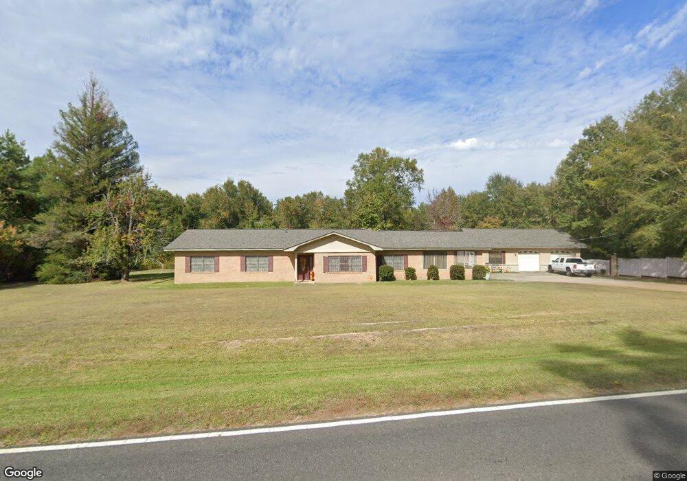
736 Highway 3061 Ruston, LA 71270
Estimated Value: $198,180 - $267,000
Studio
--
Bath
1,948
Sq Ft
$125/Sq Ft
Est. Value
About This Home
This home is located at 736 Highway 3061, Ruston, LA 71270 and is currently estimated at $242,795, approximately $124 per square foot. 736 Highway 3061 is a home located in Lincoln Parish with nearby schools including Ruston Elementary School, Hillcrest Elementary School, and Ruston Junior High School.
Ownership History
Date
Name
Owned For
Owner Type
Purchase Details
Closed on
Apr 24, 2025
Sold by
Mcfarland Constance C and Goldsmith Shannon S
Bought by
Jones Virginia J
Current Estimated Value
Home Financials for this Owner
Home Financials are based on the most recent Mortgage that was taken out on this home.
Original Mortgage
$148,200
Outstanding Balance
$147,007
Interest Rate
6.67%
Mortgage Type
New Conventional
Estimated Equity
$95,788
Create a Home Valuation Report for This Property
The Home Valuation Report is an in-depth analysis detailing your home's value as well as a comparison with similar homes in the area
Purchase History
| Date | Buyer | Sale Price | Title Company |
|---|---|---|---|
| Jones Virginia J | -- | None Listed On Document |
Source: Public Records
Mortgage History
| Date | Status | Borrower | Loan Amount |
|---|---|---|---|
| Open | Jones Virginia J | $148,200 |
Source: Public Records
Tax History
| Year | Tax Paid | Tax Assessment Tax Assessment Total Assessment is a certain percentage of the fair market value that is determined by local assessors to be the total taxable value of land and additions on the property. | Land | Improvement |
|---|---|---|---|---|
| 2025 | $1,341 | $15,889 | $802 | $15,087 |
| 2024 | $1,341 | $15,888 | $802 | $15,086 |
| 2023 | $983 | $11,046 | $585 | $10,461 |
| 2022 | $988 | $11,046 | $585 | $10,461 |
| 2021 | $915 | $11,046 | $585 | $10,461 |
| 2020 | $919 | $11,046 | $585 | $10,461 |
| 2019 | $899 | $11,064 | $585 | $10,479 |
| 2018 | $874 | $11,064 | $585 | $10,479 |
| 2017 | $877 | $11,064 | $585 | $10,479 |
| 2016 | $873 | $0 | $0 | $0 |
| 2015 | $858 | $9,958 | $655 | $9,303 |
| 2013 | $871 | $9,958 | $655 | $9,303 |
Source: Public Records
Map
Nearby Homes
- 2039 Moores Dairy Rd
- 121 Clearwater Cir
- 141 Clearwater Cir
- 11 Moores Dairy Rd
- 124 Baywood Ln
- 09 Moores Dairy Rd
- 160 Baywood Ln
- 145 Clearwater Cir
- 08 Moores Dairy Rd
- 10 Moores Dairy Rd
- 12 Moores Dairy Rd
- 16 Moores Dairy Rd
- 14 Moores Dairy Rd
- 301 E Tennessee Ave
- 1304 Lewis St
- 2121 Sleepy Hollow St
- 201 Congressional Cir
- 2113 Sleepy Hollow St
- 2108 Sleepy Hollow St
- 2117 Merion St
- 793 Highway 3061
- 722 Highway 3061
- 839 Highway 3061
- 693 Highway 3061
- 875 Highway 3061
- 723 Highway 3061
- 2016 Edmiston Rd
- 2152 Moores Dairy Rd
- 2071 Edmiston Rd
- 673 Highway 3061
- 684 Highway 3061
- 2024 Edmiston Rd
- 2024 Edmiston Rd
- 318 Hickory St
- 848 Highway 3061
- 881 Highway 3061
- 440 Water Tank Rd
- 181 Barker Dr
- 319 Hickory St
- 879 Highway 3061
Your Personal Tour Guide
Ask me questions while you tour the home.