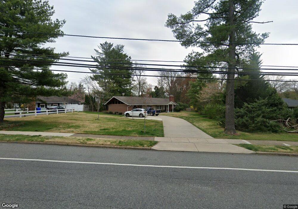
736 Kings Hwy Moorestown, NJ 08057
Estimated Value: $419,301 - $597,000
--
Bed
--
Bath
1,352
Sq Ft
$394/Sq Ft
Est. Value
About This Home
This home is located at 736 Kings Hwy, Moorestown, NJ 08057 and is currently estimated at $532,075, approximately $393 per square foot. 736 Kings Hwy is a home located in Burlington County with nearby schools including Mary E. Roberts Elementary School, Moorestown Upper Elementary School, and William Allen Middle School.
Ownership History
Date
Name
Owned For
Owner Type
Purchase Details
Closed on
Jul 12, 2020
Sold by
Welsher Lisa C
Bought by
Chou Henry R
Current Estimated Value
Home Financials for this Owner
Home Financials are based on the most recent Mortgage that was taken out on this home.
Original Mortgage
$179,000
Interest Rate
2.8%
Mortgage Type
New Conventional
Purchase Details
Closed on
Mar 1, 1996
Sold by
Welsher Carol S
Bought by
Welsher Lisa C
Purchase Details
Closed on
Oct 4, 1995
Sold by
Welsher Carol S and Savin Frances G
Bought by
Welsher Carol S
Create a Home Valuation Report for This Property
The Home Valuation Report is an in-depth analysis detailing your home's value as well as a comparison with similar homes in the area
Home Values in the Area
Average Home Value in this Area
Purchase History
| Date | Buyer | Sale Price | Title Company |
|---|---|---|---|
| Chou Henry R | $339,000 | Trident Land Transfer Co Llc | |
| Welsher Lisa C | $130,000 | -- | |
| Welsher Carol S | -- | -- |
Source: Public Records
Mortgage History
| Date | Status | Borrower | Loan Amount |
|---|---|---|---|
| Previous Owner | Chou Henry R | $179,000 |
Source: Public Records
Tax History Compared to Growth
Tax History
| Year | Tax Paid | Tax Assessment Tax Assessment Total Assessment is a certain percentage of the fair market value that is determined by local assessors to be the total taxable value of land and additions on the property. | Land | Improvement |
|---|---|---|---|---|
| 2025 | $7,476 | $263,500 | $162,000 | $101,500 |
| 2024 | $7,249 | $263,500 | $162,000 | $101,500 |
| 2023 | $7,249 | $263,500 | $162,000 | $101,500 |
| 2022 | $6,729 | $247,100 | $162,000 | $85,100 |
| 2021 | $6,640 | $247,100 | $162,000 | $85,100 |
| 2020 | $6,598 | $247,100 | $162,000 | $85,100 |
| 2019 | $6,481 | $247,100 | $162,000 | $85,100 |
| 2018 | $6,306 | $247,100 | $162,000 | $85,100 |
| 2017 | $6,360 | $247,100 | $162,000 | $85,100 |
| 2016 | $6,338 | $247,100 | $162,000 | $85,100 |
| 2015 | $6,262 | $247,100 | $162,000 | $85,100 |
| 2014 | $5,945 | $247,100 | $162,000 | $85,100 |
Source: Public Records
Map
Nearby Homes
- 21 Foxwood Dr Unit 21
- 512 Regenhard Ave
- 12 Greenvale Rd
- 42 Foxwood Dr Unit 42
- 602 Windsor Place
- 403 S Lenola Rd
- 601 Stratford Dr
- 1 Circle Dr
- 112 Beacon St
- 206 E Camden Ave
- 101 S Lenola Rd
- 430 Highland Dr
- 116 S Lincoln Ave
- 136 Chalkboard Ct
- 47 Eraser Rd
- 198 S Lincoln Ave
- 5 Domenica Dr
- 12 Vincent Way
- 9 Domenica Dr
- 18 Vincent Way
- 740 Kings Hwy
- 732 Kings Hwy
- 104 Ramblewood Rd
- 105 Haines Dr
- 101 Haines Dr
- 108 Ramblewood Rd
- 728 Kings Hwy
- 109 Haines Dr
- 112 Ramblewood Rd
- 729 Kings Hwy
- 103 Ramblewood Rd
- 724 Kings Hwy
- 733 Kings Hwy
- 725 Kings Hwy
- 113 Haines Dr
- 107 Ramblewood Rd
- 116 Ramblewood Rd
- 721 Kings Hwy
- 720 Kings Hwy
- 111 Ramblewood Rd