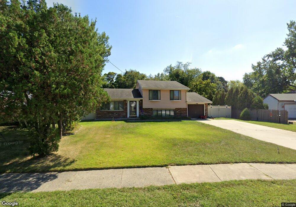
736 Lancing Rd West Deptford, NJ 08096
West Deptford Township NeighborhoodEstimated Value: $378,000 - $393,000
3
Beds
2
Baths
1,720
Sq Ft
$224/Sq Ft
Est. Value
About This Home
This home is located at 736 Lancing Rd, West Deptford, NJ 08096 and is currently estimated at $384,910, approximately $223 per square foot. 736 Lancing Rd is a home located in Gloucester County with nearby schools including Oakview Elementary School, Red Bank Elementary School, and Green-Fields Elementary School.
Ownership History
Date
Name
Owned For
Owner Type
Purchase Details
Closed on
Dec 30, 2010
Sold by
Thomas Guy H and Estate Of Elizabeth Thomas
Bought by
Pitts William Anthony and Brock Pitts Jessica E
Current Estimated Value
Home Financials for this Owner
Home Financials are based on the most recent Mortgage that was taken out on this home.
Original Mortgage
$164,000
Outstanding Balance
$109,759
Interest Rate
4.4%
Mortgage Type
New Conventional
Estimated Equity
$275,151
Create a Home Valuation Report for This Property
The Home Valuation Report is an in-depth analysis detailing your home's value as well as a comparison with similar homes in the area
Home Values in the Area
Average Home Value in this Area
Purchase History
| Date | Buyer | Sale Price | Title Company |
|---|---|---|---|
| Pitts William Anthony | $205,000 | Group 21 Title Agency |
Source: Public Records
Mortgage History
| Date | Status | Borrower | Loan Amount |
|---|---|---|---|
| Open | Pitts William Anthony | $164,000 |
Source: Public Records
Tax History Compared to Growth
Tax History
| Year | Tax Paid | Tax Assessment Tax Assessment Total Assessment is a certain percentage of the fair market value that is determined by local assessors to be the total taxable value of land and additions on the property. | Land | Improvement |
|---|---|---|---|---|
| 2025 | $7,082 | $202,800 | $60,800 | $142,000 |
| 2024 | $6,991 | $202,800 | $60,800 | $142,000 |
| 2023 | $6,991 | $202,800 | $60,800 | $142,000 |
| 2022 | $6,958 | $202,800 | $60,800 | $142,000 |
| 2021 | $6,934 | $202,800 | $60,800 | $142,000 |
| 2020 | $6,918 | $202,800 | $60,800 | $142,000 |
| 2019 | $6,725 | $202,800 | $60,800 | $142,000 |
| 2018 | $6,542 | $202,800 | $60,800 | $142,000 |
| 2017 | $6,390 | $202,800 | $60,800 | $142,000 |
| 2016 | $6,212 | $202,800 | $60,800 | $142,000 |
| 2015 | $6,072 | $208,100 | $66,100 | $142,000 |
| 2014 | $5,771 | $208,100 | $66,100 | $142,000 |
Source: Public Records
Map
Nearby Homes
- 2 Victorian Way
- 3 Victorian Way
- 7 Victorian Way
- 83 Lynn Dr
- 112 N Drexel St
- 46 Lynn Dr
- 302 W Red Bank Ave
- 21 S Columbia St
- 815 Harker Ave
- 210 Lawnton Ave
- 654 Frances Ave
- 195 Delaware St
- 193 Dubois Ave
- 34 S Jackson St
- 125 S Davis St
- 266 Passaic Ave
- 340 High St
- 131 Watkins Ave
- 154 W Barber Ave
- 1448 Victory Ave
- 740 Lancing Rd
- 732 Chetwood Ct
- 734 Lancing Rd
- 744 Lancing Rd
- 730 Chetwood Ct
- 733 Lancing Rd
- 114 Red Bank Ct
- 748 Lancing Rd
- 739 Lancing Rd
- 727 Lancing Rd
- 115 Red Bank Ct
- 745 Lancing Rd
- 728 Chetwood Ct
- 721 Lancing Rd
- 718 Lancing Rd
- 726 Chetwood Ct
- 752 Lancing Rd
- 116 Red Bank Ct
- 113 Red Bank Ct
- 751 Lancing Rd