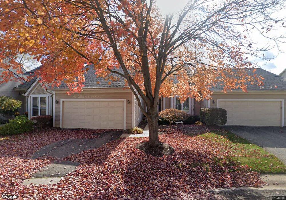
736 Mill Pointe Dr Milford, MI 48381
Estimated Value: $468,000 - $592,000
3
Beds
3
Baths
1,815
Sq Ft
$281/Sq Ft
Est. Value
About This Home
This home is located at 736 Mill Pointe Dr, Milford, MI 48381 and is currently estimated at $510,374, approximately $281 per square foot. 736 Mill Pointe Dr is a home located in Oakland County with nearby schools including Muir Middle School, Kurtz Elementary School, and Christ Lutheran Christian Day School.
Ownership History
Date
Name
Owned For
Owner Type
Purchase Details
Closed on
Dec 6, 2017
Sold by
Johnson Craig F and Johnson Kathleen L
Bought by
Johnson Craig F and Johnson Kathleen L
Current Estimated Value
Purchase Details
Closed on
Nov 13, 2012
Sold by
Varilone George Joseph
Bought by
Johnson Craig F and Johnson Kathleen L
Purchase Details
Closed on
Sep 11, 2000
Sold by
Varilone George J and Varilone Henrietta
Bought by
Varilone George Joseph and George Joseph Varilone Revocable Living
Purchase Details
Closed on
Jul 30, 1998
Sold by
Mill Pond Preserve Ltd
Bought by
Varilone George J
Home Financials for this Owner
Home Financials are based on the most recent Mortgage that was taken out on this home.
Original Mortgage
$165,000
Interest Rate
7.07%
Create a Home Valuation Report for This Property
The Home Valuation Report is an in-depth analysis detailing your home's value as well as a comparison with similar homes in the area
Home Values in the Area
Average Home Value in this Area
Purchase History
| Date | Buyer | Sale Price | Title Company |
|---|---|---|---|
| Johnson Craig F | -- | None Available | |
| Johnson Craig F | $234,000 | None Available | |
| Varilone George Joseph | -- | -- | |
| Varilone George J | $212,500 | -- |
Source: Public Records
Mortgage History
| Date | Status | Borrower | Loan Amount |
|---|---|---|---|
| Previous Owner | Varilone George J | $165,000 |
Source: Public Records
Tax History
| Year | Tax Paid | Tax Assessment Tax Assessment Total Assessment is a certain percentage of the fair market value that is determined by local assessors to be the total taxable value of land and additions on the property. | Land | Improvement |
|---|---|---|---|---|
| 2025 | $3,520 | $228,310 | $0 | $0 |
| 2024 | $3,069 | $212,550 | $0 | $0 |
| 2023 | $2,938 | $208,190 | $0 | $0 |
| 2022 | $3,886 | $194,200 | $0 | $0 |
| 2021 | $2,178 | $183,100 | $0 | $0 |
| 2020 | $2,716 | $178,430 | $0 | $0 |
| 2019 | $2,746 | $161,240 | $0 | $0 |
| 2018 | $2,711 | $154,930 | $0 | $0 |
| 2017 | $1,446 | $154,930 | $0 | $0 |
| 2016 | $3,378 | $143,910 | $0 | $0 |
| 2015 | -- | $122,860 | $0 | $0 |
| 2014 | -- | $103,700 | $0 | $0 |
| 2011 | -- | $72,000 | $0 | $0 |
Source: Public Records
Map
Nearby Homes
- 524 W Huron St
- 007 S Milford Rd
- 431 W Washington St
- 778 S Milford Rd Unit 37
- 738 S Milford Rd Unit 30
- 710 Bellevue
- 564 Dorchester Way Unit 16
- 906 Meadowbrook Way
- 312 Dorchester Way
- 120 E Liberty St Unit 304
- 120 E Liberty St Unit 303
- 120 E Liberty St Unit 207
- 120 E Liberty St Unit 206
- 120 E Liberty St Unit 201
- 120 E Liberty St Unit 203
- 120 E Liberty St Unit 305
- 120 E Liberty St Unit 302
- 120 E Liberty St Unit 205
- 120 E Liberty St Unit 301
- 120 E Liberty St Unit 204
- 736 Mill Pointe Dr Unit 19
- 732 Mill Pointe Dr
- 728 Mill Pointe Dr Unit 21
- 648 Mill Pointe Dr
- 731 Mill Pointe Dr Unit 17
- 727 Mill Pointe Dr Unit 16
- 735 Mill Pointe Dr Unit 18
- 640 Mill Pointe Dr
- 715 Pointe Ct Unit 15
- 659 Mill Pointe Dr
- 659 Mill Pointe Dr Unit 5
- 683 Pointe Ct Unit 9
- 711 Pointe Ct
- 711 Pointe Ct Unit 14
- 635 Mill Pointe Dr Unit 1
- 687 Pointe Ct Unit 10
- 691 Pointe Ct
- 707 Pointe Ct
- 623 Mill Pointe Dr Unit 26
- 695 Pointe Ct
Your Personal Tour Guide
Ask me questions while you tour the home.