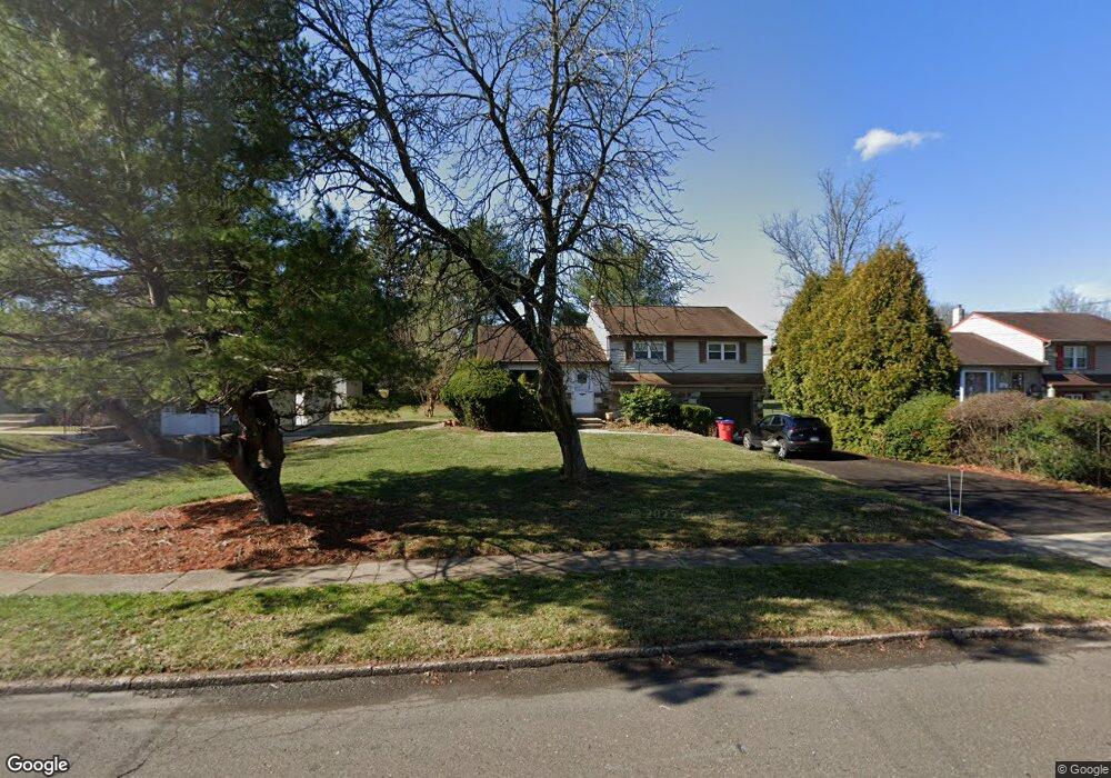
736 W Bristol Rd Warminster, PA 18974
Estimated Value: $381,000 - $429,000
3
Beds
2
Baths
1,092
Sq Ft
$379/Sq Ft
Est. Value
About This Home
This home is located at 736 W Bristol Rd, Warminster, PA 18974 and is currently estimated at $413,381, approximately $378 per square foot. 736 W Bristol Rd is a home located in Bucks County with nearby schools including McDonald Elementary School, Log College Middle School, and William Tennent High School.
Ownership History
Date
Name
Owned For
Owner Type
Purchase Details
Closed on
Jan 30, 2020
Sold by
Taylor Diane B and Estate Of Joann D Taylor
Bought by
Taylor Diane B and Taylor Robert C
Current Estimated Value
Home Financials for this Owner
Home Financials are based on the most recent Mortgage that was taken out on this home.
Original Mortgage
$73,340
Outstanding Balance
$65,109
Interest Rate
3.74%
Mortgage Type
New Conventional
Estimated Equity
$348,272
Purchase Details
Closed on
Jan 21, 1965
Sold by
Rosemore Bldg Co & Delwyn Corp
Bought by
Taylor Charles R and Jo Ann D
Create a Home Valuation Report for This Property
The Home Valuation Report is an in-depth analysis detailing your home's value as well as a comparison with similar homes in the area
Home Values in the Area
Average Home Value in this Area
Purchase History
| Date | Buyer | Sale Price | Title Company |
|---|---|---|---|
| Taylor Diane B | -- | None Available | |
| Taylor Charles R | -- | -- |
Source: Public Records
Mortgage History
| Date | Status | Borrower | Loan Amount |
|---|---|---|---|
| Open | Taylor Diane B | $73,340 |
Source: Public Records
Tax History Compared to Growth
Tax History
| Year | Tax Paid | Tax Assessment Tax Assessment Total Assessment is a certain percentage of the fair market value that is determined by local assessors to be the total taxable value of land and additions on the property. | Land | Improvement |
|---|---|---|---|---|
| 2025 | $4,475 | $21,200 | $4,280 | $16,920 |
| 2024 | $4,475 | $21,200 | $4,280 | $16,920 |
| 2023 | $4,337 | $21,200 | $4,280 | $16,920 |
| 2022 | $4,244 | $21,200 | $4,280 | $16,920 |
| 2021 | $4,145 | $21,200 | $4,280 | $16,920 |
| 2020 | $4,087 | $21,200 | $4,280 | $16,920 |
| 2019 | $3,870 | $21,200 | $4,280 | $16,920 |
| 2018 | $3,777 | $21,200 | $4,280 | $16,920 |
| 2017 | $3,667 | $21,200 | $4,280 | $16,920 |
| 2016 | $3,667 | $21,200 | $4,280 | $16,920 |
| 2015 | $3,629 | $21,200 | $4,280 | $16,920 |
| 2014 | $3,629 | $21,200 | $4,280 | $16,920 |
Source: Public Records
Map
Nearby Homes
- 1252 Dahlia Rd
- 1240 June Rd
- 1229 Manor Dr
- 202 Strawberry Ct Unit 249
- 868 Aster Rd
- 1008 Julian Dr W Unit W
- 667 Arbor Ln
- 675 Cheryl Dr
- 451 Twin Streams Dr
- 1075 Roberts Rd
- 902 Hamilton Way
- 950 Nathaniel Trail
- 1024 Gates Place
- 934 Nathaniel Trail
- 921 Nathaniel Trail
- 3303 Knox Ct Unit 3303
- 905 Holden Ct
- 3208 Knox Ct Unit 3208
- 922 Holden Ct
- 5302 Knox Ct Unit 5302
- 746 W Bristol Rd
- 726 W Bristol Rd
- 1272 Dahlia Rd
- 716 W Bristol Rd
- 1276 Dahlia Rd
- 1268 Dahlia Rd
- 1280 Dahlia Rd
- 750 W Bristol Rd
- 706 W Bristol Rd
- 206 Countryside Ct
- 755 Garden Rd
- 1284 Dahlia Rd
- 205 Countryside Ct
- 766 W Bristol Rd
- 1275 Dahlia Rd
- 204 Countryside Ct
- 203 Holly Hill Ct
- 203 Countryside Ct
- 201 Holly Hill Ct
- 202 Holly Hill Ct