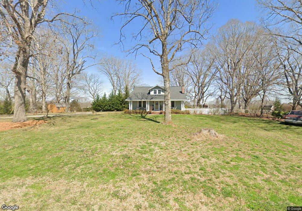
736 Wilson Cornwell Rd Shelby, NC 28150
Estimated Value: $368,000 - $572,000
Studio
--
Bath
2,447
Sq Ft
$175/Sq Ft
Est. Value
About This Home
This home is located at 736 Wilson Cornwell Rd, Shelby, NC 28150 and is currently estimated at $428,413, approximately $175 per square foot. 736 Wilson Cornwell Rd is a home with nearby schools including Union Elementary School, Burns Middle, and Burns High School.
Ownership History
Date
Name
Owned For
Owner Type
Purchase Details
Closed on
Jun 28, 2016
Sold by
Macarthur Robert Douglas and Macarthur Carol Hovis
Bought by
Wamsley Eric J and Wamsley Nicole K
Current Estimated Value
Home Financials for this Owner
Home Financials are based on the most recent Mortgage that was taken out on this home.
Original Mortgage
$216,980
Outstanding Balance
$173,661
Interest Rate
3.66%
Mortgage Type
New Conventional
Estimated Equity
$254,752
Purchase Details
Closed on
Apr 23, 2007
Sold by
Card Stephan A and Card Barbara M
Bought by
Macarthuc Robert Douglas and Macarthuc Carol Uowes
Create a Home Valuation Report for This Property
The Home Valuation Report is an in-depth analysis detailing your home's value as well as a comparison with similar homes in the area
Home Values in the Area
Average Home Value in this Area
Purchase History
| Date | Buyer | Sale Price | Title Company |
|---|---|---|---|
| Wamsley Eric J | $233,500 | None Available | |
| Macarthuc Robert Douglas | $145,000 | None Available |
Source: Public Records
Mortgage History
| Date | Status | Borrower | Loan Amount |
|---|---|---|---|
| Open | Wamsley Eric J | $216,980 |
Source: Public Records
Tax History
| Year | Tax Paid | Tax Assessment Tax Assessment Total Assessment is a certain percentage of the fair market value that is determined by local assessors to be the total taxable value of land and additions on the property. | Land | Improvement |
|---|---|---|---|---|
| 2025 | $1,761 | $277,250 | $49,638 | $227,612 |
| 2024 | $1,712 | $212,150 | $44,994 | $167,156 |
| 2023 | $1,041 | $127,737 | $44,994 | $82,743 |
| 2022 | $1,035 | $127,737 | $44,994 | $82,743 |
| 2021 | $1,041 | $127,737 | $44,994 | $82,743 |
| 2020 | $984 | $116,202 | $44,994 | $71,208 |
| 2019 | $984 | $116,202 | $44,994 | $71,208 |
| 2018 | $982 | $116,202 | $44,994 | $71,208 |
| 2017 | $977 | $116,202 | $44,994 | $71,208 |
| 2016 | $941 | $111,269 | $44,994 | $66,275 |
| 2015 | $987 | $117,057 | $41,882 | $75,175 |
| 2014 | $987 | $117,057 | $41,882 | $75,175 |
Source: Public Records
Map
Nearby Homes
- 2728 Polkville Rd
- 3010 Polkville Rd
- 3014 Polkville Rd
- 2145 Jack Wilson Rd
- 114 Highfield Ct
- 109 Highfield Ct
- 110 Ashland Ct
- 1423 Chatfield Rd
- 107 Destiny Ln
- 106 Quail Meadow Rd
- 120 Foxhill Dr
- 1429 Williamson Rd
- 00 Metcalf Rd
- 3450 Polkville Rd
- 1824 Brushy Creek Rd
- 000 Briar Ln
- 3603 Weatherly Ln
- 3620 Arrowhead Rd
- 2019 Pineview Dr
- 360 Magness Rd
- 731 Wilson Cornwell Rd
- 735 Wilson Cornwell Rd
- 741 Wilson Cornwell Rd
- 728 Wilson Cornwell Rd
- 737 Wilson Cornwell Rd
- 124 Cotton Rd
- 118 Cotton Rd
- 2910 Lee Cornwell Rd
- 724 Wilson Cornwell Rd
- 114 Cotton Rd
- 2912 Polkville Rd
- 110 Cotton Rd
- 710 Wilson Cornwell Rd
- 706 Wilson Cornwell Rd
- 104 Cotton Rd
- 724 W Zion Church Rd
- 2911 Laura Rd
- 702 Wilson Cornwell Rd
- 2821 Polkville Rd Unit 1
- 102 Cotton Rd
Your Personal Tour Guide
Ask me questions while you tour the home.