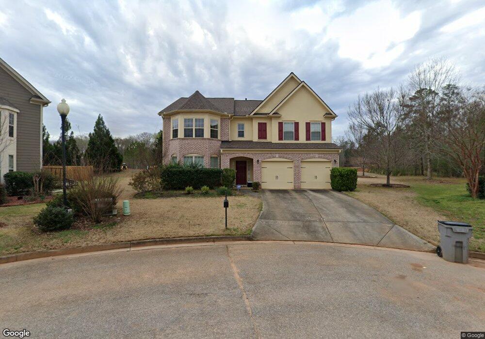
736 Windstream Dr Lagrange, GA 30241
Estimated Value: $309,000 - $402,000
4
Beds
3
Baths
3,000
Sq Ft
$118/Sq Ft
Est. Value
About This Home
This home is located at 736 Windstream Dr, Lagrange, GA 30241 and is currently estimated at $354,634, approximately $118 per square foot. 736 Windstream Dr is a home located in Troup County with nearby schools including Franklin Forest Elementary School, Hollis Hand Elementary School, and Ethel W. Kight Elementary School.
Ownership History
Date
Name
Owned For
Owner Type
Purchase Details
Closed on
Nov 24, 2009
Sold by
Lee Youghee
Bought by
Lee Youbghee
Current Estimated Value
Home Financials for this Owner
Home Financials are based on the most recent Mortgage that was taken out on this home.
Original Mortgage
$194,096
Interest Rate
5.01%
Mortgage Type
New Conventional
Create a Home Valuation Report for This Property
The Home Valuation Report is an in-depth analysis detailing your home's value as well as a comparison with similar homes in the area
Purchase History
| Date | Buyer | Sale Price | Title Company |
|---|---|---|---|
| Lee Youbghee | -- | -- | |
| Lee Younghee | $242,621 | -- |
Source: Public Records
Mortgage History
| Date | Status | Borrower | Loan Amount |
|---|---|---|---|
| Closed | Lee Younghee | $194,096 |
Source: Public Records
Tax History
| Year | Tax Paid | Tax Assessment Tax Assessment Total Assessment is a certain percentage of the fair market value that is determined by local assessors to be the total taxable value of land and additions on the property. | Land | Improvement |
|---|---|---|---|---|
| 2025 | $3,965 | $157,920 | $18,000 | $139,920 |
| 2024 | $3,442 | $128,200 | $18,000 | $110,200 |
| 2023 | $3,401 | $126,680 | $14,000 | $112,680 |
| 2022 | $3,239 | $118,040 | $14,000 | $104,040 |
| 2021 | $2,779 | $94,120 | $10,000 | $84,120 |
| 2020 | $2,718 | $92,120 | $8,000 | $84,120 |
| 2019 | $2,835 | $96,000 | $8,000 | $88,000 |
| 2018 | $2,832 | $95,880 | $8,000 | $87,880 |
| 2017 | $2,832 | $95,880 | $8,000 | $87,880 |
| 2016 | $2,832 | $95,880 | $8,000 | $87,880 |
| 2015 | $2,837 | $95,880 | $8,000 | $87,880 |
| 2014 | $2,708 | $91,486 | $8,000 | $83,486 |
| 2013 | -- | $93,408 | $8,000 | $85,408 |
Source: Public Records
Map
Nearby Homes
- 124 Shenandoah Ln
- 402 Sweetwood Ct Unit LOT 2
- 206 Freshwater Ct Unit 34E
- 206 Freshwater Ct
- 204 Freshwater Ct
- 202 Freshwater Ct
- 136 Shenandoah Ln
- 114 Shenandoah Ln
- 200 Freshwater Ct Unit 37
- 139 Shenandoah Ln
- 142 Shenandoah Ln
- 141 Shenandoah Ln
- 117 Shenandoah Ln Unit 22D
- 143 Shenandoah Ln
- 108 Shenandoah Ln Unit 27E
- 146 Shenandoah Ln
- 147 Shenandoah Ln
- 249 River Meadow Dr
- 106 Shenandoah Ln Unit 26E
- 106 Shenandoah Ln
- 707 Windstream Dr Unit B55
- 709 Windstream Dr Unit B56
- 717 Windstream Dr Unit B-60
- 717 Windstream Dr Unit A-60
- 734 Windstream Dr
- 727 Windstream Dr
- 122 Shenandoah Ln Unit 64
- 732 Windstream Dr
- 400 Sweetwood Ct
- 400 Sweetwood Ct Unit LOT 3
- 0 Windstream Unit LOT 6 02893972
- 730 Windstream Dr
- 402 Sweetwood Ct
- 401 Sweetwood Ct
- 401 Sweetwood Ct Unit 40
- 705 Windstream Dr Unit A11
- 705 Windstream Dr
- 705 Windstream Dr Unit B54
- 728 Windstream Dr
- 710 Windstream Dr
Your Personal Tour Guide
Ask me questions while you tour the home.