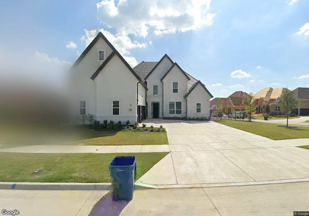
7363 Calypso Ln Frisco, TX 75036
Southwest Frisco NeighborhoodEstimated Value: $1,494,417 - $1,842,000
3
Beds
2
Baths
5,508
Sq Ft
$292/Sq Ft
Est. Value
About This Home
This home is located at 7363 Calypso Ln, Frisco, TX 75036 and is currently estimated at $1,606,104, approximately $291 per square foot. 7363 Calypso Ln is a home with nearby schools including Nichols Elementary School, Pearson Middle, and Reedy High School.
Ownership History
Date
Name
Owned For
Owner Type
Purchase Details
Closed on
Mar 30, 2021
Sold by
Makkena Sasi and Makkena Anu
Bought by
Makkena Sasi and Makkena Anu
Current Estimated Value
Purchase Details
Closed on
Oct 19, 2017
Sold by
Toll Dallas Tx Llc
Bought by
Makkena Sasikanth and Moturi Anupama
Home Financials for this Owner
Home Financials are based on the most recent Mortgage that was taken out on this home.
Original Mortgage
$801,370
Outstanding Balance
$658,879
Interest Rate
3.25%
Mortgage Type
Adjustable Rate Mortgage/ARM
Estimated Equity
$947,225
Create a Home Valuation Report for This Property
The Home Valuation Report is an in-depth analysis detailing your home's value as well as a comparison with similar homes in the area
Home Values in the Area
Average Home Value in this Area
Purchase History
| Date | Buyer | Sale Price | Title Company |
|---|---|---|---|
| Makkena Sasi | -- | None Available | |
| Makkena Sasikanth | -- | None Available |
Source: Public Records
Mortgage History
| Date | Status | Borrower | Loan Amount |
|---|---|---|---|
| Open | Makkena Sasikanth | $801,370 |
Source: Public Records
Tax History Compared to Growth
Tax History
| Year | Tax Paid | Tax Assessment Tax Assessment Total Assessment is a certain percentage of the fair market value that is determined by local assessors to be the total taxable value of land and additions on the property. | Land | Improvement |
|---|---|---|---|---|
| 2025 | $20,429 | $1,418,000 | $428,278 | $989,722 |
| 2024 | $22,498 | $1,346,972 | $0 | $0 |
| 2023 | $18,169 | $1,224,520 | $428,278 | $1,068,239 |
| 2022 | $20,895 | $1,113,200 | $334,482 | $953,887 |
| 2021 | $20,056 | $1,013,221 | $250,862 | $762,359 |
| 2020 | $18,494 | $920,000 | $250,862 | $669,138 |
| 2019 | $19,801 | $937,470 | $250,862 | $719,658 |
| 2018 | $18,276 | $852,245 | $250,862 | $601,383 |
| 2017 | $2,193 | $101,597 | $101,597 | $0 |
Source: Public Records
Map
Nearby Homes
- 7224 Revard Rd
- 953 Stampede Dr
- 248 Burnswick Isles Way
- 7760 Hackamore St
- 6625 Titus Ln
- 6579 Mountain Sky Rd
- 289 Mariposa Ln
- 4610 White Buffalo Trail
- 4606 White Buffalo Trail
- 4602 White Buffalo Trail
- 8336 Pitkin Rd
- 305 Balboa Ct
- 7205 Oakmont Dr
- 7872 Crazy Horse Dr
- 559 Rockledge Ct
- 1717 Angel Falls Dr
- 626 Oakland Hills Ln
- 625 Rockledge Ct
- 8492 Liverpool Ln
- 688 Rockledge Ct
- 7311 Calypso Ln
- 7342 Shoestring Dr
- 7351 Shoestring Dr
- 7369 Shoestring Dr
- 7333 Shoestring Dr
- 7387 Shoestring Dr
- 7285 Calypso Ln
- 7350 Calypso Ln
- 7315 Shoestring Dr
- 7300 Shoestring Dr
- 7324 Calypso Ln
- 7259 Calypso Ln
- 7298 Whiskbroom Dr
- 7298 Colfax Dr
- 7283 Shoestring Dr
- 7258 Shoestring Dr
- 7272 Whiskbroom Dr
- 7233 Calypso Ln
- 696 Carbine Trail
- 7272 Calypso Ln