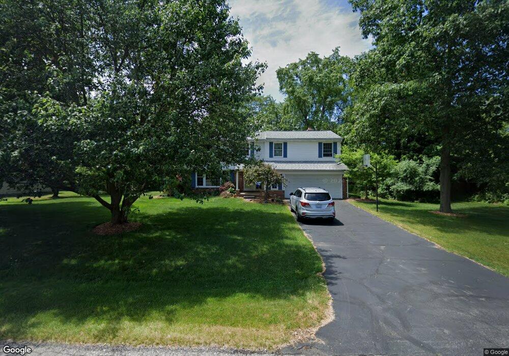
7364 Brookridge Dr West Bloomfield, MI 48322
Estimated Value: $429,000 - $468,000
4
Beds
3
Baths
2,316
Sq Ft
$192/Sq Ft
Est. Value
About This Home
This home is located at 7364 Brookridge Dr, West Bloomfield, MI 48322 and is currently estimated at $445,419, approximately $192 per square foot. 7364 Brookridge Dr is a home located in Oakland County with nearby schools including Wood Creek Elementary School, Warner Upper Elementary School, and Red Hill Montessori Academy.
Ownership History
Date
Name
Owned For
Owner Type
Purchase Details
Closed on
Apr 16, 2010
Sold by
Rock Homes Llc
Bought by
King Gregory and King Angela
Current Estimated Value
Home Financials for this Owner
Home Financials are based on the most recent Mortgage that was taken out on this home.
Original Mortgage
$153,000
Outstanding Balance
$102,004
Interest Rate
5.02%
Mortgage Type
New Conventional
Estimated Equity
$343,415
Purchase Details
Closed on
Jun 16, 2009
Sold by
Sarris Paul and Sarris Amy
Bought by
Bank Of America National Association
Purchase Details
Closed on
Jun 1, 2004
Sold by
Cooper Barbara and Kent Cooper J
Bought by
Sarris Paul and Sarris Amy
Create a Home Valuation Report for This Property
The Home Valuation Report is an in-depth analysis detailing your home's value as well as a comparison with similar homes in the area
Home Values in the Area
Average Home Value in this Area
Purchase History
| Date | Buyer | Sale Price | Title Company |
|---|---|---|---|
| King Gregory | $170,000 | None Available | |
| Bank Of America National Association | $312,062 | None Available | |
| Sarris Paul | $272,000 | First American Title |
Source: Public Records
Mortgage History
| Date | Status | Borrower | Loan Amount |
|---|---|---|---|
| Open | King Gregory | $153,000 |
Source: Public Records
Tax History Compared to Growth
Tax History
| Year | Tax Paid | Tax Assessment Tax Assessment Total Assessment is a certain percentage of the fair market value that is determined by local assessors to be the total taxable value of land and additions on the property. | Land | Improvement |
|---|---|---|---|---|
| 2024 | $1,925 | $187,090 | $0 | $0 |
| 2022 | $1,855 | $185,190 | $47,500 | $137,690 |
| 2021 | $3,431 | $159,220 | $0 | $0 |
| 2020 | $1,793 | $151,070 | $39,310 | $111,760 |
| 2018 | $3,428 | $142,020 | $27,300 | $114,720 |
| 2015 | -- | $96,160 | $0 | $0 |
| 2014 | -- | $89,780 | $0 | $0 |
| 2011 | -- | $77,300 | $0 | $0 |
Source: Public Records
Map
Nearby Homes
- 28786 Rockledge Dr
- 29020 Ramblewood Dr
- 7250 Ten Hill
- 7479 Gramercy Cir Unit 16
- 7477 Gramercy Cir Unit 17
- 7209 Stonebrook Rd
- 7507 Gramercy Cir
- 5312 Cambourne Place
- 32500 Rock Ridge Ln
- 32411 Tareyton St
- 7496 Cornwall Ct
- 30070 Lochmoor St
- 7251 N Briarcliff Knoll Dr
- 32615 Briarcrest Knoll
- 29621 Gilchrest St
- 31685 Franklin Fairway St
- 2014 Waldons Ct
- 32620 Inkster Rd
- 7371 Lindenmere Dr
- 7335 Coach Ln
- 7365 Linda Ln
- 7338 Brookridge Dr
- 7390 Brookridge Dr
- 7393 Linda Ln
- 7337 Linda Ln
- 7365 Brookridge Dr
- 7339 Brookridge Dr
- 7391 Brookridge Dr
- 5185 Coldspring Ln
- 5175 Coldspring Ln
- 7315 Linda Ln
- 7356 Linda Ln
- 5165 Coldspring Ln
- 7390 Linda Ln
- 5188 Cold Spring Ln
- 5155 Coldspring Ln
- 28720 W 14 Mile Rd
- 32748 Olde Franklin Dr
- 32764 Olde Franklin Dr Unit Bldg-Unit
- 32764 Olde Franklin Dr