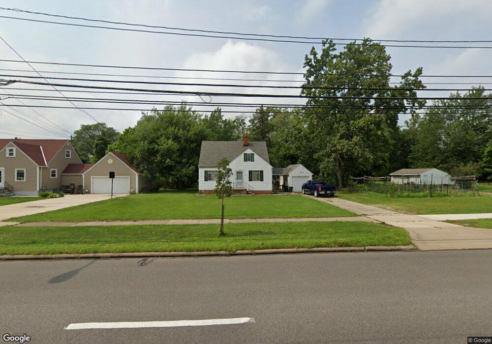
7366 Pearl Rd Middleburg Heights, OH 44130
Estimated Value: $199,027 - $256,000
3
Beds
2
Baths
1,278
Sq Ft
$185/Sq Ft
Est. Value
About This Home
This home is located at 7366 Pearl Rd, Middleburg Heights, OH 44130 and is currently estimated at $236,007, approximately $184 per square foot. 7366 Pearl Rd is a home located in Cuyahoga County with nearby schools including Big Creek Elementary School, Berea-Midpark Middle School, and Berea-Midpark High School.
Ownership History
Date
Name
Owned For
Owner Type
Purchase Details
Closed on
Mar 15, 2016
Sold by
Estate Of Raymond P Smith
Bought by
Smith David E and Smith Douglas A
Current Estimated Value
Purchase Details
Closed on
Jul 10, 1987
Sold by
Kanieski Charles J
Bought by
Smith Raymond P
Purchase Details
Closed on
Jun 19, 1987
Sold by
Kaneski Charles J and Kaneski Nancy L
Bought by
Kanieski Charles J
Purchase Details
Closed on
Oct 10, 1984
Sold by
Earhart Emma I
Bought by
Kaneski Charles J and Kaneski Nancy L
Purchase Details
Closed on
Jan 1, 1975
Bought by
Earhart Raymond A and Earhart Emma I
Create a Home Valuation Report for This Property
The Home Valuation Report is an in-depth analysis detailing your home's value as well as a comparison with similar homes in the area
Home Values in the Area
Average Home Value in this Area
Purchase History
| Date | Buyer | Sale Price | Title Company |
|---|---|---|---|
| Smith David E | -- | None Available | |
| Smith Raymond P | $54,800 | -- | |
| Kanieski Charles J | -- | -- | |
| Kaneski Charles J | $50,000 | -- | |
| Earhart Emma I | -- | -- | |
| Earhart Raymond A | -- | -- |
Source: Public Records
Tax History Compared to Growth
Tax History
| Year | Tax Paid | Tax Assessment Tax Assessment Total Assessment is a certain percentage of the fair market value that is determined by local assessors to be the total taxable value of land and additions on the property. | Land | Improvement |
|---|---|---|---|---|
| 2024 | $3,221 | $58,555 | $14,385 | $44,170 |
| 2023 | $3,406 | $51,450 | $14,210 | $37,240 |
| 2022 | $3,384 | $51,450 | $14,210 | $37,240 |
| 2021 | $3,367 | $51,450 | $14,210 | $37,240 |
| 2020 | $3,199 | $42,880 | $11,830 | $31,050 |
| 2019 | $3,111 | $122,500 | $33,800 | $88,700 |
| 2018 | $2,932 | $42,880 | $11,830 | $31,050 |
| 2017 | $3,045 | $38,860 | $10,750 | $28,110 |
| 2016 | $2,955 | $38,860 | $10,750 | $28,110 |
| 2015 | $2,765 | $38,860 | $10,750 | $28,110 |
| 2014 | $2,639 | $36,650 | $10,150 | $26,500 |
Source: Public Records
Map
Nearby Homes
- 7364 Pearl Rd
- 15861 Glenridge Ave
- 7280 Pearl Rd
- 7470 Lanier Dr
- 7475 Lanier Dr
- 16365 Barriemore Ave
- 16347 Craigmere Dr
- 7432 Baldwin Creek Dr
- 7381 Grant Blvd
- 14750 Seneca Trail
- 7446 Pinewood Dr
- 16691 Craigmere Dr
- 16147 Ramona Dr
- 7221 Craigmere Dr
- 7254 Craigmere Dr
- 14330 Pawnee Trail
- 14280 Pawnee Trail
- 15983 Galemore Dr
- 7685 Saratoga Rd
- 7400 Engle Rd
- 7372 Pearl Rd
- 7384 Pearl Rd
- 7388 Pearl Rd
- 15740 Parklawn Ave
- 15758 Parklawn Ave
- 7392 Pearl Rd
- 7390 Pearl Rd
- 15776 Parklawn Ave
- 15794 Parklawn Ave
- 15814 Parklawn Ave
- 7353 Pearl Rd
- 15834 Parklawn Ave
- 7379 Pearl Rd
- 7346 Pearl Rd
- 15735 Parklawn Ave
- 15753 Parklawn Ave
- 15854 Parklawn Ave
- 15775 Parklawn Ave
- 15813 Parklawn Ave
- 15874 Parklawn Ave