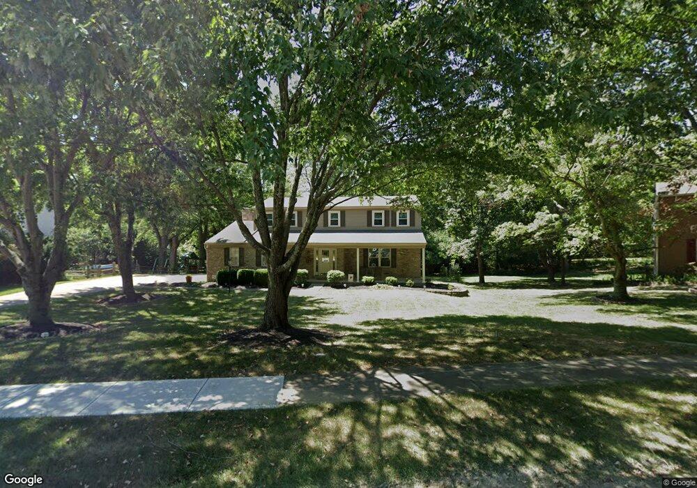
7367 Wallingford Dr Cincinnati, OH 45244
Turpin Hills NeighborhoodEstimated Value: $470,189 - $585,000
4
Beds
3
Baths
2,152
Sq Ft
$241/Sq Ft
Est. Value
About This Home
This home is located at 7367 Wallingford Dr, Cincinnati, OH 45244 and is currently estimated at $517,797, approximately $240 per square foot. 7367 Wallingford Dr is a home located in Hamilton County with nearby schools including Wilson Elementary School, Nagel Middle School, and Turpin High School.
Ownership History
Date
Name
Owned For
Owner Type
Purchase Details
Closed on
Feb 6, 2003
Sold by
Corotis Robert M
Bought by
Corotis Deborah E
Current Estimated Value
Home Financials for this Owner
Home Financials are based on the most recent Mortgage that was taken out on this home.
Original Mortgage
$87,500
Interest Rate
6.4%
Mortgage Type
Unknown
Purchase Details
Closed on
Jun 28, 1999
Sold by
Corotis Robert M
Bought by
Corotis Deborah E
Create a Home Valuation Report for This Property
The Home Valuation Report is an in-depth analysis detailing your home's value as well as a comparison with similar homes in the area
Home Values in the Area
Average Home Value in this Area
Purchase History
| Date | Buyer | Sale Price | Title Company |
|---|---|---|---|
| Corotis Deborah E | -- | -- | |
| Corotis Deborah E | -- | -- |
Source: Public Records
Mortgage History
| Date | Status | Borrower | Loan Amount |
|---|---|---|---|
| Closed | Corotis Deborah E | $87,500 |
Source: Public Records
Tax History
| Year | Tax Paid | Tax Assessment Tax Assessment Total Assessment is a certain percentage of the fair market value that is determined by local assessors to be the total taxable value of land and additions on the property. | Land | Improvement |
|---|---|---|---|---|
| 2025 | $7,800 | $124,881 | $28,340 | $96,541 |
| 2023 | $7,210 | $124,881 | $28,340 | $96,541 |
| 2022 | $5,245 | $80,885 | $18,774 | $62,111 |
| 2021 | $5,121 | $80,885 | $18,774 | $62,111 |
| 2020 | $5,180 | $80,885 | $18,774 | $62,111 |
| 2019 | $5,048 | $71,579 | $16,615 | $54,964 |
| 2018 | $4,729 | $71,579 | $16,615 | $54,964 |
| 2017 | $4,460 | $71,579 | $16,615 | $54,964 |
| 2016 | $4,273 | $66,987 | $16,625 | $50,362 |
| 2015 | $4,150 | $66,987 | $16,625 | $50,362 |
| 2014 | $4,152 | $66,987 | $16,625 | $50,362 |
| 2013 | $3,636 | $62,024 | $15,393 | $46,631 |
Source: Public Records
Map
Nearby Homes
- 2559 Concordgreen Dr
- 7392 Hunley Rd
- 7481 Heatherwood Ln
- 7080 Hunley Rd
- 2121 Clough Chase Dr
- 2105 Clough Chase Dr
- 2197 Cablecar Ct
- 2911 Perthwood Dr
- 2669 Newtown Rd
- 7249 State Rd
- 6362 Stirrup Rd
- 3305 Scioto Dr
- 1998 Lady Ellen Dr
- 7712 Stonehill Dr
- 3320 River Hills Dr
- 7967 Kimbee Dr
- 6912 Edith St
- 1786 Woodpine Ln
- 1750 Emerald Glade Ln
- 1736 Emerald Glade Ln
- 7373 Wallingford Dr
- 7361 Wallingford Dr
- 7381 Wallingford Dr
- 7352 Wallingford Dr
- 7370 Wallingford Dr
- 7364 Wallingford Dr
- 7376 Wallingford Dr
- 2422 Concordgreen Dr
- 2428 Concordgreen Dr
- 7384 Wallingford Dr
- 2434 Concordgreen Dr
- 7249 Lawyer Rd
- 7390 Wallingford Dr
- 7337 Lawyer Rd
- 7325 Lawyer Rd
- 7269 Lawyer Rd
- 7349 Lawyer Rd
- 2423 Concordgreen Dr
- 7317 Lawyer Rd
- 7255 Lawyer Rd