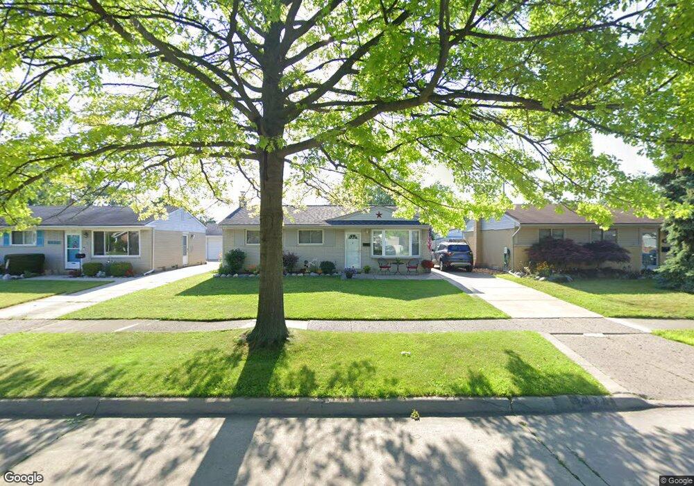
737 Alvin St Westland, MI 48186
Estimated Value: $162,000 - $224,000
3
Beds
1
Bath
958
Sq Ft
$211/Sq Ft
Est. Value
About This Home
This home is located at 737 Alvin St, Westland, MI 48186 and is currently estimated at $202,327, approximately $211 per square foot. 737 Alvin St is a home located in Wayne County with nearby schools including Alexander Hamilton Elementary School, Marshall Upper Elementary School, and Adlai Stevenson Middle School.
Ownership History
Date
Name
Owned For
Owner Type
Purchase Details
Closed on
Jan 16, 2014
Sold by
Hall Rick
Bought by
Hall Janice L
Current Estimated Value
Purchase Details
Closed on
Dec 14, 2010
Sold by
Everhome Mortgage Company
Bought by
Federal National Mortgage Association
Purchase Details
Closed on
Nov 17, 2010
Sold by
Schlamb Donald A
Bought by
Everhome Mortgage Company
Purchase Details
Closed on
Jun 12, 2007
Sold by
Schlamb Donald A and Schlamb Cathryn
Bought by
Schlamb Donald A
Purchase Details
Closed on
Nov 22, 2006
Sold by
Washington Mutual Bank
Bought by
Schlamb Donald
Purchase Details
Closed on
Jan 18, 2006
Sold by
Green Joale M
Bought by
Washington Mutual Bank Fa
Purchase Details
Closed on
Jun 8, 1998
Sold by
Di Mildred A Colombo and Di M
Bought by
Joale M Green
Create a Home Valuation Report for This Property
The Home Valuation Report is an in-depth analysis detailing your home's value as well as a comparison with similar homes in the area
Home Values in the Area
Average Home Value in this Area
Purchase History
| Date | Buyer | Sale Price | Title Company |
|---|---|---|---|
| Hall Janice L | $54,000 | Embassy Title Agency | |
| Federal National Mortgage Association | -- | None Available | |
| Everhome Mortgage Company | $146,244 | None Available | |
| Schlamb Donald A | $143,000 | Multiple | |
| Schlamb Donald | $106,000 | Fidelity National Title | |
| Washington Mutual Bank Fa | $113,492 | None Available | |
| Joale M Green | $81,000 | -- |
Source: Public Records
Tax History Compared to Growth
Tax History
| Year | Tax Paid | Tax Assessment Tax Assessment Total Assessment is a certain percentage of the fair market value that is determined by local assessors to be the total taxable value of land and additions on the property. | Land | Improvement |
|---|---|---|---|---|
| 2025 | $2,088 | $94,700 | $0 | $0 |
| 2024 | $2,088 | $89,700 | $0 | $0 |
| 2023 | $1,994 | $78,500 | $0 | $0 |
| 2022 | $2,331 | $69,400 | $0 | $0 |
| 2021 | $2,273 | $66,100 | $0 | $0 |
| 2020 | $2,248 | $60,700 | $0 | $0 |
| 2019 | $2,166 | $58,200 | $0 | $0 |
| 2018 | $1,641 | $48,800 | $0 | $0 |
| 2017 | $793 | $45,400 | $0 | $0 |
| 2016 | $2,103 | $45,200 | $0 | $0 |
| 2015 | $4,061 | $40,610 | $0 | $0 |
| 2013 | $3,494 | $36,560 | $0 | $0 |
| 2012 | $2,675 | $35,110 | $0 | $0 |
Source: Public Records
Map
Nearby Homes
- 754 Alvin St
- 183 Daniel Ave Unit 6
- 1163 Denice St
- 00000 Cherry Hill Rd
- 32732 Glen St
- 711 S Hawthorne St
- 32508 Avondale St
- 33532 Leona St
- 535 S Hubbard St
- 32411 Grandview Ave
- 34114 Avondale St
- 451 Darwin St
- 0000 Barrington Ave
- 360 van Sull St
- 366 S Wildwood St
- 32111 Birchwood Ave
- 232 S Wildwood St
- 33230 Rosslyn Ave
- 32025 Birchwood St
- 284 S Byfield St