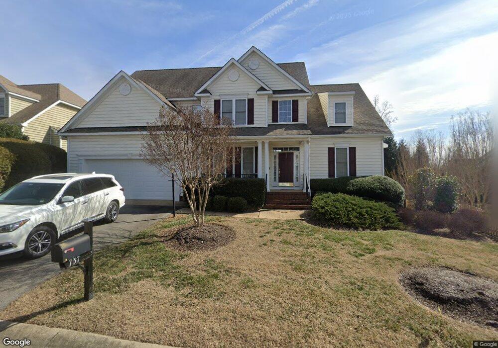
737 Colony Forest Dr Midlothian, VA 23114
Estimated Value: $716,446 - $792,000
4
Beds
5
Baths
4,477
Sq Ft
$171/Sq Ft
Est. Value
About This Home
This home is located at 737 Colony Forest Dr, Midlothian, VA 23114 and is currently estimated at $765,612, approximately $171 per square foot. 737 Colony Forest Dr is a home located in Chesterfield County with nearby schools including J B Watkins Elementary School, Midlothian Middle School, and Midlothian High School.
Ownership History
Date
Name
Owned For
Owner Type
Purchase Details
Closed on
Feb 7, 2008
Sold by
B B Hunt L L C
Bought by
Bower Walker L
Current Estimated Value
Home Financials for this Owner
Home Financials are based on the most recent Mortgage that was taken out on this home.
Original Mortgage
$311,913
Outstanding Balance
$197,568
Interest Rate
6.14%
Mortgage Type
New Conventional
Estimated Equity
$568,044
Create a Home Valuation Report for This Property
The Home Valuation Report is an in-depth analysis detailing your home's value as well as a comparison with similar homes in the area
Home Values in the Area
Average Home Value in this Area
Purchase History
| Date | Buyer | Sale Price | Title Company |
|---|---|---|---|
| Bower Walker L | $484,095 | -- |
Source: Public Records
Mortgage History
| Date | Status | Borrower | Loan Amount |
|---|---|---|---|
| Open | Bower Walker L | $311,913 |
Source: Public Records
Tax History
| Year | Tax Paid | Tax Assessment Tax Assessment Total Assessment is a certain percentage of the fair market value that is determined by local assessors to be the total taxable value of land and additions on the property. | Land | Improvement |
|---|---|---|---|---|
| 2025 | $6,342 | $709,800 | $96,000 | $613,800 |
| 2024 | $6,342 | $664,500 | $96,000 | $568,500 |
| 2023 | $5,645 | $620,300 | $96,000 | $524,300 |
| 2022 | $5,030 | $544,000 | $92,000 | $452,000 |
| 2021 | $4,542 | $475,500 | $90,000 | $385,500 |
| 2020 | $4,542 | $475,500 | $90,000 | $385,500 |
| 2019 | $4,307 | $453,400 | $90,000 | $363,400 |
| 2018 | $4,409 | $467,800 | $90,000 | $377,800 |
| 2017 | $4,349 | $450,400 | $90,000 | $360,400 |
| 2016 | $4,454 | $464,000 | $90,000 | $374,000 |
| 2015 | $4,293 | $445,900 | $90,000 | $355,900 |
| 2014 | $4,117 | $426,200 | $80,000 | $346,200 |
Source: Public Records
Map
Nearby Homes
- 736 Colony Forest Dr
- 1003 Westwood Village Ln Unit 201
- 1003 Westwood Village Ln Unit 303
- 1010 Westwood Village Way Unit 201A
- 1020 Westwood Village Way Unit 403
- 14010 Briars Cir Unit 404
- 972 Landon Laurel Ln
- 1119 Ashton Village Ln
- 910 Westwood Village Way Unit 402
- 526 Aldengate Terrace
- 1079 Arbor Heights Terrace
- 949 Landon Laurel Ln
- 1049 Arbor Heights Terrace
- 1066 Arbor Heights Terrace
- 942 Landon Laurel Ln
- 954 Landon Laurel Ln
- 960 Landon Laurel Ln
- 1042 Arbor Heights Terrace
- 1030 Arbor Heights Terrace
- 14316 Garnett Ln
- Lot 33- 737 Colony Forest Dr
- 731 Colony Forest Dr
- 14814 Colony Forest Ct
- 14808 Colony Forest Ct
- 913 Colony Forest Dr
- Lot 23 - 14806 Colony Forest Dr
- Lot 59 - 730 Colony Forest Dr
- 725 Colony Forest Dr
- 736 Colony Forest Dr
- 742 Colony Forest Dr
- 730 Colony Forest Dr
- 742 Colony Forest Dr
- Lot 58 - 724 Colony Frst Dr
- Lot 30 - 719 Colony Frst Dr
- 719 Colony Forest Dr
- 719 Colony Forest Dr
- 14802 Colony Forest Ct
- Lot 36 - 14802 Colony Forest Ct
- 14637 Charter Walk Ct
- 748 Colony Forest Dr
Your Personal Tour Guide
Ask me questions while you tour the home.