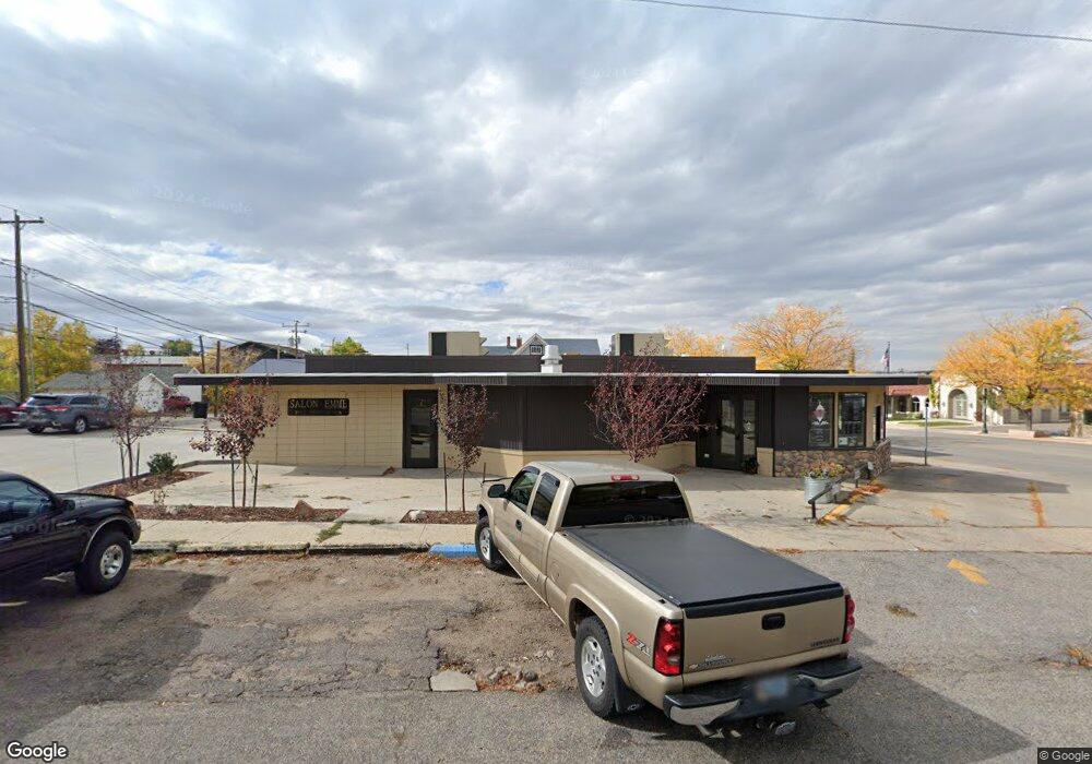
737 E 2nd St Casper, WY 82601
Central Casper Neighborhood
Studio
--
Bath
2,718
Sq Ft
8,407
Sq Ft
About This Home
This home is located at 737 E 2nd St, Casper, WY 82601. 737 E 2nd St is a home located in Natrona County.
Ownership History
Date
Name
Owned For
Owner Type
Purchase Details
Closed on
Sep 12, 2017
Sold by
Cisneros Matthew M and Cisneros Kristin Nicole
Bought by
Cisneros Properties Llc
Purchase Details
Closed on
Jul 25, 2017
Sold by
Sheppard Robert L and Sheppard Helen E
Bought by
Cisneros Matthew M and Cisneros Kristin Nicole
Purchase Details
Closed on
Jul 10, 2017
Sold by
Hockaday Tom
Bought by
Sheppard Robert L and Sheppard Helen E
Purchase Details
Closed on
Jul 7, 2017
Sold by
Chew Clifford
Bought by
Sheppard Robert L and Sheppard Helen E
Create a Home Valuation Report for This Property
The Home Valuation Report is an in-depth analysis detailing your home's value as well as a comparison with similar homes in the area
Home Values in the Area
Average Home Value in this Area
Purchase History
| Date | Buyer | Sale Price | Title Company |
|---|---|---|---|
| Cisneros Properties Llc | -- | American Title Agency | |
| Cisneros Matthew M | -- | American Title Agency | |
| Sheppard Robert L | -- | American Title Agency | |
| Sheppard Robert L | -- | American Title Agency | |
| Sheppard Robert L | -- | American Title Agency | |
| Sheppard Robert L | -- | American Title Agency |
Source: Public Records
Tax History
| Year | Tax Paid | Tax Assessment Tax Assessment Total Assessment is a certain percentage of the fair market value that is determined by local assessors to be the total taxable value of land and additions on the property. | Land | Improvement |
|---|---|---|---|---|
| 2025 | $1,353 | $18,843 | $5,337 | $13,506 |
| 2024 | $1,404 | $19,545 | $4,859 | $14,686 |
| 2023 | $1,551 | $21,282 | $8,494 | $12,788 |
| 2022 | $1,183 | $16,228 | $4,399 | $11,829 |
| 2021 | $961 | $13,184 | $3,655 | $9,529 |
| 2020 | $891 | $12,230 | $2,954 | $9,276 |
| 2019 | $990 | $13,583 | $4,389 | $9,194 |
| 2018 | $1,038 | $14,242 | $4,389 | $9,853 |
| 2017 | $898 | $12,319 | $6,384 | $5,935 |
| 2015 | $771 | $10,573 | $5,586 | $4,987 |
| 2014 | $766 | $10,512 | $5,586 | $4,926 |
Source: Public Records
Map
Nearby Homes
- 239 S Mckinley St
- 241 S Mckinley St
- 632 S Jackson St
- 46000 U S Highway 20
- 1302 E 7th St
- 623 S Wolcott St
- 340 S David St
- 205 E 8th St
- 336 S David St
- 440 E 11th St
- 1016 S Washington St
- 1117 S Lincoln St
- 1007 S Wolcott St
- 205 E G St
- 777 Bernadine St
- 120 S Beverly St
- 1223 S Wilson St
- 1227 S Center St
- 428 W 12th St
- 450 W F St
- 731 E 2nd St
- 725 E 2nd St
- 725 E 2nd St Unit Lincoln Street
- 805 E 2nd St
- 770 E 2nd St
- 730 E 2nd St
- 734 E 3rd St
- 734 E 3rd St Unit Lincoln
- 728 E 3rd St
- 720 E 3rd St
- 810 & 812 2nd St
- 714 E 3rd St
- 810 E 2nd St
- 710 E 3rd St
- 818 E 2nd St
- 302 S Lincoln St
- 302 S Lincoln St Unit 3rd
- 704 E 3rd St
- 805 E 3rd St
- 805 E 3rd St Unit Lincoln
Your Personal Tour Guide
Ask me questions while you tour the home.