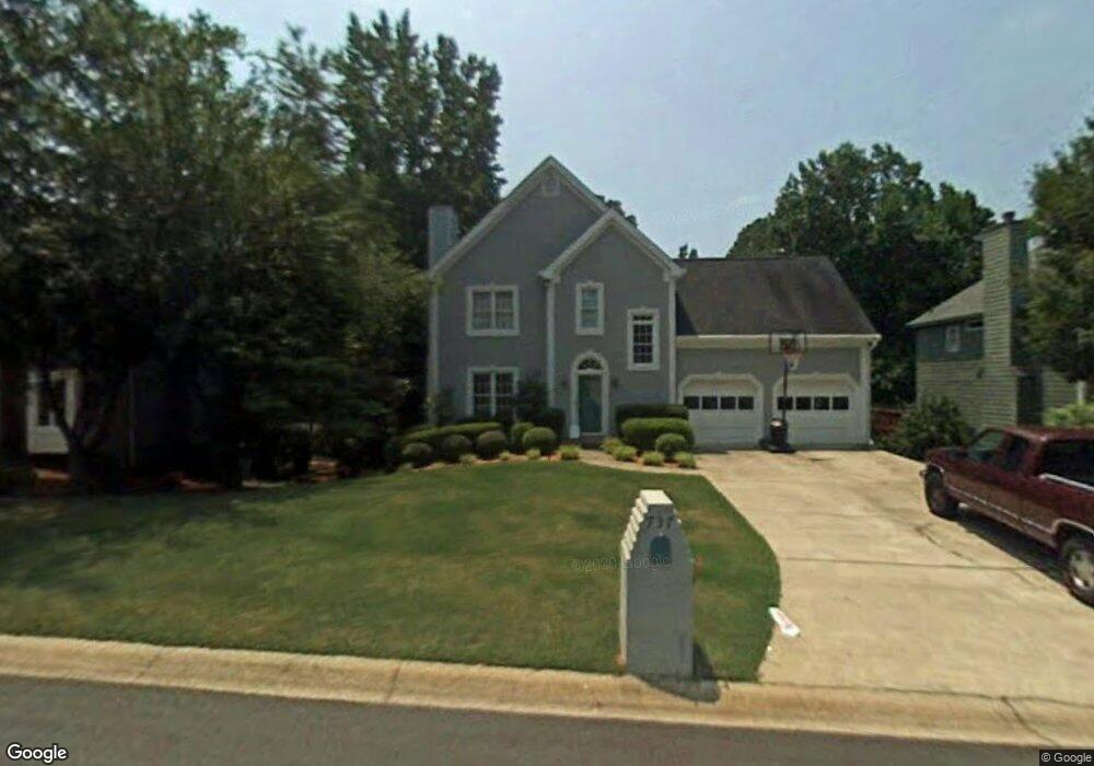
737 Jamie Way NE Unit 2A Woodstock, GA 30188
Sandy Plains NeighborhoodEstimated Value: $356,000 - $416,000
4
Beds
3
Baths
2,374
Sq Ft
$165/Sq Ft
Est. Value
About This Home
This home is located at 737 Jamie Way NE Unit 2A, Woodstock, GA 30188 and is currently estimated at $391,975, approximately $165 per square foot. 737 Jamie Way NE Unit 2A is a home located in Cobb County with nearby schools including Nicholson Elementary School, McCleskey Middle School, and Kell High School.
Ownership History
Date
Name
Owned For
Owner Type
Purchase Details
Closed on
May 9, 2025
Sold by
Blueprint Homes Atlanta Llc
Bought by
Open House Atlanta Realty & Investments Llc
Current Estimated Value
Purchase Details
Closed on
May 15, 1995
Sold by
Mason William M Lisa W
Bought by
Harrison Walter A Mary S
Create a Home Valuation Report for This Property
The Home Valuation Report is an in-depth analysis detailing your home's value as well as a comparison with similar homes in the area
Home Values in the Area
Average Home Value in this Area
Purchase History
| Date | Buyer | Sale Price | Title Company |
|---|---|---|---|
| Open House Atlanta Realty & Investments Llc | $320,500 | None Listed On Document | |
| Blueprint Homes Atlanta Llc | $315,000 | None Listed On Document | |
| Blueprint Homes Atlanta Llc | $315,000 | None Listed On Document | |
| Harrison Walter A Mary S | $142,000 | -- |
Source: Public Records
Mortgage History
| Date | Status | Borrower | Loan Amount |
|---|---|---|---|
| Closed | Harrison Walter A Mary S | $0 |
Source: Public Records
Tax History Compared to Growth
Tax History
| Year | Tax Paid | Tax Assessment Tax Assessment Total Assessment is a certain percentage of the fair market value that is determined by local assessors to be the total taxable value of land and additions on the property. | Land | Improvement |
|---|---|---|---|---|
| 2024 | $887 | $165,816 | $32,000 | $133,816 |
| 2023 | $2,385 | $125,540 | $28,000 | $97,540 |
| 2022 | $2,951 | $125,540 | $28,000 | $97,540 |
| 2021 | $2,568 | $108,044 | $22,000 | $86,044 |
| 2020 | $2,277 | $94,780 | $18,000 | $76,780 |
| 2019 | $2,100 | $86,696 | $18,000 | $68,696 |
| 2018 | $1,908 | $77,888 | $14,000 | $63,888 |
| 2017 | $1,837 | $77,888 | $14,000 | $63,888 |
| 2016 | $1,584 | $66,284 | $14,000 | $52,284 |
| 2015 | $1,621 | $66,284 | $14,000 | $52,284 |
| 2014 | $1,325 | $53,432 | $0 | $0 |
Source: Public Records
Map
Nearby Homes
- 5142 Farm Place Dr NE
- 639 Tigers Eye Terrace
- The Gavin E Plan at The Village at Shallowford - Signature Series
- The Marion A Plan at The Village at Shallowford - Classic Series
- The Cary A Plan at The Village at Shallowford - Classic Series
- 4669 Blue Topaz Trail
- 4704 Lincoln Dr NE
- 4793 Moonstone Trace
- 4785 Moonstone Trace
- 162 Ridgewood Dr
- 707 Smokey Quartz Way
- 710 Smokey Quartz Way
- 694 Smokey Quartz Way
- 4785 Moonstone NE
- 703 Smokey Quartz Way
- 706 Smokey Quartz Way
- 702 Smokey Quartz Way
- 5015 Helga Ct NE Unit 11A
- 5013 Helga Ct NE Unit 2A
- 0 Jamie Way NE
- 5029 Jamie Ct NE Unit N/a
- 5029 Jamie Ct NE Unit 95
- 5029 Jamie Ct NE
- 736 Jamie Way NE
- 5011 Helga Ct NE
- 734 Jamie Way NE
- 732 Jamie Way NE Unit 2A
- 5027 Jamie Ct NE Unit 2A
- 5014 Helga Ct NE
- 738 Jamie Way NE
- 743 Jamie Way NE Unit 2A
- 5012 Helga Ct NE
- 730 Jamie Way NE
- 5010 Helga Ct NE
- 5006 Helga Ct NE
- 740 Jamie Way NE
- 5009 Helga Ct NE