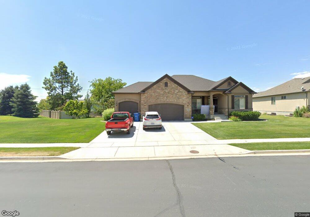
737 N 1280 E Unit LOT 29 American Fork, UT 84003
Estimated Value: $814,000 - $923,000
6
Beds
4
Baths
3,908
Sq Ft
$223/Sq Ft
Est. Value
About This Home
This home is located at 737 N 1280 E Unit LOT 29, American Fork, UT 84003 and is currently estimated at $872,193, approximately $223 per square foot. 737 N 1280 E Unit LOT 29 is a home located in Utah County with nearby schools including Deerfield Elementary School, Mountain Ridge Junior High School, and American Fork High School.
Ownership History
Date
Name
Owned For
Owner Type
Purchase Details
Closed on
Mar 1, 2024
Sold by
Cecil James C and Cecil Kathryn S
Bought by
Christmas Village And Pickles Living Trust and Cecil
Current Estimated Value
Purchase Details
Closed on
Sep 9, 2019
Sold by
Cecil James C and Cecil Kathryn S
Bought by
Cecil Kathryn S and Cecil James C
Home Financials for this Owner
Home Financials are based on the most recent Mortgage that was taken out on this home.
Original Mortgage
$360,000
Interest Rate
3.7%
Mortgage Type
New Conventional
Purchase Details
Closed on
May 31, 2012
Sold by
Perry Homes Utah Inc
Bought by
Cecil James C and Cecil Kathryn S
Home Financials for this Owner
Home Financials are based on the most recent Mortgage that was taken out on this home.
Original Mortgage
$239,000
Interest Rate
3.86%
Mortgage Type
New Conventional
Create a Home Valuation Report for This Property
The Home Valuation Report is an in-depth analysis detailing your home's value as well as a comparison with similar homes in the area
Home Values in the Area
Average Home Value in this Area
Purchase History
| Date | Buyer | Sale Price | Title Company |
|---|---|---|---|
| Christmas Village And Pickles Living Trust | -- | None Listed On Document | |
| Cecil Kathryn S | -- | Meridian Title Company | |
| Cecil James C | -- | Meridian Title Co | |
| Perry Homes Utah Inc | -- | Meridian Title Co |
Source: Public Records
Mortgage History
| Date | Status | Borrower | Loan Amount |
|---|---|---|---|
| Previous Owner | Cecil Kathryn S | $360,000 | |
| Previous Owner | Cecil James C | $239,000 |
Source: Public Records
Tax History Compared to Growth
Tax History
| Year | Tax Paid | Tax Assessment Tax Assessment Total Assessment is a certain percentage of the fair market value that is determined by local assessors to be the total taxable value of land and additions on the property. | Land | Improvement |
|---|---|---|---|---|
| 2025 | $3,790 | $472,230 | $319,800 | $538,800 |
| 2024 | $3,790 | $421,080 | $0 | $0 |
| 2023 | $3,540 | $416,955 | $0 | $0 |
| 2022 | $3,731 | $433,730 | $0 | $0 |
| 2021 | $3,020 | $548,300 | $187,900 | $360,400 |
| 2020 | $2,835 | $510,800 | $174,000 | $336,800 |
| 2019 | $2,709 | $493,500 | $162,100 | $331,400 |
| 2018 | $2,775 | $483,200 | $158,200 | $325,000 |
| 2017 | $2,637 | $247,885 | $0 | $0 |
| 2016 | $2,771 | $241,945 | $0 | $0 |
| 2015 | $2,919 | $241,945 | $0 | $0 |
| 2014 | $2,770 | $226,435 | $0 | $0 |
Source: Public Records
Map
Nearby Homes
- 649 N 1280 E
- 636 N 1280 E
- 598 N 1280 E
- 1121 E 580 N
- 1228 E 1030 N
- 2969 N 1350 W
- 2254 N 1560 W
- 1045 N 930 E Unit 58
- 1058 N 930 E Unit 64
- The McKenzie Plan at Autumn Crest
- The Christine Plan at Autumn Crest
- The Avery Plan at Autumn Crest
- The Madison Plan at Autumn Crest
- The Roosevelt Plan at Autumn Crest
- The Annie Plan at Autumn Crest
- The Michelle Plan at Autumn Crest
- 1053 N 930 E Unit 73
- 1059 N 930 E
- 1162 E 1180 N
- 1089 N 950 E
- 749 N 1280 E Unit 1
- 749 N 1280 E Unit LOT 28
- 749 N 1280 E
- 1257 E 700 N
- 745 N 1300 E
- 1235 E 700 N
- 1274 E 760 N
- 845 N 1300 E
- 757 N 1300 E Unit LOT 26
- 769 N 1280 E
- 769 N 1280 E Unit LOT 24
- 1280 E 700 N
- 546 N 1280 E Unit 10
- 732 N 1300 E
- 1295 E 700 N
- 754 N 1300 E Unit LOT 2
- 754 N 1300 E
- 771 N 1280 E
- 4465 W 8800 N
- 1292 E 700 N