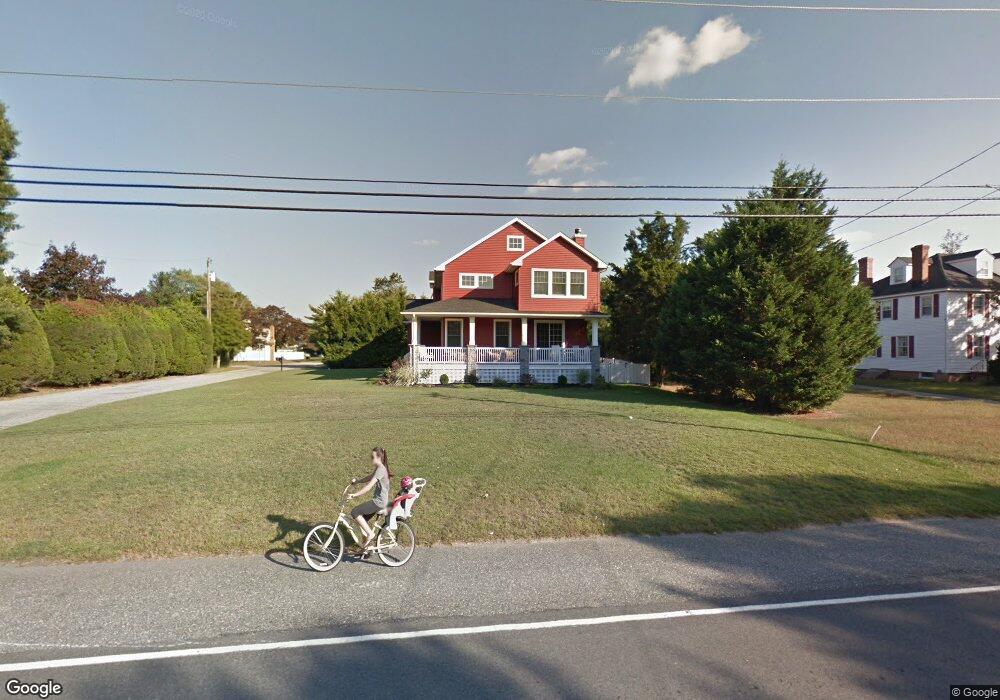
737 Route Us 9 N Marmora, NJ 08223
Estimated Value: $715,839 - $1,031,000
--
Bed
--
Bath
2,502
Sq Ft
$341/Sq Ft
Est. Value
About This Home
This home is located at 737 Route Us 9 N, Marmora, NJ 08223 and is currently estimated at $853,460, approximately $341 per square foot. 737 Route Us 9 N is a home located in Cape May County with nearby schools including Upper Township Primary School, Upper Township Elementary School, and Upper Township Middle School.
Ownership History
Date
Name
Owned For
Owner Type
Purchase Details
Closed on
May 16, 2016
Sold by
Dare David C and Dare Jill
Bought by
Swan Christine L
Current Estimated Value
Purchase Details
Closed on
Dec 20, 2010
Sold by
Davish Penelope J
Bought by
Davish Jill and Dare David C
Purchase Details
Closed on
Jan 3, 2006
Sold by
Davish Francis X and Davish Penelope J
Bought by
Davish Penelope J
Purchase Details
Closed on
May 28, 2002
Sold by
Seddon Joseph E
Bought by
Davish Francis X and Davish Penelope J
Home Financials for this Owner
Home Financials are based on the most recent Mortgage that was taken out on this home.
Original Mortgage
$106,400
Interest Rate
6.9%
Purchase Details
Closed on
Oct 15, 1998
Sold by
Margaret Foster Estate
Bought by
Seddon Joseph and Seddon Betty
Create a Home Valuation Report for This Property
The Home Valuation Report is an in-depth analysis detailing your home's value as well as a comparison with similar homes in the area
Home Values in the Area
Average Home Value in this Area
Purchase History
| Date | Buyer | Sale Price | Title Company |
|---|---|---|---|
| Swan Christine L | $455,000 | Attorney | |
| Davish Jill | -- | The Title Company Of Jersey | |
| Davish Penelope J | -- | None Available | |
| Davish Francis X | $133,000 | -- | |
| Seddon Joseph | $80,000 | -- | |
| Seddon Joseph | $80,000 | -- | |
| Seddon Joseph | $80,000 | -- |
Source: Public Records
Mortgage History
| Date | Status | Borrower | Loan Amount |
|---|---|---|---|
| Previous Owner | Davish Francis X | $106,400 |
Source: Public Records
Tax History Compared to Growth
Tax History
| Year | Tax Paid | Tax Assessment Tax Assessment Total Assessment is a certain percentage of the fair market value that is determined by local assessors to be the total taxable value of land and additions on the property. | Land | Improvement |
|---|---|---|---|---|
| 2025 | $9,155 | $398,900 | $115,200 | $283,700 |
| 2024 | $9,155 | $398,900 | $115,200 | $283,700 |
| 2023 | $8,704 | $398,900 | $115,200 | $283,700 |
| 2022 | $8,385 | $398,900 | $115,200 | $283,700 |
| 2021 | $5,985 | $398,900 | $115,200 | $283,700 |
| 2020 | $7,775 | $398,900 | $115,200 | $283,700 |
| 2019 | $7,567 | $398,900 | $115,200 | $283,700 |
| 2018 | $7,368 | $398,900 | $115,200 | $283,700 |
| 2017 | $7,276 | $398,900 | $115,200 | $283,700 |
| 2016 | $7,400 | $398,900 | $115,200 | $283,700 |
| 2015 | $7,200 | $398,900 | $115,200 | $283,700 |
| 2014 | $6,234 | $423,500 | $168,100 | $255,400 |
Source: Public Records
Map
Nearby Homes
- 527 N 527 N Shore Rd
- 601 2nd Ave
- 36 E Hollywood Ln
- 16 Lenape Ln
- 202 N Shore Rd
- 125 N Shore Rd
- 32 Norwood Rd
- 14 Lyndhurst Rd
- 1 Roosevelt Blvd
- 100 Reef Dr
- 1904 Glenwood Dr
- 2019 Glenwood Dr
- 1901 Glenwood Dr
- 9 Coral Ln
- 14 Roberts Ave
- 71 Spruce Rd
- 20 Gilbert Ln
- 38 Arkansas Ave
- 195 W 17th St Unit 1
- 15 Waterway Rd
- 2 South Dr
- 741 Route Us 9 N
- 731 Route Us 9 N
- 740 Route Us 9 S
- 736 Route Us 9 N
- 732 N Shore
- 740 Route Us 9 N
- 732 Route Us 9 N
- 731 N Shore Rd
- 801 Route Us 9 N
- 741 Steel Rd
- 730 Route Us 9 N
- 735 Lincoln Ave
- 1 Walton Ave
- 731 Lincoln Ave
- 805 Route Us 9 N
- 740 East Dr
- 801 Steel Rd
- 9 Walton Ave
- 725 N Shore Rd