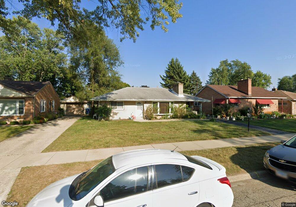
737 S Fulton Ave Waukegan, IL 60085
Lyon Acres NeighborhoodEstimated Value: $240,000 - $260,000
3
Beds
2
Baths
1,168
Sq Ft
$214/Sq Ft
Est. Value
About This Home
This home is located at 737 S Fulton Ave, Waukegan, IL 60085 and is currently estimated at $249,858, approximately $213 per square foot. 737 S Fulton Ave is a home located in Lake County with nearby schools including Lyon Magnet Elementary School, John R Lewis Middle School, and Waukegan High School.
Ownership History
Date
Name
Owned For
Owner Type
Purchase Details
Closed on
Feb 26, 1996
Sold by
Hadsell Irwin B
Bought by
Dunlap Monroe G
Current Estimated Value
Home Financials for this Owner
Home Financials are based on the most recent Mortgage that was taken out on this home.
Original Mortgage
$122,247
Outstanding Balance
$4,815
Interest Rate
7.07%
Mortgage Type
VA
Estimated Equity
$245,043
Create a Home Valuation Report for This Property
The Home Valuation Report is an in-depth analysis detailing your home's value as well as a comparison with similar homes in the area
Home Values in the Area
Average Home Value in this Area
Purchase History
| Date | Buyer | Sale Price | Title Company |
|---|---|---|---|
| Dunlap Monroe G | $120,000 | Chicago Title Insurance Co |
Source: Public Records
Mortgage History
| Date | Status | Borrower | Loan Amount |
|---|---|---|---|
| Open | Dunlap Monroe G | $122,247 |
Source: Public Records
Tax History Compared to Growth
Tax History
| Year | Tax Paid | Tax Assessment Tax Assessment Total Assessment is a certain percentage of the fair market value that is determined by local assessors to be the total taxable value of land and additions on the property. | Land | Improvement |
|---|---|---|---|---|
| 2024 | $4,098 | $66,469 | $10,748 | $55,721 |
| 2023 | $4,098 | $59,458 | $9,614 | $49,844 |
| 2022 | $4,521 | $57,250 | $8,534 | $48,716 |
| 2021 | $3,915 | $48,547 | $7,341 | $41,206 |
| 2020 | $3,880 | $45,227 | $6,839 | $38,388 |
| 2019 | $3,808 | $41,443 | $6,267 | $35,176 |
| 2018 | $3,431 | $38,235 | $7,883 | $30,352 |
| 2017 | $3,247 | $33,827 | $6,974 | $26,853 |
| 2016 | $2,842 | $29,394 | $6,060 | $23,334 |
| 2015 | $2,547 | $26,308 | $5,424 | $20,884 |
| 2014 | $2,694 | $26,079 | $5,827 | $20,252 |
| 2012 | $3,899 | $28,254 | $6,313 | $21,941 |
Source: Public Records
Map
Nearby Homes
- 819 S Fulton Ave
- 1712 11th St
- 910 Cummings Ave
- 446 S Jackson St
- 815 Prescott St
- 724 10th St
- 631 8th St
- 12601 W Atlantic Ave
- 2116 & 2101 Williamsburg Dr
- 600 Sunderlin St
- 842 Wadsworth Ave
- 1244 Victoria Ave
- 1511 14th St
- 1210 Park Ave
- 1101 Adams St
- 1102 Wadsworth Ave
- 831 S Mcalister Ave
- 515 George Ave
- 408 Besley Place
- 1521 Catalpa Ave
- 735 S Fulton Ave
- 741 S Fulton Ave
- 755 S Fulton Ave
- 727 S Fulton Ave
- 738 Washington Park
- 736 Washington Park
- 742 Washington Park
- 754 Washington Park
- 750 S Fulton Ave
- 728 Washington Park
- 723 S Fulton Ave
- 742 S Fulton Ave
- 724 Washington Park
- 736 S Fulton Ave
- 1712 8th St
- 1619 8th St
- 728 S Fulton Ave
- 715 S Fulton Ave
- 802 Washington Park
- 716 Washington Park