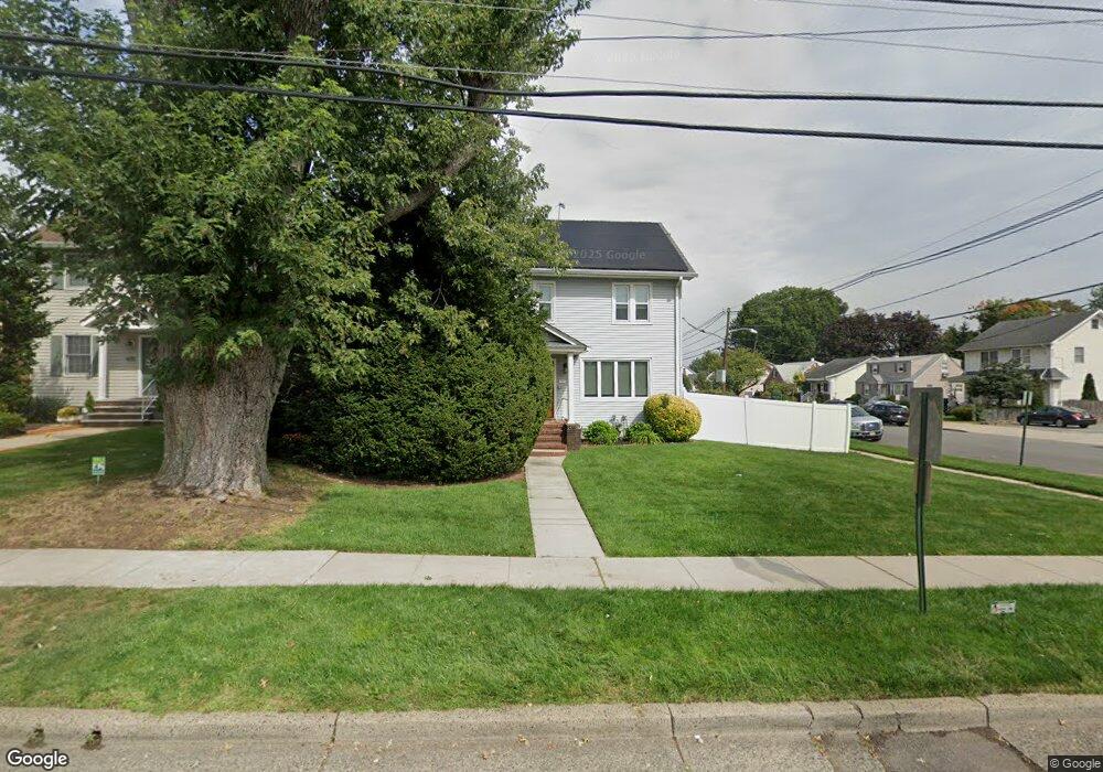
737 Wood Ave Roselle, NJ 07203
Estimated Value: $474,203 - $549,000
--
Bed
--
Bath
1,596
Sq Ft
$327/Sq Ft
Est. Value
About This Home
This home is located at 737 Wood Ave, Roselle, NJ 07203 and is currently estimated at $522,301, approximately $327 per square foot. 737 Wood Ave is a home located in Union County with nearby schools including Washington Elementary School, Grace Wilday Junior High School, and Leonard V. Moore Middle School.
Ownership History
Date
Name
Owned For
Owner Type
Purchase Details
Closed on
Mar 29, 2001
Sold by
Perfeito Anthony E and Leandro Maria Perfeito
Bought by
Nogueira Alvaro J and Nogueira Marilia
Current Estimated Value
Home Financials for this Owner
Home Financials are based on the most recent Mortgage that was taken out on this home.
Original Mortgage
$163,922
Outstanding Balance
$60,563
Interest Rate
7.05%
Mortgage Type
FHA
Estimated Equity
$461,738
Purchase Details
Closed on
Sep 22, 1998
Sold by
Latko Joanne and Simon Marisol R
Bought by
Perfeito Anthony E
Home Financials for this Owner
Home Financials are based on the most recent Mortgage that was taken out on this home.
Original Mortgage
$112,935
Interest Rate
6.89%
Mortgage Type
FHA
Create a Home Valuation Report for This Property
The Home Valuation Report is an in-depth analysis detailing your home's value as well as a comparison with similar homes in the area
Home Values in the Area
Average Home Value in this Area
Purchase History
| Date | Buyer | Sale Price | Title Company |
|---|---|---|---|
| Nogueira Alvaro J | $170,000 | Old Republic Natl Title Ins | |
| Perfeito Anthony E | $113,000 | -- |
Source: Public Records
Mortgage History
| Date | Status | Borrower | Loan Amount |
|---|---|---|---|
| Open | Nogueira Alvaro J | $163,922 | |
| Previous Owner | Perfeito Anthony E | $112,935 |
Source: Public Records
Tax History Compared to Growth
Tax History
| Year | Tax Paid | Tax Assessment Tax Assessment Total Assessment is a certain percentage of the fair market value that is determined by local assessors to be the total taxable value of land and additions on the property. | Land | Improvement |
|---|---|---|---|---|
| 2025 | $11,295 | $129,900 | $69,800 | $60,100 |
| 2024 | $11,012 | $129,900 | $69,800 | $60,100 |
| 2023 | $11,012 | $129,900 | $69,800 | $60,100 |
| 2022 | $11,088 | $129,900 | $69,800 | $60,100 |
| 2021 | $11,022 | $129,900 | $69,800 | $60,100 |
| 2020 | $10,987 | $129,900 | $69,800 | $60,100 |
| 2019 | $10,847 | $129,900 | $69,800 | $60,100 |
| 2018 | $10,563 | $127,200 | $69,800 | $57,400 |
| 2017 | $10,507 | $127,200 | $69,800 | $57,400 |
| 2016 | $10,275 | $127,200 | $69,800 | $57,400 |
| 2015 | $10,274 | $127,200 | $69,800 | $57,400 |
| 2014 | $9,988 | $127,200 | $69,800 | $57,400 |
Source: Public Records
Map
Nearby Homes
- 2513 N Wood Ave
- 540 W 7th Ave
- 38 Pallant Ave
- 538 Dietz St
- 63 Elmwood Terrace
- 13 Independence Dr
- 221 Douglas Rd
- 53 Pallant Ave
- 74 Raritan Rd
- 38 Independence Dr
- 113 Raritan Rd
- 112 Melrose Terrace
- 123 Robbinwood Terrace
- 57 Berlant Ave
- 46 Palisade Rd
- 1605 Wood Ave Unit F1
- 569 Berlant Ave
- 446 W 6th Ave
- 382 Douglas Rd
- 1715 Orchard Terrace
- 731 Wood Ave
- 729 Wood Ave
- 568 W 9th Ave
- 727 Wood Ave
- 719 Stanley Terrace
- 564 W 9th Ave
- 717 Stanley Terrace
- 575 W 9th Ave
- 2501 N Wood Ave
- 2505 N Wood Ave
- 571 W 9th Ave
- 2509 N Wood Ave
- 715 Stanley Terrace
- 569 W 9th Ave
- 567 W 9th Ave
- 717 Wood Ave
- 713 Stanley Terrace
- 556 W 9th Ave
- 2517 N Wood Ave
- 563 W 9th Ave