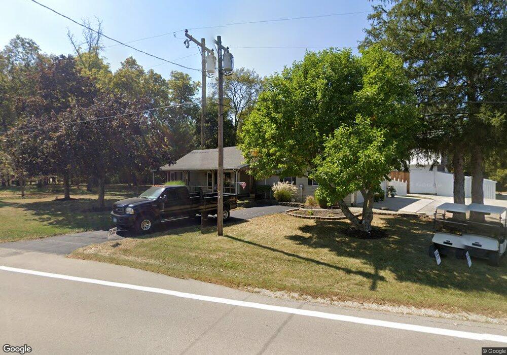
7376 N State Route 49 Greenville, OH 45331
Estimated Value: $219,000 - $245,000
2
Beds
1
Bath
1,476
Sq Ft
$157/Sq Ft
Est. Value
About This Home
This home is located at 7376 N State Route 49, Greenville, OH 45331 and is currently estimated at $232,266, approximately $157 per square foot. 7376 N State Route 49 is a home located in Darke County with nearby schools including Greenville Primary School, Greenville Middle School, and Greenville Intermediate School.
Ownership History
Date
Name
Owned For
Owner Type
Purchase Details
Closed on
Nov 4, 2020
Sold by
Sleppy Gerald E and Sleppy Delores J
Bought by
Wirrig Mary M
Current Estimated Value
Home Financials for this Owner
Home Financials are based on the most recent Mortgage that was taken out on this home.
Original Mortgage
$35,000
Outstanding Balance
$25,281
Interest Rate
2.8%
Mortgage Type
New Conventional
Estimated Equity
$206,985
Purchase Details
Closed on
Nov 13, 1992
Bought by
Wirrig Mary M
Purchase Details
Closed on
Jan 1, 1987
Bought by
Wirrig Mary M
Create a Home Valuation Report for This Property
The Home Valuation Report is an in-depth analysis detailing your home's value as well as a comparison with similar homes in the area
Home Values in the Area
Average Home Value in this Area
Purchase History
| Date | Buyer | Sale Price | Title Company |
|---|---|---|---|
| Wirrig Mary M | $35,000 | None Available | |
| Wirrig Mary M | -- | -- | |
| Wirrig Mary M | $35,500 | -- |
Source: Public Records
Mortgage History
| Date | Status | Borrower | Loan Amount |
|---|---|---|---|
| Open | Wirrig Mary M | $35,000 |
Source: Public Records
Tax History Compared to Growth
Tax History
| Year | Tax Paid | Tax Assessment Tax Assessment Total Assessment is a certain percentage of the fair market value that is determined by local assessors to be the total taxable value of land and additions on the property. | Land | Improvement |
|---|---|---|---|---|
| 2024 | $1,962 | $57,190 | $6,320 | $50,870 |
| 2023 | $1,959 | $57,190 | $6,320 | $50,870 |
| 2022 | $1,596 | $42,100 | $5,270 | $36,830 |
| 2021 | $1,602 | $42,100 | $5,270 | $36,830 |
| 2020 | $1,606 | $42,100 | $5,270 | $36,830 |
| 2019 | $1,383 | $35,970 | $5,270 | $30,700 |
| 2018 | $1,391 | $35,970 | $5,270 | $30,700 |
| 2017 | $1,269 | $35,970 | $5,270 | $30,700 |
| 2016 | $1,271 | $32,440 | $5,270 | $27,170 |
| 2015 | $1,271 | $32,440 | $5,270 | $27,170 |
| 2014 | $1,273 | $32,440 | $5,270 | $27,170 |
| 2013 | $1,233 | $30,970 | $3,800 | $27,170 |
Source: Public Records
Map
Nearby Homes
- 101 Westbury Dr
- 105 Ashford Cir
- 220 Westbury Dr
- 760 Birchwood Dr
- 947 Brighton Dr
- 774 Primrose Dr
- 1376 Sugar Maple Dr
- 1321 Sugar Maple Dr
- 781 Honeysuckle Dr
- 534 Union St
- 316 Victoria Dr
- 1278 Highland Dr
- 502 N Broadway St
- 3163 State Route 571
- 0 Wagner Ave Unit 1033333
- 0 Wagner Ave Unit 916177
- 232 Ark Ave
- 0 W St Rt 571
- 221 N Main St
- 6424 Daly Rd
- 7398 N State Route 49
- 7371 N State Route 49
- 7334 N State Route 49
- 7426 N State Route 49
- 7414 N State Route 49
- 7420 N State Route 49
- 7430 N State Route 49
- 7440 N State Route 49
- 7460 N State Route 49
- 7486 N State Route 49
- 7238 N State Route 49
- 7241 N State Route 49
- 4140 Childrens Home Bradford Rd
- 7234 N State Route 49
- 4178 Childrens Home Bradford Rd
- 7205 N State Route 49
- 7194 N State Route 49
- 7184 N State Route 49
- 7596 N State Route 49
- 4234 Childrens Home Bradford Rd