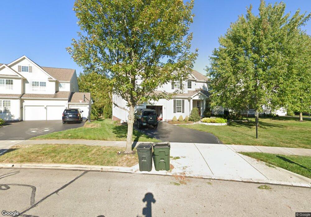
7377 Dean Farm Rd New Albany, OH 43054
Estimated Value: $753,000 - $883,000
4
Beds
4
Baths
3,300
Sq Ft
$241/Sq Ft
Est. Value
About This Home
This home is located at 7377 Dean Farm Rd, New Albany, OH 43054 and is currently estimated at $796,868, approximately $241 per square foot. 7377 Dean Farm Rd is a home located in Franklin County with nearby schools including New Albany Primary School, New Albany Intermediate School, and New Albany Middle School.
Ownership History
Date
Name
Owned For
Owner Type
Purchase Details
Closed on
Mar 17, 2021
Sold by
Lowery Sara P
Bought by
Lowery Sara P and Lowery Alex W
Current Estimated Value
Home Financials for this Owner
Home Financials are based on the most recent Mortgage that was taken out on this home.
Original Mortgage
$201,500
Interest Rate
3%
Mortgage Type
New Conventional
Purchase Details
Closed on
May 7, 2010
Sold by
M-I Homes Of Central Ohio Llc
Bought by
Lowery Sara P
Home Financials for this Owner
Home Financials are based on the most recent Mortgage that was taken out on this home.
Original Mortgage
$261,200
Interest Rate
5.05%
Mortgage Type
New Conventional
Create a Home Valuation Report for This Property
The Home Valuation Report is an in-depth analysis detailing your home's value as well as a comparison with similar homes in the area
Home Values in the Area
Average Home Value in this Area
Purchase History
| Date | Buyer | Sale Price | Title Company |
|---|---|---|---|
| Lowery Sara P | -- | Leaders Title Agency | |
| Lowery Sara P | $326,600 | Transohio |
Source: Public Records
Mortgage History
| Date | Status | Borrower | Loan Amount |
|---|---|---|---|
| Previous Owner | Lowery Sara P | $201,500 | |
| Previous Owner | Lowery Sara P | $261,200 |
Source: Public Records
Tax History Compared to Growth
Tax History
| Year | Tax Paid | Tax Assessment Tax Assessment Total Assessment is a certain percentage of the fair market value that is determined by local assessors to be the total taxable value of land and additions on the property. | Land | Improvement |
|---|---|---|---|---|
| 2024 | $12,945 | $208,080 | $45,500 | $162,580 |
| 2023 | $12,319 | $208,075 | $45,500 | $162,575 |
| 2022 | $22,046 | $192,330 | $40,250 | $152,080 |
| 2021 | $14,324 | $192,330 | $40,250 | $152,080 |
| 2020 | $14,255 | $192,330 | $40,250 | $152,080 |
| 2019 | $13,604 | $167,230 | $35,000 | $132,230 |
| 2018 | $12,363 | $167,230 | $35,000 | $132,230 |
| 2017 | $12,005 | $156,840 | $35,000 | $121,840 |
| 2016 | $11,298 | $128,000 | $27,580 | $100,420 |
| 2015 | $10,808 | $128,000 | $27,580 | $100,420 |
| 2014 | $10,613 | $128,000 | $27,580 | $100,420 |
| 2013 | $945 | $15,820 | $15,820 | $0 |
Source: Public Records
Map
Nearby Homes
- 6879 E Walnut St
- 7385 Wood Edge Ln
- 7361 Wood Edge Ln
- 8600 Steeple Wood Dr
- 7301 Wood Edge Ln
- 0 Luna Unit Lot 10 225003340
- 0 Luna Unit Lot 9 225003339
- 0 Moonstone Unit Lot 12 225003342
- 0 Moonstone Unit Lot 11 225003341
- 0 Moonstone Unit Lot 5 225003337
- 0 Moonstone Unit LOT 4 225003335
- 0 Moonstone Unit LOT 3 225003334
- 0 Moonstone Unit LOT 2 225003333
- 0 Moonstone Unit LOT 1 225003332
- 7125 Longfield Ct
- The Iris Residence Plan at Estates at Albany Acres
- Scarlett Custom Plan A at Estates at Albany Acres
- Kline Residence Plan at Estates at Albany Acres
- Ferryman Residence Plan at Estates at Albany Acres
- Ashford Plan at Estates at Albany Acres
- 7377 Dean Farm Rd Unit 66
- 7409 Upper Clarenton Dr N
- 7409 Upper Clarenton Dr N Unit 67
- 7369 Dean Farm Rd
- 7419 Upper Clarenton Dr N
- 7361 Dean Farm Rd
- 7399 Upper Clarenton Dr N
- 7438 Upper Clarenton Dr N Unit 69
- 7353 Dean Farm Rd
- 7389 Upper Clarenton Dr N Unit 102G
- 7345 Dean Farm Rd
- 7428 Upper Clarenton Dr N
- 8408 Tournus Way
- 7418 Upper Clarenton Dr N
- 7379 Upper Clarenton Dr N
- 7337 Dean Farm Rd
- 8418 Tournus Way Unit 95
- 8418 Tournus Way
- 8428 Tournus Way
- 7329 Dean Farm Rd