M
Seller's Agent in 2018
Mike Peller
Gables & Ivy Real Estate
(218) 730-0300
12 Total Sales
Estimated Value: $424,000 - $507,000
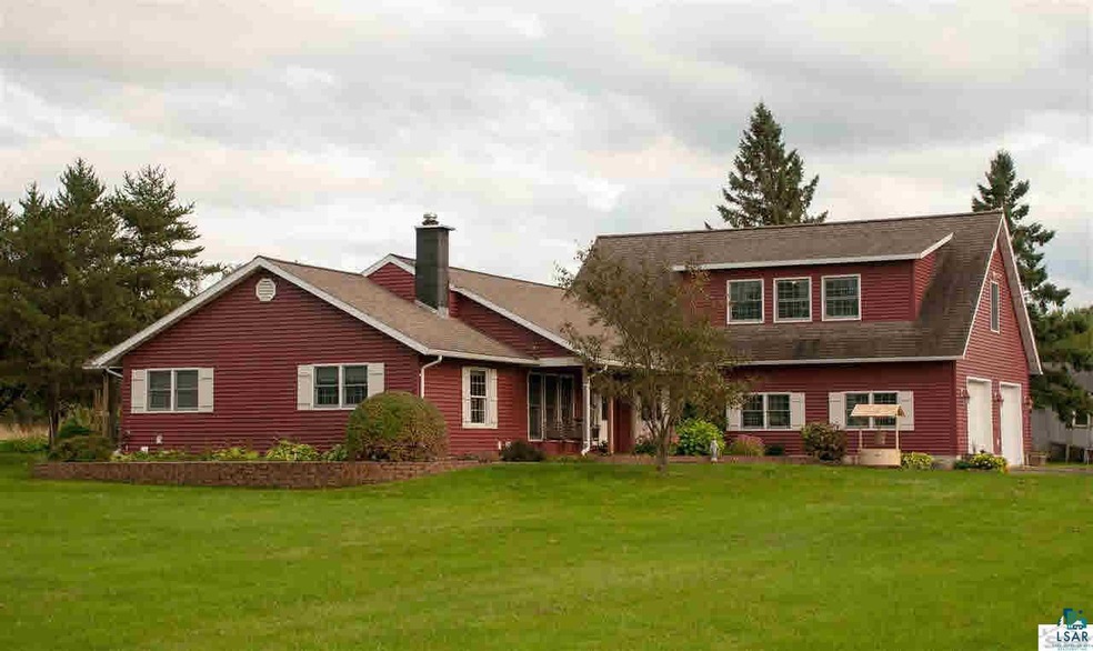
One of a kind residence just minutes to town. This modern home, built in 1994, features 4 Bedrooms, Main floor master Br and laundry, wood fireplace in living room and huge family room. Home has two car attached garage, outbuildings such as barn and tool shop. 20 acres with fencing, playhouse, swings and more.
| Date | Event | Price | List to Sale | Price per Sq Ft |
|---|---|---|---|---|
| 06/11/2018 06/11/18 | Sold | $289,000 | 0.0% | $114 / Sq Ft |
| 05/24/2018 05/24/18 | Pending | -- | -- | -- |
| 03/23/2018 03/23/18 | For Sale | $289,000 | -- | $114 / Sq Ft |
| Year | Tax Paid | Tax Assessment Tax Assessment Total Assessment is a certain percentage of the fair market value that is determined by local assessors to be the total taxable value of land and additions on the property. | Land | Improvement |
|---|---|---|---|---|
| 2024 | $5,060 | $270,700 | $24,700 | $246,000 |
| 2023 | $4,733 | $270,700 | $24,700 | $246,000 |
| 2022 | $4,262 | $270,700 | $24,700 | $246,000 |
| 2021 | $4,068 | $270,700 | $24,700 | $246,000 |
| 2020 | $4,379 | $270,700 | $24,700 | $246,000 |
| 2019 | $4,424 | $270,700 | $24,700 | $246,000 |
| 2018 | $4,743 | $265,100 | $24,700 | $240,400 |
| 2017 | $4,487 | $252,200 | $24,700 | $227,500 |
| 2016 | $4,456 | $252,200 | $24,700 | $227,500 |
| 2015 | $4,398 | $227,500 | $24,700 | $227,500 |
| 2014 | $4,398 | $257,500 | $29,400 | $228,100 |
| 2013 | $4,500 | $257,500 | $29,400 | $228,100 |
M
Seller's Agent in 2018
Mike Peller
Gables & Ivy Real Estate
(218) 730-0300
12 Total Sales

Buyer's Agent in 2018
Melissa Sundet
RE/MAX
(218) 343-8859
35 Total Sales
Source: Lake Superior Area REALTORS®
MLS Number: 6073635
APN: AM-002-00244-01
Ask me questions while you tour the home.