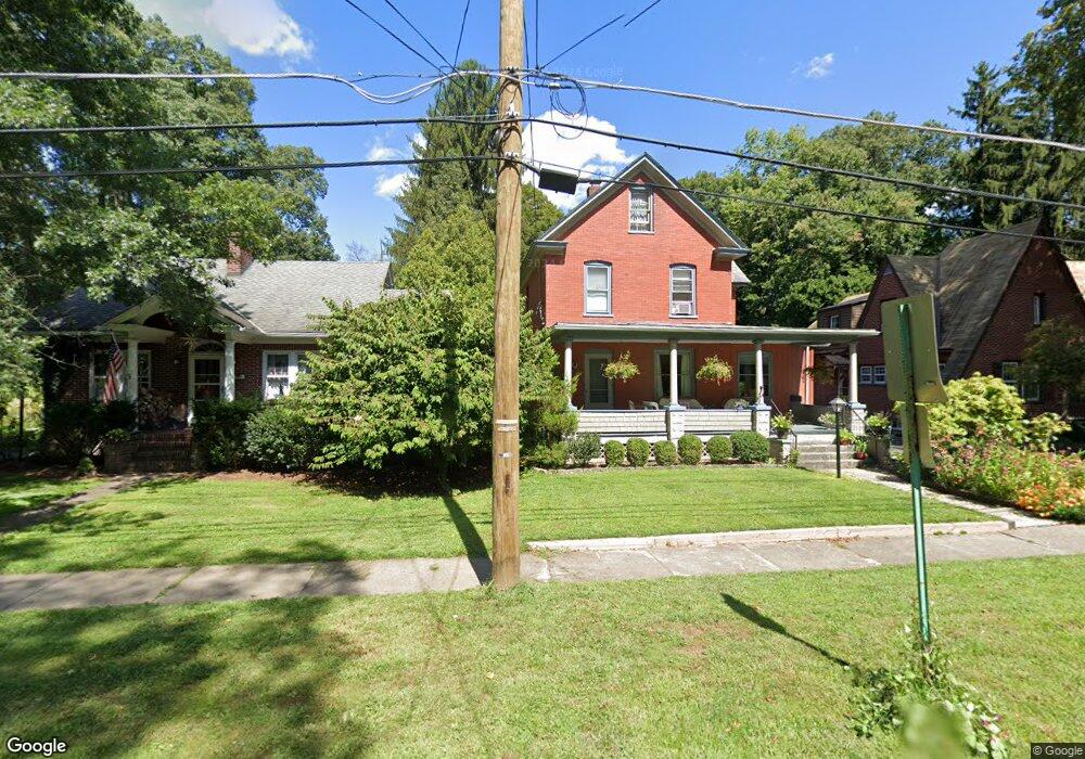
738 Bryant St Stroudsburg, PA 18360
Estimated Value: $310,000 - $376,000
3
Beds
2
Baths
2,046
Sq Ft
$168/Sq Ft
Est. Value
About This Home
This home is located at 738 Bryant St, Stroudsburg, PA 18360 and is currently estimated at $344,003, approximately $168 per square foot. 738 Bryant St is a home located in Monroe County with nearby schools including Stroudsburg Junior High School, Stroudsburg High School, and Stroudsburg Seventh-day Adventist School.
Ownership History
Date
Name
Owned For
Owner Type
Purchase Details
Closed on
Jul 9, 2007
Sold by
Mccdonald Eileen Louise and Mccdonald Ketchum Eileen
Bought by
Snuffer Neil G and Avey Kathleen A
Current Estimated Value
Home Financials for this Owner
Home Financials are based on the most recent Mortgage that was taken out on this home.
Original Mortgage
$13,500
Outstanding Balance
$8,156
Interest Rate
5.87%
Mortgage Type
Adjustable Rate Mortgage/ARM
Estimated Equity
$335,847
Create a Home Valuation Report for This Property
The Home Valuation Report is an in-depth analysis detailing your home's value as well as a comparison with similar homes in the area
Home Values in the Area
Average Home Value in this Area
Purchase History
| Date | Buyer | Sale Price | Title Company |
|---|---|---|---|
| Snuffer Neil G | $265,000 | American Abstract |
Source: Public Records
Mortgage History
| Date | Status | Borrower | Loan Amount |
|---|---|---|---|
| Open | Snuffer Neil G | $13,500 |
Source: Public Records
Tax History Compared to Growth
Tax History
| Year | Tax Paid | Tax Assessment Tax Assessment Total Assessment is a certain percentage of the fair market value that is determined by local assessors to be the total taxable value of land and additions on the property. | Land | Improvement |
|---|---|---|---|---|
| 2025 | $2,933 | $172,760 | $35,060 | $137,700 |
| 2024 | $2,416 | $172,760 | $35,060 | $137,700 |
| 2023 | $6,874 | $172,760 | $35,060 | $137,700 |
| 2022 | $6,604 | $172,760 | $35,060 | $137,700 |
| 2021 | $6,311 | $172,760 | $35,060 | $137,700 |
| 2020 | $6,110 | $172,760 | $35,060 | $137,700 |
| 2019 | $4,232 | $18,210 | $5,190 | $13,020 |
| 2018 | $4,173 | $18,210 | $5,190 | $13,020 |
| 2017 | $4,118 | $18,210 | $5,190 | $13,020 |
| 2016 | $1,145 | $18,210 | $5,190 | $13,020 |
| 2015 | -- | $18,210 | $5,190 | $13,020 |
| 2014 | -- | $18,210 | $5,190 | $13,020 |
Source: Public Records
Map
Nearby Homes
- 515 Bryant St
- 58 Broad St
- 116 Lee Ave
- 712 Thomas St
- 63 Village Dr
- 846 Thomas St
- 712 Scott St
- 830 Scott St
- 412 N 8th St
- 22 Fetherman St
- 25 N 2nd St
- 3154 Godfrey Ridge Dr
- 00 Phillips St
- 110 Kraemer Ave
- 1319 Poulos Ct
- 7297 Cherry Valley Rd
- 1198 W Main St
- 984 Forest Dr
- LOT Edgemont Rd
- 5618 Glenbrook T 165 Rd
- 740 Bryant St
- 740 Bryant St
- 740 Bryant St
- 736 Bryant St
- 734 Bryant St
- 750 Bryant St
- 732 Bryant St
- 739 Bryant St
- 735 Bryant St
- 741 Bryant St
- 754 Bryant St
- 0 Bryant & Woodcliff Ave Unit 12-9997
- 0 Bryant & Woodcliff Ave
- 728 Bryant St
- 762 Bryant St
- 729 Bryant St
- 726 Bryant St
- 755 Bryant St
- 725 Bryant St
- 725 Bryant St