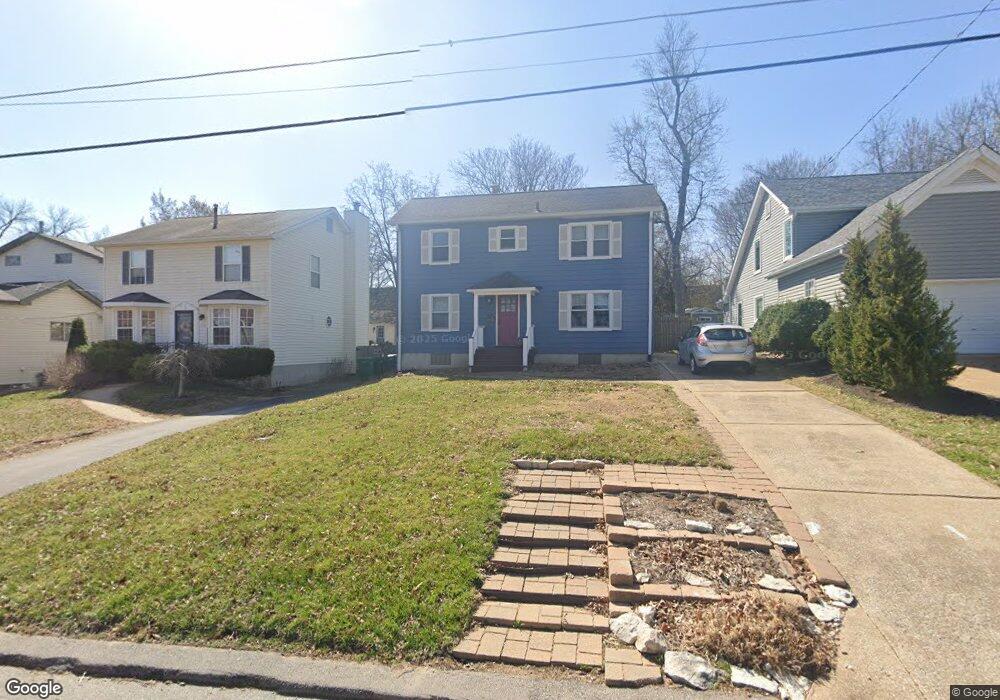
738 Eunice Ave Saint Louis, MO 63119
Estimated Value: $353,653 - $475,000
3
Beds
2
Baths
1,504
Sq Ft
$268/Sq Ft
Est. Value
About This Home
This home is located at 738 Eunice Ave, Saint Louis, MO 63119 and is currently estimated at $402,913, approximately $267 per square foot. 738 Eunice Ave is a home located in St. Louis County with nearby schools including Avery Elementary School, Hixson Middle School, and Webster Groves High School.
Ownership History
Date
Name
Owned For
Owner Type
Purchase Details
Closed on
Dec 14, 2020
Sold by
Pearce Edward H
Bought by
Pearce Michelle M
Current Estimated Value
Purchase Details
Closed on
Jun 6, 1997
Sold by
Richetti Peter W and Richetti Rita D
Bought by
Pearce Edward H and Pearce Michelle M
Home Financials for this Owner
Home Financials are based on the most recent Mortgage that was taken out on this home.
Original Mortgage
$70,000
Outstanding Balance
$9,122
Interest Rate
7.98%
Estimated Equity
$393,791
Create a Home Valuation Report for This Property
The Home Valuation Report is an in-depth analysis detailing your home's value as well as a comparison with similar homes in the area
Home Values in the Area
Average Home Value in this Area
Purchase History
| Date | Buyer | Sale Price | Title Company |
|---|---|---|---|
| Pearce Michelle M | -- | None Available | |
| Pearce Edward H | -- | -- |
Source: Public Records
Mortgage History
| Date | Status | Borrower | Loan Amount |
|---|---|---|---|
| Open | Pearce Edward H | $70,000 |
Source: Public Records
Tax History
| Year | Tax Paid | Tax Assessment Tax Assessment Total Assessment is a certain percentage of the fair market value that is determined by local assessors to be the total taxable value of land and additions on the property. | Land | Improvement |
|---|---|---|---|---|
| 2025 | $3,523 | $61,550 | $42,470 | $19,080 |
| 2024 | $3,523 | $50,380 | $30,890 | $19,490 |
| 2023 | $3,523 | $50,380 | $30,890 | $19,490 |
| 2022 | $3,344 | $44,610 | $30,890 | $13,720 |
| 2021 | $3,333 | $44,610 | $30,890 | $13,720 |
| 2020 | $3,681 | $45,960 | $30,890 | $15,070 |
| 2019 | $3,654 | $45,960 | $30,890 | $15,070 |
| 2018 | $3,749 | $41,890 | $21,620 | $20,270 |
| 2017 | $3,724 | $41,890 | $21,620 | $20,270 |
| 2016 | $3,563 | $38,370 | $18,530 | $19,840 |
| 2015 | $3,575 | $38,370 | $18,530 | $19,840 |
| 2014 | $3,413 | $35,630 | $13,550 | $22,080 |
Source: Public Records
Map
Nearby Homes
- 727 Marshall Ave
- 835 N Forest Ave
- 643 Marshall Ave
- 633 N Forest Ave
- 650 Clark Ave
- 619 N Bompart Ave
- 544 Summit Ave
- 503 Atalanta Ave
- 517 Clark Ave
- 2649 Melvin Ave
- 404 Clark Ave
- 2639 Louis Ave
- 1048 Kuhlman Ln
- 1052 Kuhlman Ln
- 643 Elmwood Ave
- 2905 Brazeau Ave
- 2503 Louis Ave
- 1088 Key West Ave
- 8737 Magdalen Ave
- 2904 Collier Ave
- 744 Eunice Ave
- 736 Eunice Ave
- 750 Eunice Ave
- 728 Eunice Ave
- 754 Eunice Ave
- 749 Marshall Ave
- 726 Eunice Ave
- 751 Eunice Ave
- 735 Eunice Ave
- 745 Eunice Ave
- 733 Eunice Ave
- 731 Marshall Ave
- 731 Eunice Ave
- 755 Eunice Ave
- 722 Eunice Ave
- 729 Eunice Ave
- 725 Eunice Ave
- 1014 Summit Ave
- 718 Eunice Ave
- 719 Marshall Ave
Your Personal Tour Guide
Ask me questions while you tour the home.