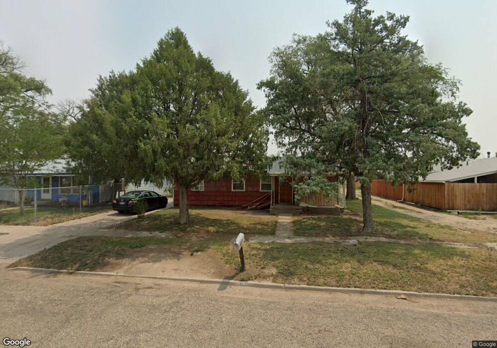
738 Maple Ave Las Animas, CO 81054
Estimated Value: $131,000 - $236,264
3
Beds
1
Bath
1,563
Sq Ft
$108/Sq Ft
Est. Value
About This Home
This home is located at 738 Maple Ave, Las Animas, CO 81054 and is currently estimated at $169,066, approximately $108 per square foot. 738 Maple Ave is a home located in Bent County with nearby schools including Las Animas Elementary School, Las Animas Junior High School, and Las Animas High School.
Ownership History
Date
Name
Owned For
Owner Type
Purchase Details
Closed on
Feb 28, 2020
Sold by
Thayer & Thayer Properties Llc
Bought by
Baylor Jason and Baylor Brittany
Current Estimated Value
Home Financials for this Owner
Home Financials are based on the most recent Mortgage that was taken out on this home.
Original Mortgage
$157,500
Outstanding Balance
$139,752
Interest Rate
3.6%
Mortgage Type
Seller Take Back
Estimated Equity
$29,314
Purchase Details
Closed on
Jun 19, 2014
Sold by
Thayer James K
Bought by
Thayer & Thayer Properties Llc
Purchase Details
Closed on
Oct 23, 2013
Sold by
Garman Yvonne and Wixom David
Bought by
Thayer James K
Purchase Details
Closed on
Apr 19, 2013
Sold by
Perko Deborah
Bought by
Garman Yvonne
Create a Home Valuation Report for This Property
The Home Valuation Report is an in-depth analysis detailing your home's value as well as a comparison with similar homes in the area
Purchase History
| Date | Buyer | Sale Price | Title Company |
|---|---|---|---|
| Baylor Jason | $175,000 | None Available | |
| Thayer & Thayer Properties Llc | -- | None Available | |
| Thayer James K | $30,000 | None Available | |
| Garman Yvonne | -- | None Available |
Source: Public Records
Mortgage History
| Date | Status | Borrower | Loan Amount |
|---|---|---|---|
| Open | Baylor Jason | $157,500 |
Source: Public Records
Tax History
| Year | Tax Paid | Tax Assessment Tax Assessment Total Assessment is a certain percentage of the fair market value that is determined by local assessors to be the total taxable value of land and additions on the property. | Land | Improvement |
|---|---|---|---|---|
| 2024 | $471 | $4,227 | $162 | $4,065 |
| 2023 | $468 | $4,227 | $162 | $4,065 |
| 2022 | $396 | $7,990 | $310 | $7,680 |
| 2021 | $398 | $3,692 | $250 | $3,442 |
| 2020 | $354 | $3,288 | $250 | $3,038 |
| 2019 | $372 | $3,262 | $250 | $3,012 |
| 2018 | $372 | $3,419 | $252 | $3,167 |
| 2017 | $375 | $3,419 | $252 | $3,167 |
| 2016 | $393 | $3,592 | $279 | $3,313 |
| 2015 | -- | $3,592 | $279 | $3,313 |
| 2014 | -- | $3,593 | $279 | $3,314 |
| 2013 | -- | $3,593 | $279 | $3,314 |
Source: Public Records
Map
Nearby Homes
- 705 Locust Ave
- 1032 Locust Ave
- 1046 Locust Ave
- 1103 Ambassador Thompson Blvd
- 651 Ash Ave
- 509 5th St
- 621 Carson Ave
- 415 9th St
- 940 Carson Ave
- 433 Grove Ave
- 426 Poplar Ave
- 629 St Vrain Ave
- 312 Carson Ave
- 626 St Vrain St
- 626 St Vrain Ave
- 535 Moore Ave
- 606 Hurd Ave
- 10928 Us Highway 50
- 0 Cr Ff 5
- 10525 County Rd Ee
- 742 Maple Ave
- 722 Maple Ave
- 739 Maple Ave
- 745 Maple Ave
- 756 Maple Ave
- 749 Amb Thompson Blvd
- 743 Maple Ave
- 721 Maple Ave
- 735 Amb Thompson Blvd
- 805 Amb Thompson Blvd
- 725 Grand Ave
- 735 Grand Ave
- 721 Grand Ave
- 745 Grand Ave
- 747 Maple Ave
- 749 Grand Ave
- 747 Grand Ave
- 660 Maple Ave
- 711 Grand Ave
- 705 Grand Ave
Your Personal Tour Guide
Ask me questions while you tour the home.