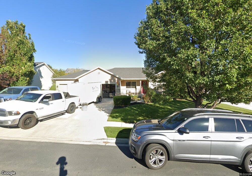
738 N 600 W American Fork, UT 84003
Estimated Value: $558,000 - $713,000
3
Beds
2
Baths
2,821
Sq Ft
$218/Sq Ft
Est. Value
About This Home
This home is located at 738 N 600 W, American Fork, UT 84003 and is currently estimated at $613,653, approximately $217 per square foot. 738 N 600 W is a home located in Utah County with nearby schools including Shelley Elementary School, American Fork Junior High School, and American Fork High School.
Ownership History
Date
Name
Owned For
Owner Type
Purchase Details
Closed on
May 24, 2012
Sold by
Trosper Raymond Marquist
Bought by
Trosper Raymond Marquist and R S T Family Trust
Current Estimated Value
Home Financials for this Owner
Home Financials are based on the most recent Mortgage that was taken out on this home.
Original Mortgage
$200,000
Outstanding Balance
$84,330
Interest Rate
3.86%
Mortgage Type
New Conventional
Estimated Equity
$529,323
Purchase Details
Closed on
Feb 23, 2009
Sold by
Trosper Raymond Marquist
Bought by
Trosper Raymond Marquist and Trosper Sarah K
Home Financials for this Owner
Home Financials are based on the most recent Mortgage that was taken out on this home.
Original Mortgage
$184,000
Interest Rate
4.91%
Mortgage Type
New Conventional
Purchase Details
Closed on
Feb 17, 2009
Sold by
Trosper Raymond Marquist and Trosper Sara K
Bought by
Trosper Raymond Marquist
Home Financials for this Owner
Home Financials are based on the most recent Mortgage that was taken out on this home.
Original Mortgage
$184,000
Interest Rate
4.91%
Mortgage Type
New Conventional
Purchase Details
Closed on
Dec 19, 2003
Sold by
Woods Duane and Woods Lisa
Bought by
Trosper Raymond Marquist
Home Financials for this Owner
Home Financials are based on the most recent Mortgage that was taken out on this home.
Original Mortgage
$198,000
Interest Rate
7.62%
Mortgage Type
Purchase Money Mortgage
Purchase Details
Closed on
Jan 7, 2003
Sold by
All American Development & Const Ii Lc
Bought by
Woods Duane and Woods Lisa
Home Financials for this Owner
Home Financials are based on the most recent Mortgage that was taken out on this home.
Original Mortgage
$161,600
Interest Rate
6.75%
Purchase Details
Closed on
Aug 29, 2002
Sold by
L P I Lc
Bought by
All American Development & Construction
Home Financials for this Owner
Home Financials are based on the most recent Mortgage that was taken out on this home.
Original Mortgage
$159,000
Interest Rate
6.43%
Mortgage Type
Construction
Create a Home Valuation Report for This Property
The Home Valuation Report is an in-depth analysis detailing your home's value as well as a comparison with similar homes in the area
Home Values in the Area
Average Home Value in this Area
Purchase History
| Date | Buyer | Sale Price | Title Company |
|---|---|---|---|
| Trosper Raymond Marquist | -- | Meridian Title Company | |
| Trosper Raymond Marquist | -- | Meridican Title Company | |
| Trosper Raymond Marquist | -- | Meridiant Title Company | |
| Trosper Raymond Marquist | -- | Surety Title | |
| Trosper Raymond Marquist | -- | Surety Title | |
| Trosper Raymond Marquist | -- | None Available | |
| Trosper Raymond Marquist | -- | Equity Title Agency Inc | |
| Woods Duane | -- | First American Title Co | |
| All American Development & Construction | -- | First American Title Co |
Source: Public Records
Mortgage History
| Date | Status | Borrower | Loan Amount |
|---|---|---|---|
| Open | Trosper Raymond Marquist | $200,000 | |
| Closed | Trosper Raymond Marquist | $184,000 | |
| Closed | Trosper Raymond Marquist | $198,000 | |
| Previous Owner | Woods Duane | $161,600 | |
| Previous Owner | All American Development & Construction | $159,000 | |
| Closed | Woods Duane | $40,400 |
Source: Public Records
Tax History Compared to Growth
Tax History
| Year | Tax Paid | Tax Assessment Tax Assessment Total Assessment is a certain percentage of the fair market value that is determined by local assessors to be the total taxable value of land and additions on the property. | Land | Improvement |
|---|---|---|---|---|
| 2025 | $2,586 | $316,030 | $220,700 | $353,900 |
| 2024 | $2,586 | $287,375 | $0 | $0 |
| 2023 | $2,429 | $286,165 | $0 | $0 |
| 2022 | $2,561 | $297,770 | $0 | $0 |
| 2021 | $2,196 | $398,700 | $158,400 | $240,300 |
| 2020 | $2,055 | $361,900 | $141,400 | $220,500 |
| 2019 | $1,890 | $344,200 | $130,800 | $213,400 |
| 2018 | $1,777 | $309,400 | $123,800 | $185,600 |
| 2017 | $1,707 | $160,435 | $0 | $0 |
| 2016 | $1,686 | $147,235 | $0 | $0 |
| 2015 | $1,777 | $147,235 | $0 | $0 |
| 2014 | $1,627 | $132,990 | $0 | $0 |
Source: Public Records
Map
Nearby Homes
- 641 N 420 W
- 602 W 860 N
- 962 N 780 St W Unit 508
- 974 N 780 St W Unit 509
- 916 N 780 St W Unit 501
- 822 W 800 St N Unit LOT319
- 822 N 860 W Unit 317
- 914 N 400 W Unit A
- 987 N 410 W
- 3889 W 950 Cir N Unit 366
- 777 W State Rd
- 540 N 300 W
- 356 N 480 W
- 471 W 1040 N
- 3935 W 1000 N Unit 438
- 3983 W 1000 N Unit 442
- 4007 W 1000 N
- 3947 W 1000 N Unit 439
- 3959 W 1000 N
- 984 N 300 W