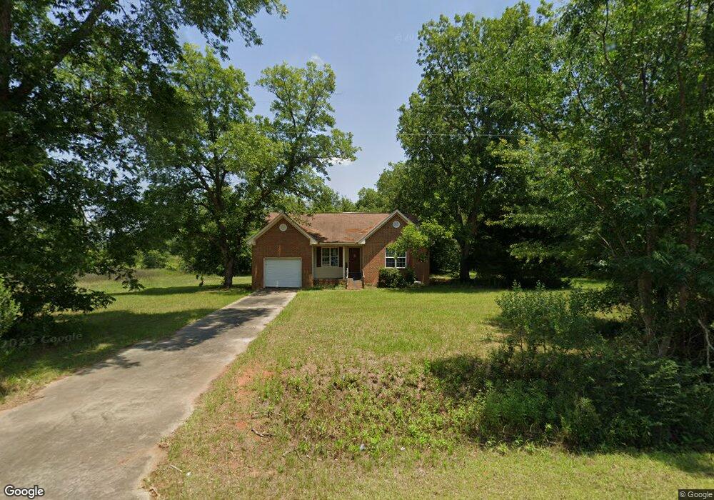
738 Pat Whatley Rd Dawson, GA 39842
Estimated Value: $120,000 - $156,000
3
Beds
2
Baths
1,494
Sq Ft
$90/Sq Ft
Est. Value
About This Home
This home is located at 738 Pat Whatley Rd, Dawson, GA 39842 and is currently estimated at $135,024, approximately $90 per square foot. 738 Pat Whatley Rd is a home located in Terrell County with nearby schools including Cooper-Carver Elementary School, Terrell Middle School, and Terrell High School.
Ownership History
Date
Name
Owned For
Owner Type
Purchase Details
Closed on
Dec 5, 2024
Sold by
United States Rural Housing Service
Bought by
Chandrasekar Saravanan
Current Estimated Value
Purchase Details
Closed on
Apr 2, 2024
Sold by
Holley Rosie M
Bought by
United States Rural Housing Service
Create a Home Valuation Report for This Property
The Home Valuation Report is an in-depth analysis detailing your home's value as well as a comparison with similar homes in the area
Home Values in the Area
Average Home Value in this Area
Purchase History
| Date | Buyer | Sale Price | Title Company |
|---|---|---|---|
| Chandrasekar Saravanan | $106,080 | -- | |
| United States Rural Housing Service | $109,105 | -- |
Source: Public Records
Tax History Compared to Growth
Tax History
| Year | Tax Paid | Tax Assessment Tax Assessment Total Assessment is a certain percentage of the fair market value that is determined by local assessors to be the total taxable value of land and additions on the property. | Land | Improvement |
|---|---|---|---|---|
| 2024 | $1,535 | $49,567 | $6,274 | $43,293 |
| 2023 | $1,536 | $49,567 | $6,274 | $43,293 |
| 2022 | $1,536 | $49,567 | $6,274 | $43,293 |
| 2021 | $1,536 | $49,567 | $6,274 | $43,293 |
| 2020 | $1,474 | $49,567 | $6,274 | $43,293 |
| 2019 | $1,426 | $49,567 | $6,274 | $43,293 |
| 2018 | $1,426 | $49,567 | $6,274 | $43,293 |
| 2017 | $1,486 | $49,567 | $6,274 | $43,293 |
| 2016 | $1,426 | $49,567 | $6,274 | $43,293 |
| 2015 | -- | $49,567 | $6,274 | $43,293 |
| 2014 | -- | $49,567 | $6,274 | $43,293 |
| 2013 | -- | $49,567 | $6,274 | $43,292 |
Source: Public Records
Map
Nearby Homes
- 361/552 NW Tenth Ave
- 448 Henry Mitchell Dr NE
- 229 7th Ave NW
- 527 Orange St NE
- 13XX Graves Hwy
- 434 Foster Ave
- 904 Ash St NE
- 411 E Lee St
- 513 College St NE
- 0 Cox Rd
- 0 Cooper Dr NE Unit 7597500
- 0 Cooper Dr NE Unit 10543060
- 828 Cooper Dr NE
- 707 Johnson St SE
- 1240 Askew Dr NE
- 1258 Askew Dr NE
- 1264 Ball Park Ave NE
- 1256 Ball Park Ave NE
- 1239 Askew Dr NE
- 439 Cherry St SE
- 724 Pat Whatley Rd
- 602 Pat Whatley Rd
- 1091 Metts Rd
- 0000 Metts Rd
- 561 Pat Whatley Rd
- 905 Metts Rd
- 0 Pat Watley Rd Unit 157660
- 000 Pat Whatley Rd
- 09 Pat Whatley Rd
- 01 Pat Whatley Rd
- 141 Pat Whatley Rd
- 08 Pat Whatley Rd
- 1 Pat Whatley Rd
- 0 Pat Whatley Rd
- 845 Metts Rd
- 797 Metts Rd
- 761 Metts Rd
- 320 Pat Whatley Rd
- 215 Pat Whatley Rd
- 1165 Jones Mill Rd