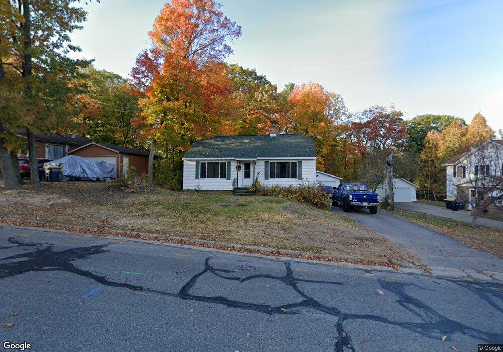
738 W Davenport St Rhinelander, WI 54501
Estimated Value: $126,000 - $167,000
--
Bed
--
Bath
--
Sq Ft
0.29
Acres
About This Home
This home is located at 738 W Davenport St, Rhinelander, WI 54501 and is currently estimated at $151,581. 738 W Davenport St is a home located in Oneida County with nearby schools including Crescent Elementary School, James Williams Middle School, and Rhinelander High School.
Ownership History
Date
Name
Owned For
Owner Type
Purchase Details
Closed on
Feb 22, 2017
Sold by
Olson Wayne W and Olson Kay F
Bought by
Olson Brent A
Current Estimated Value
Home Financials for this Owner
Home Financials are based on the most recent Mortgage that was taken out on this home.
Original Mortgage
$36,000
Outstanding Balance
$29,798
Interest Rate
4.19%
Mortgage Type
New Conventional
Estimated Equity
$121,783
Purchase Details
Closed on
Nov 12, 2012
Sold by
Olson Rosa Diane
Bought by
Olson Wayne W
Create a Home Valuation Report for This Property
The Home Valuation Report is an in-depth analysis detailing your home's value as well as a comparison with similar homes in the area
Home Values in the Area
Average Home Value in this Area
Purchase History
| Date | Buyer | Sale Price | Title Company |
|---|---|---|---|
| Olson Brent A | $36,000 | None Available | |
| Olson Wayne W | $5,000 | -- |
Source: Public Records
Mortgage History
| Date | Status | Borrower | Loan Amount |
|---|---|---|---|
| Open | Olson Brent A | $36,000 |
Source: Public Records
Tax History Compared to Growth
Tax History
| Year | Tax Paid | Tax Assessment Tax Assessment Total Assessment is a certain percentage of the fair market value that is determined by local assessors to be the total taxable value of land and additions on the property. | Land | Improvement |
|---|---|---|---|---|
| 2024 | $1,642 | $67,100 | $9,500 | $57,600 |
| 2023 | $1,583 | $67,100 | $9,500 | $57,600 |
| 2022 | $1,087 | $67,100 | $9,500 | $57,600 |
| 2021 | $1,567 | $67,100 | $9,500 | $57,600 |
| 2020 | $1,167 | $67,100 | $9,500 | $57,600 |
| 2019 | $1,190 | $67,100 | $9,500 | $57,600 |
| 2018 | $1,191 | $67,100 | $9,500 | $57,600 |
| 2017 | $1,384 | $67,100 | $9,500 | $57,600 |
| 2016 | $1,455 | $67,100 | $9,500 | $57,600 |
| 2015 | $1,408 | $67,100 | $9,500 | $57,600 |
| 2014 | $1,408 | $67,100 | $9,500 | $57,600 |
| 2011 | $1,183 | $64,800 | $9,500 | $55,300 |
Source: Public Records
Map
Nearby Homes
- 773 Balsam St
- 1640 Balsam St Unit 26
- 51 Crescent St
- 237 Maple St
- 745 W Phillip St
- Lot on Hemlock St
- 504 Hemlock St
- 825 River St
- 225 Alban St
- 603 Evergreen Ct
- 413 Conro St
- Lot 6 Riverglen Ave
- 1530 River St
- 127 E Anderson St
- 324 Abner St
- 408 N Stevens St
- 204 Court Park
- 903 S Keenan St
- 17 E Harvey St
- 106 N Baird Ave
- 730 W Davenport St
- 746 W Davenport St
- 722 W Davenport St
- 733 Balsam St
- 727 Balsam St
- 729 W Davenport St
- 754 W Davenport St
- 710 W Davenport St
- 737 Balsam St
- 719 Balsam St
- 745 Balsam St
- 717 W Davenport St
- 749 Balsam St
- 715 Balsam St
- 747 W Davenport St
- 739 W Davenport St
- 711 Pelican St
- 753 W Davenport St
- 755 Balsam St
- 761 W Davenport St