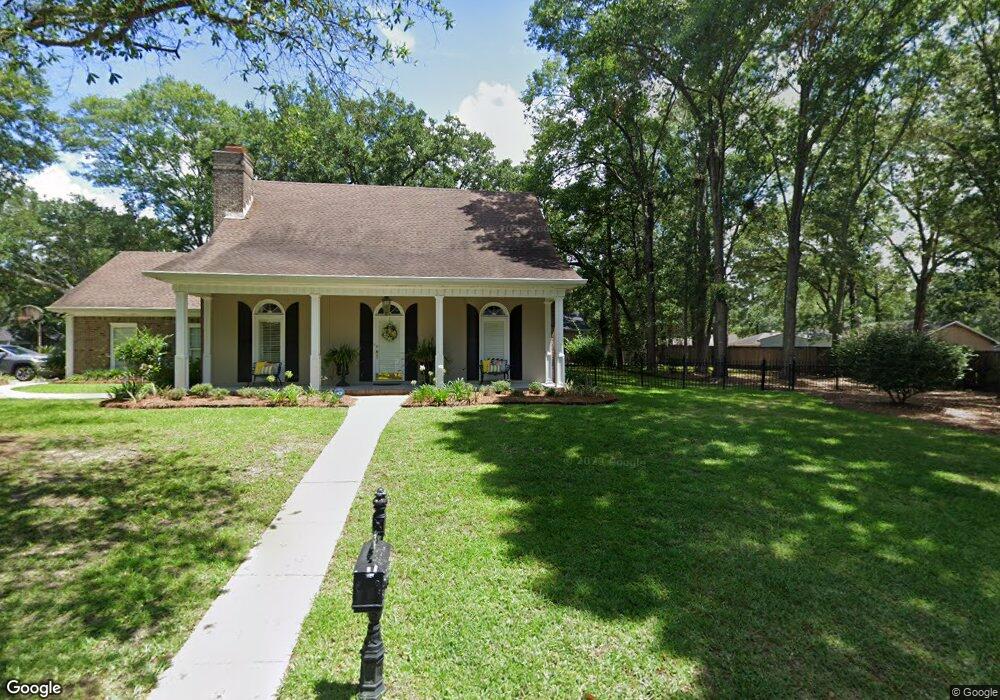
7380 Carson Rd S Mobile, AL 36695
Sheldon NeighborhoodEstimated Value: $278,060 - $339,000
5
Beds
3
Baths
2,295
Sq Ft
$134/Sq Ft
Est. Value
About This Home
This home is located at 7380 Carson Rd S, Mobile, AL 36695 and is currently estimated at $307,515, approximately $133 per square foot. 7380 Carson Rd S is a home with nearby schools including ER Dickson Elementary School, Burns Middle School, and WP Davidson High School.
Ownership History
Date
Name
Owned For
Owner Type
Purchase Details
Closed on
May 20, 2011
Sold by
Stewart Betty Jean
Bought by
Hudson Pamela Kay and Miller Regina Ann
Current Estimated Value
Purchase Details
Closed on
Jan 26, 2001
Sold by
Hubbell Wayne Charles and Hubbell Mary R
Bought by
Stewart Raymond E and Stewart Betty Jean
Home Financials for this Owner
Home Financials are based on the most recent Mortgage that was taken out on this home.
Original Mortgage
$142,650
Interest Rate
7.18%
Create a Home Valuation Report for This Property
The Home Valuation Report is an in-depth analysis detailing your home's value as well as a comparison with similar homes in the area
Home Values in the Area
Average Home Value in this Area
Purchase History
| Date | Buyer | Sale Price | Title Company |
|---|---|---|---|
| Hudson Pamela Kay | $198,000 | None Available | |
| Stewart Raymond E | -- | Surety Land Title Inc |
Source: Public Records
Mortgage History
| Date | Status | Borrower | Loan Amount |
|---|---|---|---|
| Previous Owner | Stewart Raymond E | $142,650 |
Source: Public Records
Tax History
| Year | Tax Paid | Tax Assessment Tax Assessment Total Assessment is a certain percentage of the fair market value that is determined by local assessors to be the total taxable value of land and additions on the property. | Land | Improvement |
|---|---|---|---|---|
| 2025 | -- | $23,730 | $3,500 | $20,230 |
| 2024 | -- | $23,610 | $3,500 | $20,110 |
| 2023 | $786 | $23,710 | $3,500 | $20,210 |
| 2022 | $850 | $21,220 | $3,500 | $17,720 |
| 2021 | $821 | $20,520 | $3,500 | $17,020 |
| 2020 | $817 | $20,410 | $3,500 | $16,910 |
| 2019 | $752 | $18,880 | $3,500 | $15,380 |
| 2018 | $713 | $17,960 | $0 | $0 |
| 2017 | $665 | $16,800 | $0 | $0 |
| 2016 | $700 | $17,640 | $0 | $0 |
| 2013 | $739 | $17,400 | $0 | $0 |
Source: Public Records
Map
Nearby Homes
- 7271 Carson Rd S
- 1265 Hanover Ct
- 1361 Dellwyn Ct
- 1291 Carson Rd W
- 1337 Carson Rd W
- 1484 Pebble Creek Dr
- 1171 Newbury Ln E
- 1645 Ashmoor Dr E
- 1542 Stone Hedge Dr W
- 1130 Jonathan Ct
- 1263 Smithfield Rd E
- 7693 Pembroke Cir
- 1735 Ashmoor Dr W
- 1000 Choctaw Bluff Rd
- 7180 Charlanda Blvd
- 7485 Creekwood Dr
- 7190 Bradshaw Ct
- 6939 Johnston Ln
- 1920 Bradshire Dr
- 1930 Bradshire Dr
- 1365 Revere Ct Unit DOG
- 7385 Carson Rd S
- 1350 Revere Ct
- 1341 Revere Ct
- 7381 Carson Rd S
- 1342 Revere Ct
- 1331 Revere Ct
- 7391 Carson Rd S
- 1360 Brookneal Cir
- 7371 Carson Rd S
- 7401 Carson Rd S
- 1340 Brookneal Cir
- 1321 Revere Ct
- 1336 Revere Ct
- 7411 Carson Rd S
- 1320 Brookneal Cir
- 1320 Revere Ct
- 1353 Wellsley Ct
- 1345 Wellsley Ct
- 7421 Carson Rd S
Your Personal Tour Guide
Ask me questions while you tour the home.