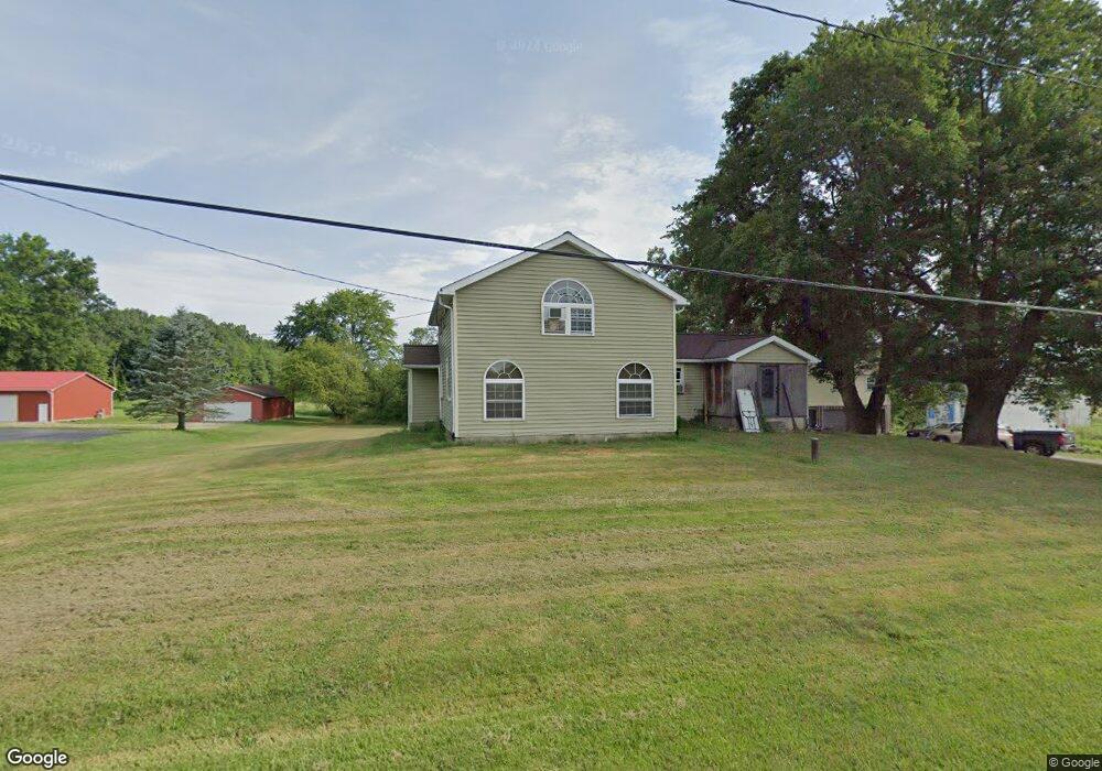
7387 State Route 305 Burghill, OH 44404
Estimated Value: $161,000 - $216,000
4
Beds
2
Baths
1,789
Sq Ft
$107/Sq Ft
Est. Value
About This Home
This home is located at 7387 State Route 305, Burghill, OH 44404 and is currently estimated at $191,808, approximately $107 per square foot. 7387 State Route 305 is a home located in Trumbull County with nearby schools including Badger Elementary School, Badger Middle School, and Badger High School.
Ownership History
Date
Name
Owned For
Owner Type
Purchase Details
Closed on
Mar 3, 2008
Sold by
Household Realty Corp
Bought by
Frantz Robert L
Current Estimated Value
Home Financials for this Owner
Home Financials are based on the most recent Mortgage that was taken out on this home.
Original Mortgage
$66,300
Outstanding Balance
$41,415
Interest Rate
5.79%
Mortgage Type
Purchase Money Mortgage
Estimated Equity
$150,393
Purchase Details
Closed on
Nov 16, 2000
Sold by
Steele Pearl A and Steele Robert E
Bought by
Steele Dale Robert and Steele Donna Jean
Purchase Details
Closed on
Mar 9, 1994
Sold by
Messersmith Leota
Bought by
Pearl A Seaton
Purchase Details
Closed on
Jan 1, 1990
Bought by
Leota Messersmith
Create a Home Valuation Report for This Property
The Home Valuation Report is an in-depth analysis detailing your home's value as well as a comparison with similar homes in the area
Home Values in the Area
Average Home Value in this Area
Purchase History
| Date | Buyer | Sale Price | Title Company |
|---|---|---|---|
| Frantz Robert L | $31,900 | Sovereign Title Agency Llc | |
| Steele Dale Robert | $89,000 | -- | |
| Pearl A Seaton | $42,000 | -- | |
| Leota Messersmith | -- | -- |
Source: Public Records
Mortgage History
| Date | Status | Borrower | Loan Amount |
|---|---|---|---|
| Open | Frantz Robert L | $66,300 |
Source: Public Records
Tax History Compared to Growth
Tax History
| Year | Tax Paid | Tax Assessment Tax Assessment Total Assessment is a certain percentage of the fair market value that is determined by local assessors to be the total taxable value of land and additions on the property. | Land | Improvement |
|---|---|---|---|---|
| 2024 | $2,106 | $47,220 | $6,090 | $41,130 |
| 2023 | $2,106 | $47,220 | $6,090 | $41,130 |
| 2022 | $1,793 | $36,890 | $5,530 | $31,360 |
| 2021 | $1,825 | $36,890 | $5,530 | $31,360 |
| 2020 | $1,805 | $36,890 | $5,530 | $31,360 |
| 2019 | $1,684 | $32,380 | $5,110 | $27,270 |
| 2018 | $1,720 | $32,380 | $5,110 | $27,270 |
| 2017 | $1,684 | $32,380 | $5,110 | $27,270 |
| 2016 | $1,591 | $30,770 | $5,110 | $25,660 |
| 2015 | $1,560 | $30,770 | $5,110 | $25,660 |
| 2014 | -- | $30,770 | $5,110 | $25,660 |
| 2013 | $1,410 | $27,060 | $5,110 | $21,950 |
Source: Public Records
Map
Nearby Homes
- 3164 Ohio 7
- 4016 State Route 7
- 7131 Drake Stateline Rd NE
- 7155 Drake State Line Rd
- 8084 State Route 609
- 5329 Tamarack Dr
- 7974 Thompson Sharpsville Rd
- 8038 Thompson Sharpsville Rd
- 8274 Thompson Sharpsville Rd
- 7529 State Line
- 1921 Custer Orangeville Rd
- 2701 Orangeville Rd
- 2601 Orangeville Rd
- 571 Buckeye Dr
- 4076 Seneca Rd
- 2486 Waynewood Dr NE
- 2000 Orangeville Rd
- 1212 State Route 7 NE
- 2728 Sodom Hutchings Rd
- 2343 Downing Ln
- 7367 State Route 305
- 7366 State Route 305
- 7349 State Route 305
- 7354 State Route 305
- 7340 State Route 305
- 7441 State Route 305
- 7319 Ohio 305
- 7316 State Route 305
- 7308 State Route 305
- 7290 State Route 305
- 7486 State Route 305
- 7504 State Route 305
- 7508 Wilson Sharpsville
- 7254 State Route 305
- 7508 State Route 305
- 7524 State Route 305
- 7542 State Route 305
- 7219 Wilson Sharpsville
- 7200 State Route 305
- 7195 State Route 305