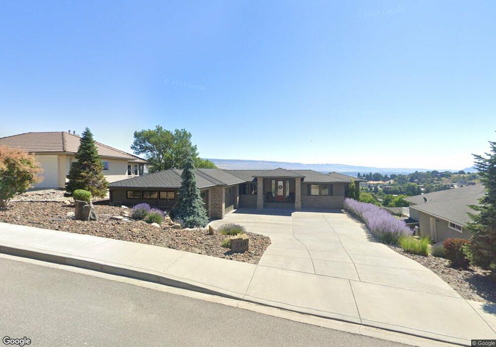
739 Castle Heights Dr Wenatchee, WA 98801
Estimated Value: $848,000 - $938,000
3
Beds
2
Baths
2,038
Sq Ft
$431/Sq Ft
Est. Value
About This Home
This home is located at 739 Castle Heights Dr, Wenatchee, WA 98801 and is currently estimated at $878,573, approximately $431 per square foot. 739 Castle Heights Dr is a home located in Chelan County with nearby schools including Washington Elementary School, Orchard Middle School, and Wenatchee High School.
Ownership History
Date
Name
Owned For
Owner Type
Purchase Details
Closed on
Jul 11, 2007
Sold by
R F Smith Builders Inc
Bought by
Mcdarment Christopher C and Mcdarment Holly L
Current Estimated Value
Home Financials for this Owner
Home Financials are based on the most recent Mortgage that was taken out on this home.
Original Mortgage
$275,000
Outstanding Balance
$171,074
Interest Rate
6.41%
Mortgage Type
New Conventional
Estimated Equity
$707,499
Purchase Details
Closed on
Sep 23, 2005
Sold by
Chapman Brian J and Chapman Meredith E
Bought by
Rf Smith Builders Inc
Create a Home Valuation Report for This Property
The Home Valuation Report is an in-depth analysis detailing your home's value as well as a comparison with similar homes in the area
Home Values in the Area
Average Home Value in this Area
Purchase History
| Date | Buyer | Sale Price | Title Company |
|---|---|---|---|
| Mcdarment Christopher C | $558,000 | Central Washington Title Ser | |
| Rf Smith Builders Inc | $70,000 | First American Title |
Source: Public Records
Mortgage History
| Date | Status | Borrower | Loan Amount |
|---|---|---|---|
| Open | Mcdarment Christopher C | $275,000 |
Source: Public Records
Tax History Compared to Growth
Tax History
| Year | Tax Paid | Tax Assessment Tax Assessment Total Assessment is a certain percentage of the fair market value that is determined by local assessors to be the total taxable value of land and additions on the property. | Land | Improvement |
|---|---|---|---|---|
| 2021 | $6,442 | $658,776 | $80,936 | $577,840 |
| 2020 | $4,744 | $462,003 | $72,000 | $390,003 |
| 2019 | $5,030 | $459,959 | $53,663 | $406,296 |
| 2018 | $5,697 | $515,104 | $62,080 | $453,024 |
| 2017 | $5,148 | $477,727 | $62,080 | $415,647 |
| 2016 | $3,789 | $469,303 | $62,080 | $407,223 |
| 2015 | $3,789 | $441,196 | $62,080 | $379,116 |
| 2013 | $3,789 | $340,058 | $64,000 | $276,058 |
Source: Public Records
Map
Nearby Homes
- 2012 Linville Dr
- 756 Castle Heights Dr
- 2013 Linville Dr
- 1827 Dorner Place
- 1900 Cumbo Ct
- 1955 Castlerock Ave
- 1701 Skyline Dr
- 401 Castleview Place
- 1 NNA Skyline Dr
- 340 Brandi Ln
- 1530 Skyline Dr
- 0 Millerdale Heights Unit NWM2447188
- 1513 Apollo Place
- 1627 Jefferson St
- 1428 John St
- 301 Canyon Place
- 300 S Elliott Ave Unit 29
- 721 Kriewald Ct
- 1242 Cherry St
- 0 Skyline Dr Unit NWM2422182
- 743 Castle Heights Dr
- 735 Castle Heights Dr
- 780 Queens Ct
- 784 Queens Ct
- 747 Castle Heights Dr
- 631 Castle Heights Dr
- 2008 Linville Dr
- 774 Queens Ct
- 744 Castle Heights Dr
- 748 Castle Heights Dr
- 786 Queens Ct
- 2016 Linville Dr
- 627 Castle Heights Dr
- 767 Queens Ct
- 751 Castle Heights Dr
- 2020 Linville Dr
- 636 Castle Heights Dr
- 623 Castle Heights Dr
- 767 Kings Ct
- 741 Kings Ct