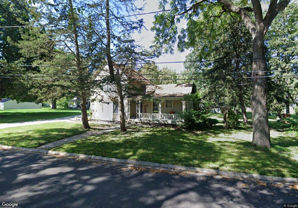
739 Cleveland Ave Batavia, IL 60510
Southeast Batavia NeighborhoodEstimated Value: $351,000 - $450,000
3
Beds
3
Baths
1,563
Sq Ft
$246/Sq Ft
Est. Value
About This Home
This home is located at 739 Cleveland Ave, Batavia, IL 60510 and is currently estimated at $384,463, approximately $245 per square foot. 739 Cleveland Ave is a home located in Kane County with nearby schools including J B Nelson Elementary School, Sam Rotolo Middle School, and Batavia Sr High School.
Ownership History
Date
Name
Owned For
Owner Type
Purchase Details
Closed on
Aug 31, 2011
Sold by
West John M and West Pamela J
Bought by
Hodge Brian T and Westlund Carrie A
Current Estimated Value
Home Financials for this Owner
Home Financials are based on the most recent Mortgage that was taken out on this home.
Original Mortgage
$156,000
Outstanding Balance
$107,134
Interest Rate
4.32%
Mortgage Type
New Conventional
Estimated Equity
$277,329
Purchase Details
Closed on
Jan 10, 2007
Sold by
West Pamela J
Bought by
West Pamela J
Create a Home Valuation Report for This Property
The Home Valuation Report is an in-depth analysis detailing your home's value as well as a comparison with similar homes in the area
Home Values in the Area
Average Home Value in this Area
Purchase History
| Date | Buyer | Sale Price | Title Company |
|---|---|---|---|
| Hodge Brian T | $195,000 | Attorneys Title Guaranty Fun | |
| West Pamela J | -- | None Available |
Source: Public Records
Mortgage History
| Date | Status | Borrower | Loan Amount |
|---|---|---|---|
| Open | Hodge Brian T | $156,000 |
Source: Public Records
Tax History Compared to Growth
Tax History
| Year | Tax Paid | Tax Assessment Tax Assessment Total Assessment is a certain percentage of the fair market value that is determined by local assessors to be the total taxable value of land and additions on the property. | Land | Improvement |
|---|---|---|---|---|
| 2024 | $7,139 | $98,298 | $42,471 | $55,827 |
| 2023 | $6,969 | $89,216 | $38,547 | $50,669 |
| 2022 | $6,757 | $83,379 | $36,025 | $47,354 |
| 2021 | $6,478 | $79,077 | $34,166 | $44,911 |
| 2020 | $6,315 | $77,557 | $33,509 | $44,048 |
| 2019 | $6,206 | $74,812 | $32,323 | $42,489 |
| 2018 | $5,952 | $71,963 | $31,092 | $40,871 |
| 2017 | $5,802 | $69,590 | $30,067 | $39,523 |
| 2016 | $5,673 | $67,563 | $29,191 | $38,372 |
| 2015 | -- | $66,024 | $28,526 | $37,498 |
| 2014 | -- | $63,946 | $27,628 | $36,318 |
| 2013 | -- | $71,727 | $36,118 | $35,609 |
Source: Public Records
Map
Nearby Homes
- Lot 1 Center St
- 637 E Wilson St
- 428 E Wilson St
- 1025 E Wilson St
- 129 S Prairie St
- 621 Young Ave
- 323 Church St
- 820 N Van Buren St
- 1136 Pine Ct
- Lot 4 Manchester Ave
- 1267 Foxglove Dr
- 1273 Foxglove Dr
- 1277 Foxglove Dr
- 1283 Foxglove Dr
- 1285 Foxglove Dr
- 1017 Willow Ln Unit 2
- 304 Manchester Ave
- 710 N Van Buren St
- 817 Woodland Hills Rd
- 133 Mayflower Dr
- 727 Cleveland Ave
- 740 Cleveland Ave
- 751 Cleveland Ave
- 719 Cleveland Ave
- 730 Cleveland Ave
- 750 Center St
- 713 Cleveland Ave
- 202 S Forest Ave
- 760 Center St
- 763 Cleveland Ave
- 703 Cleveland Ave
- 111 Branford Ave
- 214 S Forest Ave
- 770 Center St
- Lot OF 1 Center St
- 105 Branford Ave
- 659 Kramer Ct
- 653 Kramer Ct
- 761 Center St
- 207 S Forest Ave