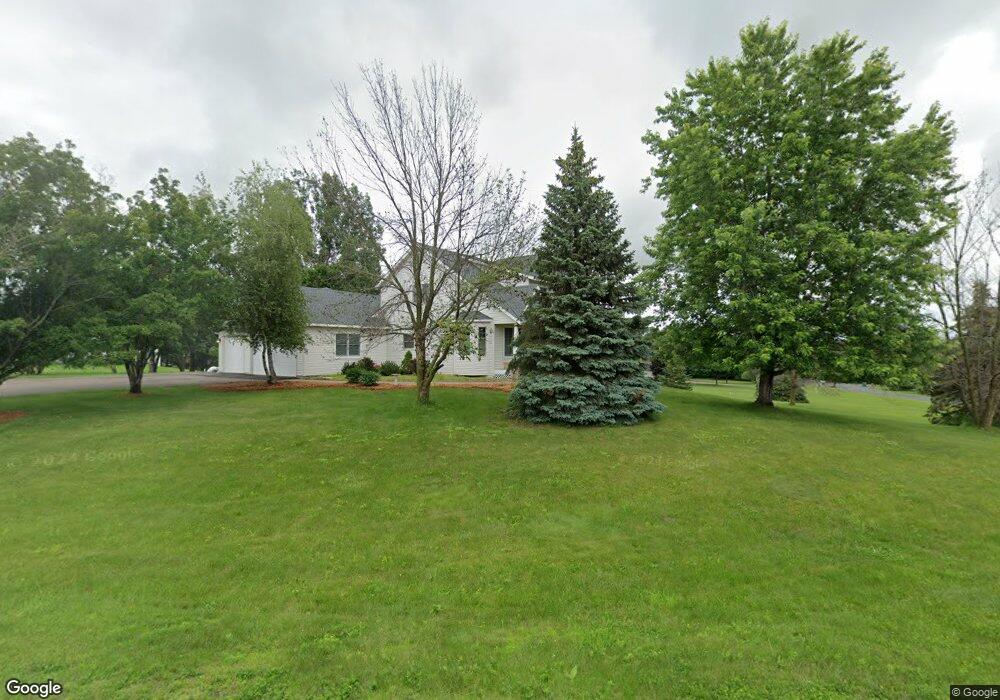
739 Crosby Dr Hudson, WI 54016
Estimated Value: $654,000 - $735,000
4
Beds
4
Baths
--
Sq Ft
2
Acres
About This Home
This home is located at 739 Crosby Dr, Hudson, WI 54016 and is currently estimated at $680,792. 739 Crosby Dr is a home located in St. Croix County with nearby schools including E.P. Rock Elementary School, Hudson Middle School, and Hudson High School.
Ownership History
Date
Name
Owned For
Owner Type
Purchase Details
Closed on
Mar 5, 2019
Sold by
Dehoogh Derek De and Dehoogh Christina De
Bought by
Thao Fue and Thao Mary
Current Estimated Value
Home Financials for this Owner
Home Financials are based on the most recent Mortgage that was taken out on this home.
Original Mortgage
$408,500
Outstanding Balance
$359,141
Interest Rate
4.4%
Mortgage Type
New Conventional
Estimated Equity
$321,651
Purchase Details
Closed on
Feb 21, 2013
Sold by
Dehoogh Heidi Lynn
Bought by
Dehoogh Derek Michael
Purchase Details
Closed on
Jul 16, 2010
Sold by
Vandersalm Arlo Jay and Vandersalm Nancy Sue
Bought by
Dehoogh Heidi Lynn and Dehoogh Derek Michael
Home Financials for this Owner
Home Financials are based on the most recent Mortgage that was taken out on this home.
Original Mortgage
$305,880
Interest Rate
4.62%
Mortgage Type
FHA
Purchase Details
Closed on
Dec 19, 2008
Sold by
Vandersalm Arlo Jay and Vandersalm Nancy Sue
Bought by
Vandersalm Arlo Jay and Vandersalm Nancy Sue
Create a Home Valuation Report for This Property
The Home Valuation Report is an in-depth analysis detailing your home's value as well as a comparison with similar homes in the area
Home Values in the Area
Average Home Value in this Area
Purchase History
| Date | Buyer | Sale Price | Title Company |
|---|---|---|---|
| Thao Fue | $430,000 | None Available | |
| Dehoogh Derek Michael | -- | None Available | |
| Dehoogh Heidi Lynn | $310,000 | Land Title Inc | |
| Vandersalm Arlo Jay | -- | None Available |
Source: Public Records
Mortgage History
| Date | Status | Borrower | Loan Amount |
|---|---|---|---|
| Open | Thao Fue | $408,500 | |
| Previous Owner | Dehoogh Heidi Lynn | $305,880 |
Source: Public Records
Tax History Compared to Growth
Tax History
| Year | Tax Paid | Tax Assessment Tax Assessment Total Assessment is a certain percentage of the fair market value that is determined by local assessors to be the total taxable value of land and additions on the property. | Land | Improvement |
|---|---|---|---|---|
| 2024 | $65 | $633,000 | $120,000 | $513,000 |
| 2023 | $5,897 | $633,000 | $120,000 | $513,000 |
| 2022 | $5,687 | $413,100 | $90,000 | $323,100 |
| 2021 | $5,590 | $413,100 | $90,000 | $323,100 |
| 2020 | $5,441 | $413,100 | $90,000 | $323,100 |
| 2019 | $5,248 | $413,100 | $90,000 | $323,100 |
| 2018 | $4,871 | $413,100 | $90,000 | $323,100 |
| 2017 | $4,498 | $281,100 | $38,500 | $242,600 |
| 2016 | $4,498 | $281,100 | $38,500 | $242,600 |
| 2015 | $4,063 | $281,100 | $38,500 | $242,600 |
| 2014 | $3,828 | $281,100 | $38,500 | $242,600 |
| 2013 | $3,927 | $281,100 | $38,500 | $242,600 |
Source: Public Records
Map
Nearby Homes
- xxx Crosby Dr
- 106 Bridgewater Trail
- 158 Bridgewater Trail
- 753 Aldro Rd
- 81 Bridgewater Trail
- 42 Stone Harbor Place
- 671 Darnold Dr
- 425 Jack Pine Dr
- 464 Stageline Rd
- 665 Darnold Dr
- 786 Harlar Cir
- 54 Tribute Ave
- 217 W Canyon Dr
- 118 Quail Cir
- 251 W Canyon Dr
- 261 W Canyon Dr
- 53 E Canyon Dr
- 81 Lockwood Ct
- 50 Robin Ln
- 667 Red Maple Ln
- 742 Crosby Dr
- 738 Crosby Dr
- 734 Crosby Dr
- 730 Crosby Dr
- 726 Crosby Dr
- 727 Crosby Dr
- 725 Peter Ln
- 729 Peter Ln
- 735 Crosby Dr
- 513 Pamela Ln
- 517 Pamela Ln
- 521 Pamela Ln
- 518 Pamela Ln
- 517 Joseph Cir
- 746 Crosby Dr
- 663 Valerie Ave Unit 415
- 663 Valerie Ave Unit 314
- 663 Valerie Ave Unit 214
- 663 Valerie Ave Unit 312
- 663 Valerie Ave Unit 311