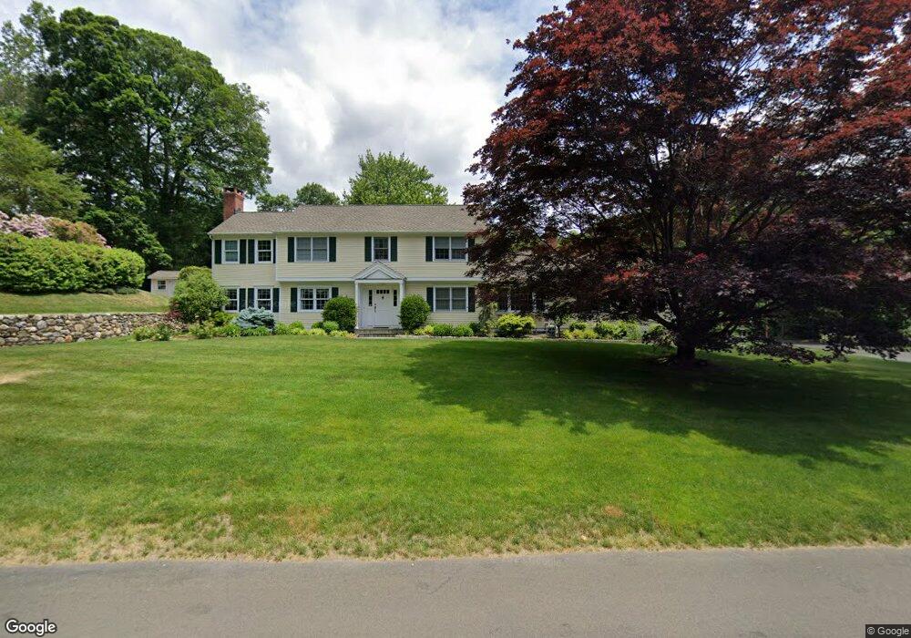
739 Mountain Laurel Rd Fairfield, CT 06824
Lake Mohegan Hills NeighborhoodEstimated Value: $1,214,000 - $1,616,000
4
Beds
4
Baths
2,844
Sq Ft
$498/Sq Ft
Est. Value
About This Home
This home is located at 739 Mountain Laurel Rd, Fairfield, CT 06824 and is currently estimated at $1,416,358, approximately $498 per square foot. 739 Mountain Laurel Rd is a home located in Fairfield County with nearby schools including Burr Elementary School, Tomlinson Middle School, and Fairfield Warde High School.
Ownership History
Date
Name
Owned For
Owner Type
Purchase Details
Closed on
Mar 6, 1989
Sold by
Bereca Victor
Bought by
Watkins John W
Current Estimated Value
Create a Home Valuation Report for This Property
The Home Valuation Report is an in-depth analysis detailing your home's value as well as a comparison with similar homes in the area
Home Values in the Area
Average Home Value in this Area
Purchase History
We collect this data history from publicly available records. To have your information removed, we recommend requesting removal directly through your county’s website.
| Date | Buyer | Sale Price | Title Company |
|---|---|---|---|
| Watkins John W | $315,000 | -- |
Source: Public Records
Mortgage History
We collect this data history from publicly available records. To have your information removed, we recommend requesting removal directly through your county’s website.
| Date | Status | Borrower | Loan Amount |
|---|---|---|---|
| Open | Watkins John W | $295,423 | |
| Closed | Watkins John W | $301,000 | |
| Closed | Watkins John W | $245,000 | |
| Closed | Watkins John W | $245,000 |
Source: Public Records
Tax History
| Year | Tax Paid | Tax Assessment Tax Assessment Total Assessment is a certain percentage of the fair market value that is determined by local assessors to be the total taxable value of land and additions on the property. | Land | Improvement |
|---|---|---|---|---|
| 2025 | $14,483 | $510,160 | $216,580 | $293,580 |
| 2024 | $14,233 | $510,160 | $216,580 | $293,580 |
| 2023 | $14,035 | $510,160 | $216,580 | $293,580 |
| 2022 | $13,897 | $510,160 | $216,580 | $293,580 |
| 2021 | $13,764 | $510,160 | $216,580 | $293,580 |
| 2020 | $13,354 | $498,470 | $187,950 | $310,520 |
| 2019 | $13,354 | $498,470 | $187,950 | $310,520 |
| 2018 | $13,140 | $498,470 | $187,950 | $310,520 |
| 2017 | $12,870 | $498,470 | $187,950 | $310,520 |
| 2016 | $12,686 | $498,470 | $187,950 | $310,520 |
| 2015 | $12,874 | $519,330 | $207,970 | $311,360 |
| 2014 | $12,672 | $519,330 | $207,970 | $311,360 |
Source: Public Records
Map
Nearby Homes
- 475 Springer Rd
- 757 Galloping Hill Rd
- 145 Galloping Hill Rd
- 470 Rock Ridge Rd
- 265 Shelter Rock Rd
- 260 Pansy Rd
- 251 Shelter Rock Rd
- 210 Pansy Rd
- 274 Valleyview Rd
- 750 Burr St
- 130 Stillson Rd
- 65 Tahmore Place
- 1090 Galloping Hill Rd
- 112 Calico Ln
- 692 Stillson Rd
- 706 Judd St
- 200 Joan Dr
- 1185 Stillson Rd
- 2032 N Benson Rd
- 126 Homefair Dr
- 38 Oriole Ln
- 766 Mountain Laurel Rd Unit Furn
- 766 Mountain Laurel Rd Unit Unfurn
- 766 Mountain Laurel Rd
- 789 Mountain Laurel Rd
- 719 Mountain Laurel Rd
- 722 Mountain Laurel Rd
- 60 Oriole Ln
- 723 Mountain Laurel Rd
- 55 Oriole Ln
- 715 Mountain Laurel Rd
- 798 Mountain Laurel Rd
- 727 Mountain Laurel Rd
- 817 Mountain Laurel Rd
- 80 Oriole Ln
- 820 Mountain Laurel Rd
- 652 Mountain Laurel Rd
- 356 Springer Rd
- 324 Springer Rd
- 99 Oriole Ln
Your Personal Tour Guide
Ask me questions while you tour the home.