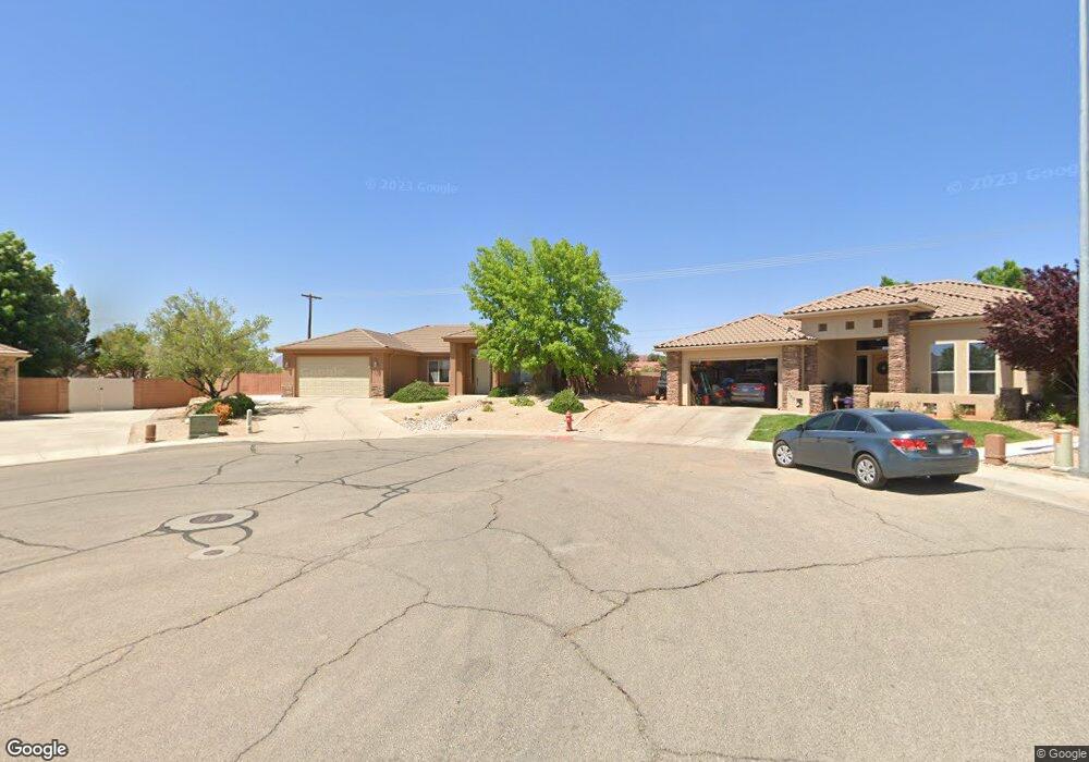
739 N 1620 W St. George, UT 84770
Estimated Value: $461,000 - $477,871
4
Beds
2
Baths
1,689
Sq Ft
$277/Sq Ft
Est. Value
About This Home
This home is located at 739 N 1620 W, St. George, UT 84770 and is currently estimated at $468,468, approximately $277 per square foot. 739 N 1620 W is a home located in Washington County with nearby schools including Sunset School, Snow Canyon Middle School, and Lava Ridge Intermediate School.
Ownership History
Date
Name
Owned For
Owner Type
Purchase Details
Closed on
May 13, 2011
Sold by
Magolski Darlene and Magolski Robert Edwin
Bought by
Magolski Robert E and Magolski Darlene S
Current Estimated Value
Purchase Details
Closed on
Apr 1, 2011
Sold by
Magolski Darlene and Magolski Robert Edwin
Bought by
Magolski Living Trust
Purchase Details
Closed on
Oct 21, 2009
Sold by
Magolski Darlene and Carmona Darlene
Bought by
Magolski Darlene and Magolski Robert Edwin
Purchase Details
Closed on
Aug 7, 2007
Sold by
Carmona Aldo and Carmona Darlene
Bought by
Carmona Darlene
Create a Home Valuation Report for This Property
The Home Valuation Report is an in-depth analysis detailing your home's value as well as a comparison with similar homes in the area
Home Values in the Area
Average Home Value in this Area
Purchase History
| Date | Buyer | Sale Price | Title Company |
|---|---|---|---|
| Magolski Robert E | -- | None Available | |
| Magolski Living Trust | -- | None Available | |
| Magolski Darlene | -- | Accommodation | |
| Carmona Darlene | -- | Accommodation |
Source: Public Records
Tax History Compared to Growth
Tax History
| Year | Tax Paid | Tax Assessment Tax Assessment Total Assessment is a certain percentage of the fair market value that is determined by local assessors to be the total taxable value of land and additions on the property. | Land | Improvement |
|---|---|---|---|---|
| 2025 | $1,672 | $256,190 | $56,100 | $200,090 |
| 2023 | $1,762 | $263,285 | $42,900 | $220,385 |
| 2022 | $1,848 | $259,655 | $42,900 | $216,755 |
| 2021 | $1,663 | $348,500 | $55,000 | $293,500 |
| 2020 | $1,489 | $293,900 | $55,000 | $238,900 |
| 2019 | $1,445 | $278,500 | $55,000 | $223,500 |
| 2018 | $1,412 | $140,580 | $0 | $0 |
| 2017 | $1,313 | $126,885 | $0 | $0 |
| 2016 | $1,368 | $122,265 | $0 | $0 |
| 2015 | $1,304 | $111,815 | $0 | $0 |
| 2014 | $1,403 | $121,110 | $0 | $0 |
Source: Public Records
Map
Nearby Homes
- 1732 N 540 W Unit 120
- 954 N 1725 W Unit 32
- 1732 W 540 N Unit 120
- 1732 W 540 N Unit 13
- 1732 W 540 N Unit 68
- 1732 W 540 N Unit 17
- 1732 W 540 N Unit 92
- 1793 W 950 N Unit 3
- 1385 W 625 N
- 1385 W 625 North St
- 1708 W 1020 N Unit 146
- 1735 W 540 N Unit 1006
- 1735 W 540 N Unit 2302
- 1735 W 540 N Unit 2302
- 1735 W 540 N Unit 1202
- 1735 W 540 N Unit 1001
- 1742 W 1020 N Unit 123
- 1782 W 1020 N Unit 133
- 695 N Daybreak Dr
- 727 N 1275 W
- 739 N 1620 West Cir
- 731 N 1620 West Cir
- 740 N 1620 Cir W
- 731 N 1620 Cir W
- 740 N 1620 West Cir
- 732 N 1620 West Cir
- 723 N 1620 W
- 723 N 1620 West Cir
- 724 N 1620 West Cir
- 729 N 1590 W
- 724 N 1620 Cir W
- 709 N 1620 West Cir
- 1592 W 730 N
- 709 N 1620 Cir W
- 710 N 1620 Cir W
- 710 N 1620 West Cir
- 721 N 1590 W
- 695 N 1620 Cir W
- 695 N 1620 West Cir
- 707 N 1590 W