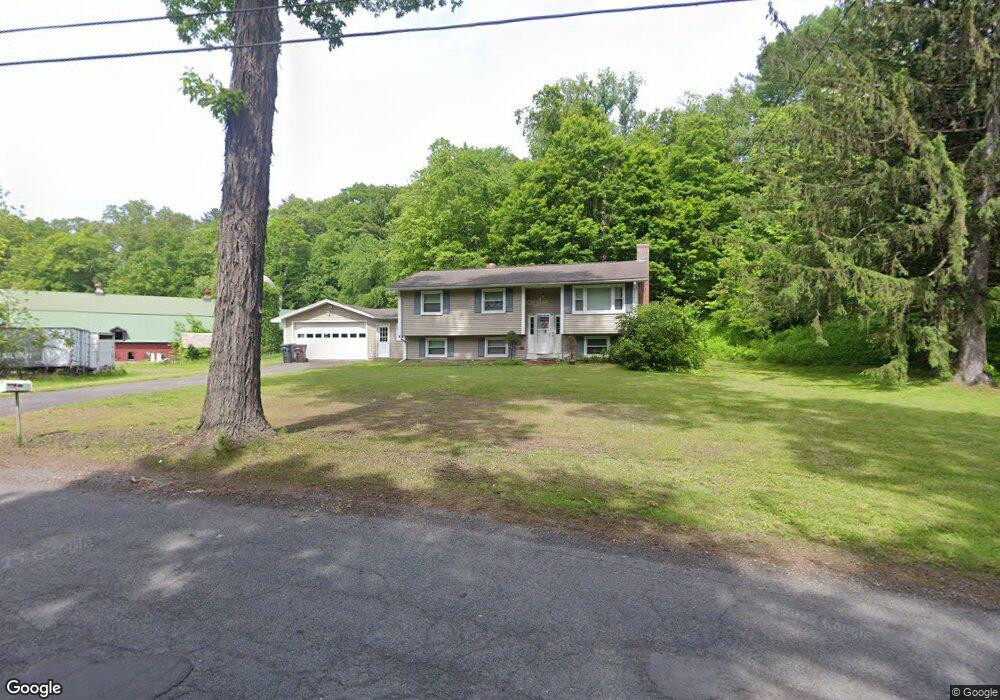
739 Pochassic Rd Westfield, MA 01085
Estimated Value: $335,000 - $377,000
3
Beds
2
Baths
1,054
Sq Ft
$332/Sq Ft
Est. Value
About This Home
This home is located at 739 Pochassic Rd, Westfield, MA 01085 and is currently estimated at $349,973, approximately $332 per square foot. 739 Pochassic Rd is a home located in Hampden County with nearby schools including Westfield High School.
Ownership History
Date
Name
Owned For
Owner Type
Purchase Details
Closed on
Jan 3, 2003
Sold by
Pease Phillip L
Bought by
Boisseau Thaddeus M and Boisseau Katharine A
Current Estimated Value
Home Financials for this Owner
Home Financials are based on the most recent Mortgage that was taken out on this home.
Original Mortgage
$144,000
Interest Rate
6.08%
Mortgage Type
Purchase Money Mortgage
Purchase Details
Closed on
Nov 27, 1996
Sold by
Boisseau Harold D and Boisseau Pauline B
Bought by
Pease Phillip L
Home Financials for this Owner
Home Financials are based on the most recent Mortgage that was taken out on this home.
Original Mortgage
$103,425
Interest Rate
7.82%
Mortgage Type
Purchase Money Mortgage
Create a Home Valuation Report for This Property
The Home Valuation Report is an in-depth analysis detailing your home's value as well as a comparison with similar homes in the area
Home Values in the Area
Average Home Value in this Area
Purchase History
| Date | Buyer | Sale Price | Title Company |
|---|---|---|---|
| Boisseau Thaddeus M | $160,000 | -- | |
| Pease Phillip L | $106,900 | -- |
Source: Public Records
Mortgage History
| Date | Status | Borrower | Loan Amount |
|---|---|---|---|
| Open | Pease Phillip L | $140,000 | |
| Closed | Boisseau Thaddeus M | $144,000 | |
| Previous Owner | Pease Phillip L | $103,425 |
Source: Public Records
Tax History Compared to Growth
Tax History
| Year | Tax Paid | Tax Assessment Tax Assessment Total Assessment is a certain percentage of the fair market value that is determined by local assessors to be the total taxable value of land and additions on the property. | Land | Improvement |
|---|---|---|---|---|
| 2025 | $4,530 | $298,400 | $116,900 | $181,500 |
| 2024 | $4,520 | $283,000 | $106,400 | $176,600 |
| 2023 | $4,192 | $256,200 | $101,100 | $155,100 |
| 2022 | $4,192 | $226,700 | $90,200 | $136,500 |
| 2021 | $4,057 | $214,900 | $85,000 | $129,900 |
| 2020 | $3,946 | $205,000 | $85,000 | $120,000 |
| 2019 | $3,855 | $196,000 | $81,000 | $115,000 |
| 2018 | $3,795 | $196,000 | $81,000 | $115,000 |
| 2017 | $3,736 | $192,400 | $82,300 | $110,100 |
| 2016 | $3,740 | $192,400 | $82,300 | $110,100 |
| 2015 | $3,567 | $192,400 | $82,300 | $110,100 |
| 2014 | $2,667 | $192,400 | $82,300 | $110,100 |
Source: Public Records
Map
Nearby Homes
- 745 West Rd
- 1020 Russell Rd
- 555 Russell Rd Unit D18
- 549 Russell Rd Unit 6B
- 1430 Russell Rd Unit 9
- 1430 Russell Rd Unit 35
- 781 Western Ave
- 66 Stoney Ln
- 291 Pochassic Rd
- 40 Heritage Ln
- 324 Russell Rd Unit 204
- 324 Russell Rd Unit 101
- 14 Pinewood Ln
- 148 Prospect Street Extension
- 10 Day Lily Ln
- 3 Angelica Dr
- 50 Russellville Rd
- 508 Granville Rd
- 70 Yeoman Ave
- 11 Highland Cir